Edgewood is a census-designated place (CDP) in Siskiyou County, California, United States. Its population is 72 as of the 2020 census, up from 43 from the 2010 census. Edgewood is located three miles north of the town of Weed.

Lakeland Highlands is an unincorporated community and census-designated place (CDP) in Polk County, Florida, United States. The population was 11,056 at the 2010 census. It is part of the Lakeland–Winter Haven Metropolitan Statistical Area. It is an affluent residential community located south of the Lakeland city limits, and north of the Mulberry city limits. Lakeland Highlands neighbors Medulla, and together the two communities make up much of what is known as South Lakeland (unincorporated).

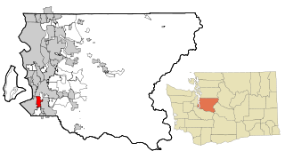
Ames Lake is an unincorporated community and census-designated place (CDP) in King County, Washington, United States. The population was 1,524 at the 2020 census, up from 1,486 at the 2010 census.

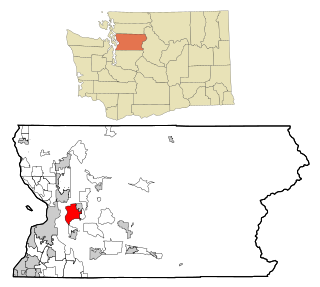
Cottage Lake is a census-designated place (CDP) in King County, Washington, United States. The population was 22,494 at the 2010 census. The lake itself falls within the 98072 ZIP code, while the developments east of the lake fall under the 98077 ZIP code.

Lake Morton-Berrydale is a census-designated place (CDP) in King County, Washington, United States. The population was 10,474 at the 2020 census.

Lakeland North is a census-designated place (CDP) in King County, Washington, United States. The population was 13,663 at the 2020 census. Part of the community was annexed into neighboring Auburn in 2008.

Maple Heights-Lake Desire is a census-designated place (CDP) in King County, Washington, United States. At the 2020 census, the population was 3,873.

Mirrormont is a census-designated place (CDP) in King County, Washington, United States, south of Issaquah. The population was 3,858 at the 2020 census. Within the last decade, the area has seen a shift in development as larger homes have been constructed in Cedar Grove, the Highlands at Tiger Mountain and Mirrormont.

Union Hill-Novelty Hill is a census-designated place (CDP) in King County, Washington, United States. The area was first recognized by the Census Bureau in the 2000 census. The population was 22,683 at the 2020 census.

Erlands Point-Kitsap Lake is an unincorporated area and former census-designated place (CDP) in Kitsap County, Washington, United States. The population was 2,935 at the 2010 census. For the 2020 census, the area was split into two CDPs, Erlands Point and Kitsap Lake.

Tracyton is a census-designated place (CDP) in Kitsap County, Washington, United States. Its population was 5,967 at the 2020 census. It was named for 19th century Secretary of the Navy Benjamin F. Tracy.

South Hill is a census-designated place (CDP) in Pierce County, Washington, immediately south of Puyallup. The population was 64,708 at time of the 2020 census, up from 52,431 in 2010. The area primarily consists of suburban housing and shopping with several retail shopping centers, residential neighborhoods, and apartment/condo complexes throughout. Because South Hill is unincorporated, its addresses are part of the Puyallup "postal city" or ZCTA.

Lake Cavanaugh is a census-designated place (CDP) in Skagit County, Washington, United States. The population was 200 at the 2020 census. It is included in the Mount Vernon–Anacortes, Washington Metropolitan Statistical Area.

High Bridge is a census-designated place (CDP) in Snohomish County, Washington, United States. The population was 3,140 at the 2020 census, up from 2,994 at the 2010 census. High Bridge includes the Echo Lake community and the former Echo Lake CDP, which was superseded by the larger High Bridge CDP in 2010.

Lake Ketchum is a census-designated place (CDP) in Snohomish County, Washington, United States. The population was 1,268 at the 2020 census, up from 930 at the 2010 census.

Martha Lake is a census-designated place (CDP) in Snohomish County, Washington, United States. The population was 21,129 at the 2020 census. It lies west of Mill Creek and northeast of Lynnwood, near the lake of the same name.

Lake Stickney is a census-designated place (CDP) in Snohomish County, Washington, United States. The population was 15,413 at the 2020 census. The CDP was known as Paine Field-Lake Stickney prior to 2010. The new Lake Stickney CDP no longer contains the Paine Field airport.

West Lake Stevens is a former census-designated place (CDP) in Snohomish County, Washington, United States. The population was 18,071 at the 2000 census.

Milton is a city in King and Pierce counties in the U.S. state of Washington. The population was 8,697 at the time of the 2020 census. Milton borders the larger but newer town of Edgewood.

Bangor Base is a census-designated place (CDP) in Kitsap County, Washington, within U.S. Naval Base Kitsap on the Kitsap Peninsula. Its population was 5,482 at the 2020 census.


