Inland Northwest Last updated October 13, 2025 Region of the United States
Region
Inland Northwest
Map of the Inland Northwest. Counties highlighted in red are always included, while counties highlighted in pink are sometimes included.
Composition Largest metropolitan areas Dialect Pacific Northwest English
The Inland Northwest , historically and alternatively known as the Inland Empire , is a region of the Northwestern United States centered on the Greater Spokane, Washington Area , [ 1] encompassing all of Eastern Washington and Northern Idaho . Under broader definitions, Northeastern Oregon and Western Montana may be included in the Inland Northwest. Alternatively, stricter definitions may exclude Central Washington and Idaho County, Idaho .
The phrase Inland Empire was first used by the Spokane Falls Review newspaper of Spokane Falls, Washington Territory (today’s Spokane, Washington) in its first issue on May 19, 1883.
As of 2016 [ update] U.S. Census Bureau estimated the combined population of eastern Washington and northern Idaho alone to be 2,240,645, comparable to that of New Mexico . Its Canadian counterpart, north of the border, is the British Columbia Interior , which together comprise the inland portion of the broader Pacific Northwest . Significant urban centers include the Spokane–Coeur d'Alene area and the Tri-Cities .
There have been several proposals to politically unite the Inland Northwest. In the mid and late 1860s, there was a proposal centered on Lewiston in northern Idaho for a Columbia Territory to be formed in the region from parts of what is now eastern Washington, northern Idaho and western Montana. [ 2] In 1901, another proposal was made, this time to combine the Idaho Panhandle with Eastern Washington to create the State of Lincoln . A third proposal was popularized in the late 1920s to consist of eastern Washington, northern Idaho and western Montana to the Continental Divide.
Counties Washington Adams , Asotin , Benton , Chelan , Columbia , Douglas , Ferry , Franklin , Garfield , Grant , Kittitas , Klickitat , Lincoln , Okanogan , Pend Oreille , Spokane , Stevens , Walla Walla , Whitman , and Yakima Idaho Benewah , Bonner , Boundary , Clearwater , Idaho , Kootenai , Latah , Lewis , Nez Perce , and Shoshone Oregon (sometimes included)
Morrow , Umatilla , Union , and Wallowa Montana (sometimes included)
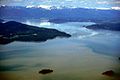
Flathead , Lake , Lincoln , Mineral , Missoula , Ravalli , and Sanders Geography The region is bounded by the Cascade Mountains on the west and the Rocky Mountains (following the spine of the remote and rugged Cabinet Mountains ) on the east, the Blue Mountains of Oregon and foothills of the Wallowa Mountains to the south, southeast, and encompasses the Columbia river basin (or Columbia Plateau ). Between the three mountain ranges are large, sweeping areas of semi-arid steppe , part of which has been irrigated due to the Columbia Basin Project , resulting in expansive farmland in central Washington. The Palouse , original home of the Appaloosa , is another major agricultural region located in the gently rolling hills of southeastern Washington and extending into Idaho. In northern Idaho, the precipitation from the Pacific Ocean over the North Central Rockies forests , create the North American inland temperate rainforest . [ 3] The Coeur d'Alene Mountains of this range is noted for its natural resource wealth, particularly the Silver Valley with its mining heritage dating back to the 1880s.
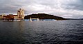
Spokane , the region's largest city, is located near where the arid, and largely unforested Columbia plateau meets the lush forests of the Selkirk Mountains . The urban area stretches east into Idaho along the I-90 corridor through the Spokane River valley. Across the border in Idaho the suburbs stretch into the cities of Post Falls and Coeur d'Alene on the north shore of Lake Coeur d'Alene . The Northeastern Washington and North Idaho portion of the Inland Empire are mountainous and forested, and the crest of the Bitterroot Range of the Rocky Mountains forms part of the eastern boundary of the Inland Empire region, while the Columbia River forms a significant part of its southern boundary.
Climate The Washington side is generally semi-arid , while the Idaho side experiences a mostly dry summer continental climate .
Climate data for Spokane (Spokane Int'l ), 1991–2020 normals, [ i] extremes 1881–present [ ii] Month Jan Feb Mar Apr May Jun Jul Aug Sep Oct Nov Dec Year Record high °F (°C) 62 63 74 90 97 109 108 108 98 87 70 60 109 Mean maximum °F (°C) 48.2 51.1 63.0 73.9 84.0 90.5 97.5 97.0 89.2 74.6 56.4 48.0 99.1 Mean daily maximum °F (°C) 34.5 39.5 48.6 56.9 67.1 73.7 84.4 83.8 73.6 57.7 42.3 33.8 58.0 Daily mean °F (°C) 29.6 32.9 40.0 47.0 56.0 62.3 71.0 70.3 61.1 47.9 36.3 29.1 48.6 Mean daily minimum °F (°C) 24.7 26.3 31.5 37.0 44.9 50.8 57.6 56.7 48.6 38.0 30.3 24.3 39.2 Mean minimum °F (°C) 4.4 9.8 18.5 26.4 32.7 40.2 45.9 45.6 35.4 23.2 14.1 7.1 −3.0 Record low °F (°C) −30 −24 −10 14 24 33 37 35 22 7 −21 −25 −30 Average precipitation inches (mm) 1.97 1.44 1.83 1.25 1.55 1.17 0.42 0.47 0.58 1.37 2.06 2.34 16.45 Average snowfall inches (cm) 12.3 7.8 3.9 0.7 0.1 0.0 0.0 0.0 0.1 0.5 6.2 13.8 45.4 Average precipitation days (≥ 0.01 in) 14.2 10.9 11.8 10.3 9.7 7.8 4.0 3.2 4.7 8.9 13.4 13.8 112.7 Average snowy days (≥ 0.1 in) 9.5 5.7 4.0 1.0 0.3 0.0 0.0 0.0 0.1 0.3 4.3 9.5 34.7 Average relative humidity (%) 82.5 79.1 70.3 61.0 58.2 53.9 44.0 45.0 53.9 66.6 82.7 85.5 65.2 Mean monthly sunshine hours 78.3 118.0 199.3 242.3 296.7 322.8 382.4 340.4 271.2 191.0 73.8 59.1 2,575.3 Percentage possible sunshine 28 41 54 59 63 68 79 77 72 57 26 22 54 Source: NOAA (relative humidity and sun 1961–1990) [ 5] [ 6] [ 7]
Climate data for Kennewick, Washington, 1991–2020 normals, extremes 1894–present Month Jan Feb Mar Apr May Jun Jul Aug Sep Oct Nov Dec Year Record high °F (°C) 74 74 87 95 104 114 115 115 100 89 79 72 115 Mean maximum °F (°C) 59.5 61.8 70.8 81.5 91.4 97.9 103.4 102.1 92.9 80.1 68.1 59.8 104.4 Mean daily maximum °F (°C) 41.7 48.1 58.1 66.3 75.3 82.0 91.3 90.3 80.5 65.9 50.9 41.5 66.0 Daily mean °F (°C) 35.5 39.5 47.0 54.3 62.7 69.2 76.8 75.8 66.8 54.5 42.9 35.6 55.1 Mean daily minimum °F (°C) 29.6 31.0 36.2 42.5 50.4 56.7 62.7 61.6 53.5 43.4 35.2 30.0 44.4 Mean minimum °F (°C) 15.3 18.8 26.1 33.5 40.1 48.4 54.5 53.3 43.8 30.7 22.5 16.8 10.0 Record low °F (°C) −27 −23 8 18 26 35 38 37 21 14 −8 −29 −29 Average precipitation inches (mm) 1.13 0.79 0.66 0.61 0.81 0.59 0.20 0.17 0.26 0.66 0.86 1.13 7.87 Average snowfall inches (cm) 1.3 0.1 0.0 0.0 0.0 0.0 0.0 0.0 0.0 0.0 0.4 0.4 2.2 Average precipitation days (≥ 0.01 in) 11.1 8.1 7.8 6.9 6.3 4.7 2.1 1.9 2.6 6.3 8.9 10.5 77.2 Average snowy days (≥ 0.1 in) 0.8 0.1 0.0 0.0 0.0 0.0 0.0 0.0 0.0 0.0 0.3 0.6 1.8 Source 1: NOAA [ 8] Source 2: National Weather Service [ 9]
Climate data for Yakima Airport , Washington (1991–2020 normals, [ a] extremes 1946–present) Month Jan Feb Mar Apr May Jun Jul Aug Sep Oct Nov Dec Year Record high °F (°C) 68 69 80 92 102 115 109 110 100 91 73 72 115 Mean maximum °F (°C) 54.6 59.2 68.9 79.6 89.9 95.0 100.2 99.1 91.2 78.0 64.0 52.3 101.8 Mean daily maximum °F (°C) 39.5 47.2 56.6 64.7 74.1 80.7 89.9 88.5 79.4 64.4 48.9 38.2 64.3 Mean daily minimum °F (°C) 24.0 26.1 30.2 35.2 43.5 49.5 55.0 53.3 44.9 35.3 27.2 23.1 37.3 Mean minimum °F (°C) 7.5 11.0 20.2 23.5 29.3 36.3 41.9 41.3 32.5 20.9 12.9 5.1 −1.6 Record low °F (°C) −21 −25 −1 18 25 30 34 35 24 4 −13 −17 −25 Average precipitation inches (mm) 1.19 0.81 0.64 0.55 0.74 0.50 0.20 0.21 0.23 0.64 0.86 1.44 8.01 Average snowfall inches (cm) 6.2 2.7 0.6 0 0 0 0 0 0 0.1 3.0 7.7 20.3 Average precipitation days 9.4 7.5 6.4 5.8 6.2 5.2 2.4 2.3 3.2 4.7 8.6 10.1 71.8 Average snowy days 4.3 2.2 0.7 0.1 0 0 0 0 0 0.1 1.8 6.2 15.4 Mean monthly sunshine hours 64 113 186 210 279 300 341 310 240 186 60 62 2,351 Mean daily sunshine hours 2 4 6 7 9 10 11 10 8 6 2 2 6 Percentage possible sunshine 22 38 50 51 60 63 71 71 64 55 21 23 49 Average ultraviolet index 1 2 3 5 6 7 8 7 5 3 1 1 4 Source 1: NOAA [ 10] [ 11] Source 2: Weather Atlas (sun and uv) [ 12]
Climate data for Wenatchee, (1971-2000 normals) Month Jan Feb Mar Apr May Jun Jul Aug Sep Oct Nov Dec Year Record high °F (°C) 65 66 78 93 104 114 110 106 101 90 76 67 114 Mean daily maximum °F (°C) 35.1 42.8 54.9 64.6 73.1 80.1 88.0 88.0 77.7 63.7 46.0 35.7 62.5 Daily mean °F (°C) 29.2 35.1 44.4 52.7 60.9 67.8 74.4 73.7 64.5 52.3 39.1 30.5 52.1 Mean daily minimum °F (°C) 23.2 27.4 33.9 40.8 48.6 55.5 61.0 60.2 51.2 40.8 32.2 25.2 41.7 Record low °F (°C) −17 −18 5 20 27 39 40 41 21 19 0 −19 −19 Average precipitation inches (mm) 1.35 0.94 0.64 0.51 0.51 0.69 0.30 0.41 0.40 0.49 1.36 1.52 9.12 Source: NOAA (normals, 1971−2000) [ 13] [ 14]
Climate data for Missoula, Montana (Missoula Airport ) Month Jan Feb Mar Apr May Jun Jul Aug Sep Oct Nov Dec Year Record high °F (°C) 60 66 78 90 95 102 107 105 99 85 73 60 107 Mean daily maximum °F (°C) 33.2 38.8 49.8 58.5 67.3 75.2 85.9 84.9 73.1 57.8 41.5 31.0 58.2 Mean daily minimum °F (°C) 18.3 21.2 27.7 32.8 39.8 46.6 51.4 50.1 41.8 32.4 24.9 16.7 33.7 Record low °F (°C) −33 −28 −13 2 21 26 31 29 15 −4 −23 −30 −33 Average precipitation inches (mm) 0.85 0.70 1.00 1.22 2.01 2.07 0.99 1.19 1.17 0.88 1.01 1.04 14.13 Average snowfall inches (cm) 8.3 6.1 5.1 1.2 0.2 — 0.0 0.0 — 0.6 5.4 11.0 37.9 Average precipitation days (≥ 0.01 in) 11.8 9.4 11.4 11.1 12.3 12.1 7.1 7.5 8.2 8.4 11.1 12.3 122.7 Average snowy days (≥ 0.1 in) 9.4 6.8 5.1 1.6 0.3 0.1 0.0 0.0 0.0 0.9 5.4 9.8 39.4 Average relative humidity (%) 81.3 78.1 70.3 61.2 61.7 61.1 51.7 52.5 62.8 70.8 80.2 83.5 67.9 Mean monthly sunshine hours 95.8 133.0 209.3 245.0 280.5 311.1 389.3 334.8 264.7 194.3 99.5 82.9 2,640.2 Percentage possible sunshine 34 46 57 60 60 66 81 76 70 58 35 31 59 Source: NOAA (normals 1981−2010, relative humidity and sun 1961–1990) [ 15] [ 16] [ 17]
Demographics Population Centers The Inland Northwest is home to seven Metropolitan Statistical Areas (MSA), eight if Western Montana is included, as defined by the U.S. Census Bureau. The two largest centers of population are formed out of multiple neighboring MSAs that are classified as Combined Statistical Areas . [ 18] The largest in the region is the conurbation formed by the Spokane and Coeur d'Alene MSAs, the Spokane-Coeur d'Alene combined statistical area, which ranks 70th in the nation. The second largest center is the Kennewick-Richland-Walla Walla combined statistical area, which is made up of the Tri-Cities and Walla Walla and ranks as the 103rd largest in the nation. [ 19]
Statistical Areas Kennewick-Richland-Walla Walla CSA (pop. 370,395) [ 21] Largest Cities by Population Spokane, Washington (pop. 228,989) [ 26] Spokane Valley, Washington (pop. 102,976) [ 27] Yakima, Washington (pop. 96,968) [ 28] Kennewick, Washington (pop. 83,921) [ 29] Pasco, Washington (pop. 77,108) [ 30] * Missoula, Montana (pop. 73,489) [ 31] Richland, Washington (pop. 60,560) [ 32] Coeur d'Alene, Idaho (pop. 54,628) [ 33] Post Falls, Idaho (pop. 38,485) [ 34] Wenatchee, Washington (pop. 35,508) [ 35] Lewiston, Idaho (pop. 34,203) [ 36] Walla Walla, Washington (pop. 34,060) [ 37] Pullman, Washington (pop. 32,901) [ 38] Moscow, Idaho (pop. 25,435) [ 39] Moses Lake, Washington (pop. 25,146) [ 40] * Kalispell, Montana (pop. 24,558) [ 41] * Hermiston, Oregon (pop. 19,354) [ 42] Ellensburg, Washington (pop. 18,666) [ 43] * Pendleton, Oregon (pop. 17,107) [ 44] Sunnyside, Washington (pop. 16,375) [ 45] West Richland, Washington (pop. 16,295) [ 46] Hayden, Idaho (pop. 15,570) [ 47] East Wenatchee, Washington (pop. 14,158) [ 48] Cheney, Washington (pop. 13,255) [ 49] * La Grande, Oregon (pop. 13,026) [ 50] Liberty Lake, Washington (pop. 12,003) [ 51] Grandview, Washington (pop. 10,907) [ 52] Airway Heights, Washington (pop. 10,757) [ 53] *
Culture Arts and theater In Spokane, the Davenport Arts District has the largest concentration of art galleries and is home to many of Spokane's main performing arts venues, including the Knitting Factory , Fox Theater , and Bing Crosby Theater . The Knitting Factory is a concert house that serves as a setting for many mainstream touring musicians and acts. The Martin Woldson Theater at the Fox , restored to its original 1931 Art Deco state after years of being derelict, [ 60] is home to the Spokane Symphony Orchestra . The Metropolitan Performing Arts Center was restored in 1988 and renamed the Bing Crosby Theater in 2006 to honor the former Spokanite. [ 61] Touring stand-up comedians are hosted by the Spokane Comedy Club. [ 62] Theater is provided by Spokane's only resident professional company, The Modern Theater, [ 63] though there are also the Spokane Civic Theatre and several other amateur community theaters and smaller groups. The First Interstate Center for the Arts often hosts large traveling exhibitions, shows, and tours.
In the Tri-Cities, the Richland Players Theater has offered live performances annually for over 70 years.[ citation needed ] [ citation needed ] [ 64] Today, the theater has more than 7,500 attendees annually attracting audiences from across the region such as Spokane, Yakima, and Walla Walla.[ citation needed ] [ 65]
The Spokane area is served by The Spokesman-Review , a daily newspaper, as well as the Inlander , an alternative weekly , and the bi-weekly Spokane Journal of Business . Spokane is the 73rd largest TV market in the nation according to Nielsen . [ 66] KREM carries CBS on channel 2, KXLY carries ABC on channel 4, KHQ carries NBC on channel 6 and KAYU carries FOX on channel 28.
The Tri-Cities is served by the Tri-City Herald , a daily newspaper. Yakima is served by the Yakima Herald-Republic , a daily newspaper. The Tri-Cities and Yakima are considered one media market by Nielsen, the 122nd largest in the country. [ 66] KNDU carries NBC, KVEW carries ABC, KEPR carries CBS and KFFX carries Fox.
Notes ↑ Mean monthly maxima and minima (i.e. the expected highest and lowest temperature readings at any point during the year or given month) calculated based on data at said location from 1991 to 2020. ↑ Mean maxima and minima (i.e., the highest and lowest temperature readings during an entire month or year) calculated based on data at said location from 1991 to 2020. ↑ Official records for Spokane kept at Spokane Weather Bureau Office from February 1881 to July 1889, and at Spokane International Airport since August 1889. [ 4] References ↑ Stratton, David H., ed. (2004), Spokane & the Inland Empire: An Interior Pacific Northwest Anthology , Washington State University, ISBN 0-87422-277-X ↑ Merle W. Wells. "Territorial Government in the Inland Empire: The Movement to Create Columbia Territory, 1864–69." The Pacific Northwest Quarterly . Vol. 44, No. 2 (April 1953), pp. 80–87. ↑ Woodward, Susan L. (2012–2015). "Inland Rainforests of the Northwest" . Radford University. Archived from the original on January 6, 2021. Retrieved May 4, 2021 . ↑ "Threaded Station Extremes" . ThreadEx . NOAA's National Centers for Environmental Information (NCEI) and the National Weather Service (NWS), the Northeast Regional Climate Center (NRCC). Retrieved October 18, 2021 . ↑ "NowData – NOAA Online Weather Data" . National Oceanic and Atmospheric Administration . Archived from the original on April 2, 2019. Retrieved October 18, 2021 . ↑ "Summary of Monthly Normals SPOKANE INTL AP, WA US USW00024157 1991-2020" . National Oceanic and Atmospheric Administration . Retrieved October 18, 2021 . ↑ "WMO climate normals for Spokane/INTL, WA 1961–1990" . National Oceanic and Atmospheric Administration. Archived from the original on December 7, 2020. Retrieved May 28, 2014 . ↑ "U.S. Climate Normals Quick Access" . National Oceanic and Atmospheric Administration. Archived from the original on August 12, 2022. Retrieved August 4, 2022 . ↑ "NOAA Online Weather Data" . National Weather Service. Archived from the original on May 30, 2022. Retrieved July 25, 2022 . ↑ "NOAA NCEI U.S. Climate Normals Quick Access" . National Oceanic and Atmospheric Administration . Archived from the original on May 5, 2021. Retrieved August 6, 2021 . ↑ "Station Name: WA YAKIMA AIRPORT" . National Oceanic and Atmospheric Administration (FTP ). Retrieved September 8, 2019 . [ dead ftp link ] (To view documents see Help:FTP ) ↑ "Monthly weather forecast and climate - Yakima, WA" . Archived from the original on March 28, 2020. Retrieved March 28, 2020 . ↑ "Climatography of the United States NO.81" (PDF) . National Oceanic and Atmospheric Administration . May 2011. Archived from the original (PDF) on August 9, 2014. Retrieved January 11, 2011 . ↑ "Hundreds of deaths reported as cities urge residents to conserve power during ravaging heat wave" . CNN . Retrieved June 30, 2021 . ↑ "NowData-NOAA Online Weather Data" . National Oceanic and Atmospheric Administration (NOAA). Retrieved September 10, 2015 . ↑ "MT Missoula INTL AP" . NOAA. Archived from the original on October 31, 2020. Retrieved September 10, 2015 . ↑ "WMO Climate Normals for Missoula/Johnson–Bell Field, MT 1961–1990" . NOAA. Archived from the original on October 31, 2020. Retrieved September 10, 2015 . 1 2 3 4 5 6 "Combined Statistical Areas of the United States and Puerto Rico" (PDF) . census.gov . U.S. Census Bureau. Retrieved April 30, 2022 . ↑ "Kennewich-Richand-Walla Walla, WA CSA" . censusreporter.org . Retrieved April 30, 2022 . 1 2 3 "QuickFacts" . census.gov . U.S. Census Bureau. Retrieved April 30, 2022 . 1 2 3 "QuickFacts" . census.gov . U.S. Census Bureau. Retrieved April 30, 2022 . ↑ "QuickFacts: Yakima County, Washington" . census.gov . U.S. Census Bureau. Retrieved April 30, 2022 . ↑ "Quick Facts" . census.gov . U.S. Census Bureau. Retrieved April 30, 2022 . ↑ "QuickFacts: Missoula County, Montana" . census.gov . U.S. Census Bureau. Retrieved April 30, 2022 . ↑ "QuickFacts" . census.gov . U.S. Census Bureau. Retrieved April 30, 2022 . ↑ "QuickFacts: Spokane city, Washington" . census.gov . U.S. Census Bureau. Retrieved April 29, 2022 . ↑ "QuickFacts: Spokane Valley city, Washington" . census.gov . U.S. Census Bureau. Retrieved April 29, 2022 . ↑ "QuickFacts: Yakima city, Washington" . census.gov . U.S. Census Bureau. Retrieved April 29, 2022 . ↑ "QuickFacts: Kennewick city, Washington" . census.gov . U.S. Census Bureau. Retrieved April 29, 2022 . ↑ "QuickFacts: Pasco city, Washington" . census.gov . U.S. Census Bureau. Retrieved April 30, 2022 . ↑ "QuickFacts: Missoula city, Montana" . census.gov . U.S. Census Bureau. Retrieved April 29, 2022 . ↑ "QuickFacts: Richland city, Washington" . census.gov . U.S. Census Bureau. Retrieved April 30, 2022 . ↑ "QuickFacts: Coeur d'Alene city, Idaho" . census.gov . U.S. Census Bureau. Retrieved April 30, 2022 . ↑ "QuickFacts: Post Falls city, Idaho" . census.gov . U.S. Census Bureau. Retrieved April 30, 2022 . ↑ "QuickFacts: Wenatchee city, Washington" . census.gov . U.S. Census Bureau. Retrieved April 30, 2022 . ↑ "QuickFacts: Lewiston city, Idaho" . census.gov . U.S. Census Bureau. Retrieved April 30, 2022 . ↑ "QuickFacts: Walla Walla city, Washington" . census.gov . U.S. Census Bureau. Retrieved April 30, 2022 . ↑ "QuickFacts: Pullman city, Washington" . census.gov . U.S. Census Bureau. Retrieved April 30, 2022 . ↑ "QuickFacts: Moscow city, Idaho" . census.gov . U.S. Census Bureau. Retrieved April 30, 2022 . ↑ "QuickFacts: Moses Lake city, Washington" . census.gov . U.S. Census Bureau. Retrieved April 30, 2022 . ↑ "QuickFacts: Kalispell city, Montana" . census.gov . U.S. Census Bureau. Retrieved April 30, 2022 . ↑ "QuickFacts: Hermiston city, Oregon" . census.gov . U.S. Census Bureau. Retrieved April 30, 2022 . ↑ "QuickFacts: Ellensburg city, Washington" . census.gov . U.S. Census Bureau. Retrieved April 30, 2022 . ↑ "QuickFacts: Pendleton city, Oregon" . census.gov . U.S. Census Bureau. Retrieved April 30, 2022 . ↑ "QuickFacts: Sunnyside city, Washington" . census.gov . U.S. Census Bureau. Retrieved April 30, 2022 . ↑ "QuickFacts: West Richland city, Washington" . census.gov . U.S. Census Bureau. Retrieved April 30, 2022 . ↑ "QuickFacts: Hayden city, Idaho" . census.gov . U.S. Census Bureau. Retrieved April 30, 2022 . ↑ "QuickFacts: East Wentachee city, Washington" . census.gov . U.S. Census Bureau. Retrieved April 30, 2022 . ↑ "QuickFacts: Cheney city, Washington" . census.gov . U.S. Census Bureau. Retrieved April 30, 2022 . ↑ "QuickFacts: La Grande city, Oregon" . census.gov . U.S. Census Bureau. Retrieved April 30, 2022 . ↑ "QuickFacts: Liberty Lake city, Washington" . census.gov . U.S. Census Bureau. Retrieved April 30, 2022 . ↑ "QuickFacts: Grandview city, Washington" . census.gov . U.S. Census Bureau. Retrieved April 30, 2022 . ↑ "QuickFacts: Airway Heights city, Washington" . census.gov . U.S. Census Bureau. Retrieved April 30, 2022 . ↑ "Communities of the Inland Northwest" . ewu.edu . Eastern Washington University. Retrieved October 17, 2022 . ↑ St. George, Donna (September 24, 1997). "National Origins: Washington–Idaho Border; America's Golden Land of Lentils" . New York Times . Retrieved October 17, 2022 . ↑ "Project details – Columbia Basin Project" . United States Bureau of Reclamation . Archived from the original on February 15, 2015. Retrieved October 25, 2009 . ↑ Parker, Tom (2002). Discovering Washington Wines: An Introduction to One of the Most Exciting Premium Wine Regions . Raconteurs Press. pp. 8– 10, 36– 37. ISBN 0-9719258-5-2 ↑ "United States Wine and Grape Industry FAQS" . wineamerica.org . WineAmerica. Retrieved October 17, 2022 . ↑ "Regions & AVAs" . washingtonwine.org . Washington State Wine Commission. Retrieved October 17, 2022 . ↑ Prager, Mike (October 29, 2017). "From a $2,500 start, the restored Fox theater was brought back from the brink" . Spokesman-Review . Retrieved November 11, 2021 . ↑ Sowa, Tom (September 29, 2006). "Met Theater will be renamed to honor Bing Crosby" . The Spokesman-Review . Retrieved October 13, 2014 . ↑ "Spokane Comedy Club" . Spokane Comedy Club. Retrieved February 18, 2017 . ↑ "About Us" . The Modern Theater. Retrieved January 24, 2014 . ↑ "Richland Players: Bringing great productions to the Tri-Cities" . tri-cityherald.com . Archived from the original on March 16, 2021. ↑ "Theater History" . Archived from the original on May 25, 2014. Retrieved May 22, 2014 . 1 2 "Nielsen DMA Rankings – Full List" . lyonspr.com . Nielsen. Archived from the original on April 12, 2018. Retrieved October 17, 2022 .
47°00′N 118°00′W / 47.0°N 118.0°W / 47.0; -118.0 (Inland Northwest )
This page is based on this
Wikipedia article Text is available under the
CC BY-SA 4.0 license; additional terms may apply.
Images, videos and audio are available under their respective licenses.