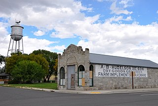
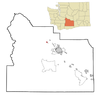
Grandview, Washington | |
---|---|
Coordinates: 46°15′13″N119°54′36″W / 46.25361°N 119.91000°W | |
Country | United States |
State | Washington |
County | Yakima |
Incorporated | September 21, 1909 |
Government | |
• Type | Mayor–council [1] |
• Mayor | Ashley Lara [2] |
Area | |
• Total | 6.52 sq mi (16.89 km2) |
• Land | 6.44 sq mi (16.68 km2) |
• Water | 0.08 sq mi (0.21 km2) |
Elevation | 804 ft (245 m) |
Population | |
• Total | 10,907 |
11,043 | |
• Density | 1,720.19/sq mi (664.17/km2) |
Time zone | UTC−8 (Pacific (PST)) |
• Summer (DST) | UTC−7 (PDT) |
ZIP code | 98930 |
Area code | 509 |
FIPS code | 53-27925 |
GNIS feature ID | 1512251 [4] |
Website | grandview.wa.us |
Grandview is a city in Yakima County, Washington, United States. It is about 38 miles west of Kennewick and 38 miles southeast of Yakima. The population was 10,907 at the 2020 census. [5] Grandview's economy is agriculture based; with apples, cherries, concord and wine grapes, hops, asparagus, corn, wheat, dairy and other fruit and vegetable production supported by processing plants and cold storage facilities.
Grandview received its name from the Granger Land Company in 1905 due to its view of Mount Rainier and Mount Adams. [7] [8] Grandview was officially incorporated on September 21, 1909. It began simply as the halfway point on the rail line between Prosser and Sunnyside.
Grandview is located at 46°15′13″N119°54′36″W / 46.25361°N 119.91000°W (46.253670, -119.910133). [9]
According to the United States Census Bureau, the city has a total area of 6.31 square miles (16.34 km2), of which, 6.23 square miles (16.14 km2) is land and 0.08 square miles (0.21 km2) is water. [10]
Census | Pop. | Note | %± |
---|---|---|---|
1910 | 320 | — | |
1920 | 1,011 | 215.9% | |
1930 | 1,085 | 7.3% | |
1940 | 1,449 | 33.5% | |
1950 | 2,503 | 72.7% | |
1960 | 3,366 | 34.5% | |
1970 | 3,605 | 7.1% | |
1980 | 5,615 | 55.8% | |
1990 | 7,169 | 27.7% | |
2000 | 8,377 | 16.9% | |
2010 | 10,862 | 29.7% | |
2020 | 10,907 | 0.4% | |
2022 (est.) | 11,043 | [6] | 1.2% |
U.S. Decennial Census [11] 2020 Census [5] |
As of the 2010 census, there were 10,862 people, 2,996 households, and 2,459 families living in the city. The population density was 1,743.5 inhabitants per square mile (673.2/km2). There were 3,136 housing units at an average density of 503.4 per square mile (194.4/km2). The racial makeup of the city was 55.2% White, 0.9% African American, 0.6% Native American, 0.5% Asian, 0.1% Pacific Islander, 38.8% from other races, and 4.0% from two or more races. Hispanic or Latino of any race were 79.7% of the population.
There were 2,996 households, of which 57.1% had children under the age of 18 living with them, 54.5% were married couples living together, 18.5% had a female householder with no husband present, 9.0% had a male householder with no wife present, and 17.9% were non-families. 14.2% of all households were made up of individuals, and 5.6% had someone living alone who was 65 years of age or older. The average household size was 3.60 and the average family size was 3.90.
The median age in the city was 26.3 years. 37% of residents were under the age of 18; 11.2% were between the ages of 18 and 24; 26.8% were from 25 to 44; 17.1% were from 45 to 64; and 7.9% were 65 years of age or older. The gender makeup of the city was 50.0% male and 50.0% female.
As of the 2000 census, there were 8,377 people, 2,431 households, and 1,956 families living in the city. The population density was 1,552.3 people per square mile (599.0/km2). There were 2,581 housing units at an average density of 478.3 per square mile (184.5/km2). The racial makeup of the city was 51.12% White, 0.58% African American, 0.94% Native American, 0.94% Asian, 0.11% Pacific Islander, 43.27% from other races, and 3.03% from two or more races. Hispanic or Latino of any race were 68.04% of the population.
There were 2,431 households, out of which 49.9% had children under the age of 18 living with them, 60.0% were married couples living together, 14.6% had a female householder with no husband present, and 19.5% were non-families. 16.6% of all households were made up of individuals, and 7.8% had someone living alone who was 65 years of age or older. The average household size was 3.40 and the average family size was 3.80.
In the city, the age distribution of the population shows 36.2% under the age of 18, 11.3% from 18 to 24, 27.0% from 25 to 44, 16.1% from 45 to 64, and 9.4% who were 65 years of age or older. The median age was 27 years. For every 100 females, there were 98.5 males. For every 100 females age 18 and over, there were 96.6 males.
The median income for a household in the city was $32,588, and the median income for a family was $36,165. Males had a median income of $29,321 versus $21,959 for females. The per capita income for the city was $12,489. About 16.0% of families and 20.3% of the population were below the poverty line, including 26.0% of those under age 18 and 17.6% of those age 65 or over.
Yakima County is a county in the U.S. state of Washington. As of the 2020 census, its population was 256,728. The county seat and most populous city is Yakima. The county was formed out of Ferguson County in January 1865 and is named for the Yakama tribe of Native Americans.
Dover is a city in Bonner County, Idaho. The population was 556 at the 2010 census.
Wilder is a city in Canyon County, Idaho, United States. The population was 1,533 at the 2010 census.
Grand Chain is a village in Pulaski County, Illinois, United States. The population was 190 at the 2010 census. The village's official name changed from "Grand Chain" to "New Grand Chain" in the 1970s, but its residents continue to refer to it as "Grand Chain."
Grandview is a town in Hammond Township, Spencer County, Indiana, along the Ohio River. The population was 749 at the 2010 census.
Grandview is a city in Louisa County, Iowa, United States. The population was 437 at the time of the 2020 census. It is part of the Muscatine Micropolitan Statistical Area.
Grandview Plaza is a city in Geary County, Kansas, United States. As of the 2020 census, the population of the city was 1,697.
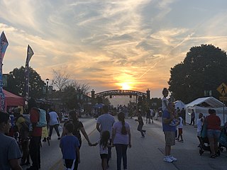
Grandview is a city in Jackson County, Missouri, United States. The population was 24,475 at the 2010 census. It is part of the Kansas City metropolitan area.
Grandview Heights, or simply Grandview, is a city in Franklin County, Ohio, United States. The population was 8,085 at the 2020 census.
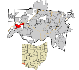
Grandview is a census-designated place (CDP) in Miami Township, Hamilton County, Ohio, United States. The population was 1,312 at the 2020 census.
North Powder is a city in Union County, Oregon, United States. The population was 439 at the 2010 census.
Benton City is a city in Benton County, Washington, United States. It is also included in the Tri-Cities metropolitan area, which consists of both Benton and Franklin counties. The population was 3,479 at the 2020 census. The city shares a school district with the adjacent unincorporated community of Kiona.
West Richland is a city in Benton County, Washington. The population was 16,295 at the time of the 2020 census. The city is part of the Tri-Cities metropolitan area, whose principal cities are Richland, Kennewick, and Pasco.
Desert Aire is a census-designated place (CDP) in Grant County, Washington, United States. Desert Aire's elevation is 560 ft (170 m). The population was 2,288 at the 2020 census up from 1,626 at the 2010 census.
Granger is a city in Yakima County, Washington, United States. The population was 3,624 at the 2020 census. Although it was classified as a town in 2000, it has since been reclassified as a city.
Naches is a town in Yakima County, Washington, United States. The population was 1,084 at the 2020 census. The town is located along the Naches River west of Yakima near the eastern foothills of the Cascade Range.
Selah is a city in Yakima County, Washington, United States. It is north of Yakima and part of its metropolitan area. The city's population was 8,153 at the 2020 census.
Union Gap is a city in Yakima County, Washington, United States. The population was 6,568 at the 2020 census. Union Gap has become the retail hub for the entire Yakima Valley as a result of Valley Mall and other thriving businesses being located here. Part of the city is part of the Yakama Nation.
Zillah is a city in Yakima County, Washington, United States, with a population of 3,179 as of the 2020 census.
Colby is a city in Clark and Marathon counties in the U.S. state of Wisconsin. It is part of the Wausau, Wisconsin Metropolitan Statistical Area. The population was 1,852 at the 2010 census. Of this, 1,354 were in Clark County, and 498 were in Marathon County. The city is bordered by the Town of Colby, the Town of Hull, and the City of Abbotsford. Colby cheese was first created in Colby.