Parker, Washington | |
|---|---|
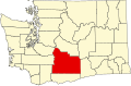
 Parker, Washington Location of Parker, Washington  Parker, Washington Parker, Washington (Washington (state)) | |
| Coordinates: 46°30′05″N120°27′57″W / 46.50139°N 120.46583°W [1] | |
| Country | United States |
| State | Washington |
| County | Yakima |
| Elevation | 929 ft (283 m) |
| Population | |
• Total | 154 |
| Time zone | UTC-8 (Pacific (PST)) |
| • Summer (DST) | UTC-7 (PDT) |
| ZIP code | 98939 |
| Area code | 509 |
| FIPS code | 53-53265 [3] |
| GNIS feature ID | 2585018 [1] |
Parker is a census-designated place and unincorporated community in central Yakima County, Washington, United States. It is located on U.S. Route 97 between the cities of Union Gap and Wapato on the Yakama Indian Reservation. The town had a population of 154 at the 2010 census.