Zillah | |
---|---|
Zillah, Washington | |
Coordinates: 46°24′13″N120°15′39″W / 46.40361°N 120.26083°W Coordinates: 46°24′13″N120°15′39″W / 46.40361°N 120.26083°W [1] | |
Country | United States |
State | Washington |
County | Yakima |
Founded | 1892 |
Incorporated | January 5, 1911 |
Government | |
• Mayor | Dr. Scott Carmack |
Area | |
• Total | 1.82 sq mi (4.72 km2) |
• Land | 1.82 sq mi (4.72 km2) |
• Water | 0.00 sq mi (0.00 km2) |
Elevation | 820 ft (250 m) |
Population | |
• Total | 3,179 |
• Estimate (2021) [4] | 3,157 |
• Density | 1,724.33/sq mi (665.91/km2) |
Time zone | UTC-8 (PST) |
• Summer (DST) | UTC-7 (PDT) |
ZIP code | 98953 |
Area code | 509 |
FIPS code | 53-80500 [5] |
GNIS feature ID | 1512822 [6] |
Website | cityofzillah.us |
Zillah is a city in Yakima County, Washington, United States, with a population of 3,179 as of the 2020 census. [3]
Zillah was founded in 1891 following the completion of the Sunnyside Canal project, an irrigation scheme delivering water from the Yakima River to the arid lower Yakima Valley. Walter Granger, superintendent of the canal company, chose the town site in 1892. The town was named for Miss Zillah Oakes, daughter of Thomas Fletcher Oakes, who, as president of the Northern Pacific Railway, had backed the building of the canal. The town was named after Miss Zillah because she would scream and cry on the way to the new town, while on the trip her father promised to name the town after her if she would stop. Granger housed the headquarters of the Washington Irrigation Company in Zillah, giving it economical advantages for a time. He also made his residency in Zillah, becoming its mayor after retiring from the irrigation company. Zillah was officially incorporated on January 5, 1911. [7]
Zillah is located on Interstate 82 about 15 miles (24 km) southeast of Yakima.
According to the United States Census Bureau, the city has a total area of 1.78 square miles (4.61 km2), all of it land. [8]
Historical population | |||
---|---|---|---|
Census | Pop. | %± | |
1920 | 647 | — | |
1930 | 728 | 12.5% | |
1940 | 803 | 10.3% | |
1950 | 911 | 13.4% | |
1960 | 1,059 | 16.2% | |
1970 | 1,138 | 7.5% | |
1980 | 1,599 | 40.5% | |
1990 | 1,911 | 19.5% | |
2000 | 2,198 | 15.0% | |
2010 | 2,964 | 34.8% | |
2020 | 3,179 | 7.3% | |
2021 (est.) | 3,157 | [4] | −0.7% |
U.S. Decennial Census [9] 2020 Census [3] |
As of the census of 2010, there were 2,964 people, 1,033 households, and 741 families living in the city. The population density was 1,665.2 inhabitants per square mile (642.9/km2). There were 1,105 housing units at an average density of 620.8 per square mile (239.7/km2). The racial makeup of the city was 63.8% White, 0.3% African American, 3.8% Native American, 0.9% Asian, 0.2% Pacific Islander, 27.1% from other races, and 3.9% from two or more races. Hispanic or Latino of any race were 42.5% of the population.
There were 1,033 households, of which 43.4% had children under the age of 18 living with them, 53.0% were married couples living together, 13.1% had a female householder with no husband present, 5.6% had a male householder with no wife present, and 28.3% were non-families. 23.9% of all households were made up of individuals, and 8.9% had someone living alone who was 65 years of age or older. The average household size was 2.87 and the average family size was 3.40.
The median age in the city was 31.9 years. 31.4% of residents were under the age of 18; 8.9% were between the ages of 18 and 24; 27.3% were from 25 to 44; 22.9% were from 45 to 64; and 9.3% were 65 years of age or older. The gender makeup of the city was 49.8% male and 50.2% female.
As of the census of 2000, there were 2,198 people, 792 households, and 591 families living in the city. The population density was 1,807.9 inhabitants per square mile (695.6/km2). There were 837 housing units at an average density of 688.4 per square mile (264.9/km2). The racial makeup of the city was 73.25% White, 0.82% African American, 2.14% Native American, 0.77% Asian, 0.36% Pacific Islander, 18.29% from other races, and 4.37% from two or more races. Hispanic or Latino of any race were 26.07% of the population.
There were 792 households, out of which 40.2% had children under the age of 18 living with them, 56.9% were married couples living together, 13.8% had a female householder with no husband present, and 25.3% were non-families. 21.7% of all households were made up of individuals, and 10.0% had someone living alone who was 65 years of age or older. The average household size was 2.78 and the average family size was 3.22.
In the city, the population was spread out, with 31.2% under the age of 18, 8.2% from 18 to 24, 27.6% from 25 to 44, 19.3% from 45 to 64, and 13.7% who were 65 and up. The median age was 33 years. For every 100 females, there were 92.0 males. For every 100 females age 18 and over, there were 89.0 males.
The median income for a household in the city was $38,214, and the median income for a family was $44,688. Males had a median income of $33,819 versus $23,603 for females. The per capita income for the city was $16,415. 13.8% of the population and 9.0% of families were below the poverty line. Out of the total population, 16.4% of those under the age of 18 and 16.6% of those 65 and older were living below the poverty line.
The Zillah School District is a small rural district of approximately 1,250 students. Its four schools are:
Zillah is one of Yakima County's smallest districts by area, at an estimated 44 square miles. It also offers an alternative school program.
Yakima County is a county in the U.S. state of Washington. As of the 2020 census, its population was 256,728. The county seat and largest city is Yakima. The county was formed out of Ferguson County in January 1865 and is named for the Yakama tribe of Native Americans.
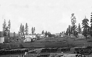
Plummer is a city in Benewah County, Idaho, United States. The population was 1,044 at the 2010 census, up from 990 in 2000. It is the largest city within the Coeur d'Alene Reservation, and is accessed by U.S. Route 95, the state's primary north-south highway.
Oxford is a city in Franklin County, Idaho, United States. The population was 48 at the 2010 census.
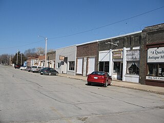
Floyd is a city in Floyd County, Iowa, United States. The population was 313 at the time of the 2020 census.
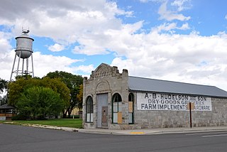
North Powder is a city in Union County, Oregon, United States. The population was 439 at the 2010 census.
Benton City is a city in Benton County, Washington, United States. The population was 3,038 at the 2010 census. The city shares a school district with the adjacent unincorporated community of Kiona.
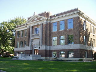
Prosser is a city in and the county seat of Benton County, Washington, United States. Situated along the Yakima River, it had a population of 5,714 at the 2010 census.
West Richland is a city in Benton County, Washington. The population was 16,295 at the time of the 2020 census. The city is part of the Tri-Cities metropolitan area, whose principal cities are Richland, Kennewick, and Pasco.
Gleed is a census-designated place (CDP) in Yakima County, Washington, United States. The population was 2,906 at the 2010 census.
Grandview is a city in Yakima County, Washington, United States. It is about 38 miles west of Kennewick and 38 miles southeast of Yakima. The population was 10,907 at the 2020 census. Grandview's economy is agriculture based; with apples, cherries, concord and wine grapes, hops, asparagus, corn, wheat, dairy and other fruit and vegetable production supported by processing plants and cold storage facilities.
Granger is a city in Yakima County, Washington, United States. The population was 3,624 at the 2020 census. Although it was classified as a town in 2000, it has since been reclassified as a city.
Harrah is a town in Yakima County, Washington, United States. The population was 585 at the 2020 census. It is on the Yakama Indian Reservation. The mayor is Barbara Harrer.
Moxee is a small suburban community southeast of Yakima, Washington. Yakima and Moxee are both north of the Yakama Indian Reservation in Yakima County, Washington, United States. The population of Moxee was 4,326 at the 2020 census.
Naches is a town in Yakima County, Washington, United States. The population was 1,084 at the 2020 census.
Satus is a census-designated place (CDP) in Yakima County, Washington, United States, located on the eastern corner of the Yakama Indian Reservation. The population was 746 at the 2000 census. It is southwest from the Toppenish National Wildlife Refuge. The community was not recognized in the 2010 census. The area was first settled and established as a post office location in 1890.
Selah is a city in Yakima County, Washington, United States. The population was 8,153 at the 2020 census.
Sunnyside is a city in Yakima County, Washington, United States. The population was 16,375 at the 2020 census.
Terrace Heights is a census-designated place (CDP) in Yakima County, Washington, United States. The population was 6,937 at the 2010 census. It is essentially a suburb of the city of Yakima.
Toppenish is a city in Yakima County, Washington. As of the 2020 census, the city population was 8,854. It is located within the Yakama Indian Reservation, established in 1855.
Union Gap is a city in Yakima County, Washington, United States. As of the 2020 census, the city population was 6,568. Union Gap has become the retail hub for the entire Yakima Valley as a result of Valley Mall and other thriving businesses being located here. Part of the city is part of the Yakama Nation.