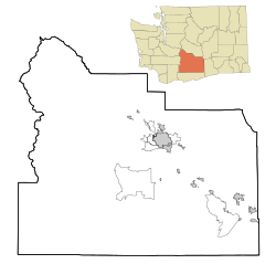
Black Rock is an unincorporated community and a census-designated place in McKinley County, New Mexico, United States. The population was 1,323 at the 2010 census.

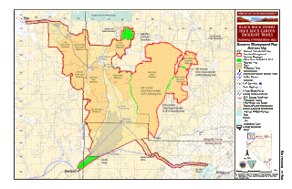
The Black Rock Desert is a semi-arid region of lava beds and playa, or alkali flats, situated in the Black Rock Desert–High Rock Canyon Emigrant Trails National Conservation Area, a silt playa 100 miles (160 km) north of Reno, Nevada that encompasses more than 300,000 acres (120,000 ha) of land and contains more than 120 miles (200 km) of historic trails. It is in the northern Nevada section of the Great Basin with a lakebed that is a dry remnant of Pleistocene Lake Lahontan.
BlackRock is a global investment management firm.
The UK Antarctic Place-Names Committee is a United Kingdom government committee, part of the Foreign and Commonwealth Office, responsible for recommending names of geographical locations within the British Antarctic Territory (BAT) and the South Georgia and the South Sandwich Islands (SGSSI). Such names are formally approved by the Commissioners of the BAT and SGSSI respectively and published in the BAT Gazetteer and the SGSSI Gazetteer maintained by the Committee. The BAT names are also published in the international Composite Gazetteer of Antarctica maintained by SCAR.
Lützow-Holm Bay is a large bay, about 220 kilometres (120 nmi) wide, indenting the coast of Queen Maud Land in Antarctica between Riiser-Larsen Peninsula and the coastal angle immediately east of the Flatvaer Islands. It was discovered by Captain Hjalmar Riiser-Larsen in two airplane flights from his expedition vessel, the Norvegia, on February 21 and 23, 1931. The name honours Commander Finn Lützow-Holm of the Royal Norwegian Navy Air Service, a pilot for Captain Riiser-Larsen on the Aagaard in 1935.
The Black River is a 41.1-mile-long (66.1 km) river on the Upper Peninsula of the U.S. state of Michigan, flowing mostly in Gogebic County into Lake Superior at 46°40′03″N90°02′57″W. Its source at 46°18′54″N90°01′15″W is a boreal wetland on the border with Iron County, Wisconsin. The northern section of the river, 14 miles (23 km) within the boundaries of the Ottawa National Forest, was designated a National Wild and Scenic River in 1992.
Black Rock is an unincorporated community and near-ghost town in the Beaver Bottoms in southern Millard County, Utah, United States, approximately 20 miles (32 km) north of Milford.

Annenkov Island is an island in South Georgia and the South Sandwich Islands, to the west of the main island of South Georgia. The Pickersgill Islands are to its southeast. It is irregularly shaped and 4 miles (6.4 km) long and 650 m (2,130 ft) high, lying 8 miles (13 km) off the south-central coast of South Georgia.

North Springfield is an unincorporated community and census-designated place in the town of Springfield, Windsor County, Vermont, United States. As of the 2010 census, the population of the CDP was 573. It lies at an altitude of 495 feet (151 m). A post office has been operated in North Springfield since 1832. Black River Produce, a major food processor and distributor, is headquartered in the village.

Arlington is a census-designated place (CDP) in southeastern Carbon County, Wyoming, United States. The population was 25 at the 2010 census.
Blackrock Head is a conspicuous coastal rock outcrop on the eastern part of Law Promontory, 3 nautical miles (6 km) northwest of Tryne Point in Antarctica. It was discovered in February 1936 by Discovery Investigations personnel on the William Scoresby and so named by them for its black, rocky appearance.
Blackrock Ridge is a ridge of exposed dark rock trending west-southwest–east-northeast, located 1.5 nautical miles (3 km) north of Penguin Point in central Seymour Island. The descriptive name "Filo Negro" was applied to this feature in Argentine geological reports on the island in 1978. The approved name, jointly recommended by the Advisory Committee on Antarctic Names and the UK Antarctic Place-Names Committee in 1991, avoids duplication with Black Ridge in the Deep Freeze Range.

Diamond, also known as Caseyville, is an unincorporated community in southern Raccoon Township, Parke County, in the U.S. state of Indiana.
Blackrock is an unincorporated community in York County, Pennsylvania, United States. Blackrock is located near the Mason–Dixon line, approximately one mile northwest of the town of Lineboro.
Bluerock Mountain is a mountain in Western North Carolina, near the community of Bat Cave. It is split between Henderson and Rutherford counties, it is home of the Bat Cave Preserve and part of Chimney Rock State Park. Its elevation reaches 2,835 feet (864 m).
Black Rock is an unincorporated community and former logging camp in Polk County, Oregon, United States. It is located about three miles west of Falls City, in the Central Oregon Coast Range on the Little Luckiamute River.

Rockport is an unincorporated community in Penn Township, Parke County, in the U.S. state of Indiana.
Rock Hill is an unincorporated community in Ohio Township, Spencer County, in the U.S. state of Indiana.
Black Rock is an extinct community located in Warren Township in Warren County, Indiana, near the border with Tippecanoe County. The site, which is still listed as a populated place by the USGS, is mostly forested and is part of the Black Rock Nature Preserve administered by NICHES Land Trust.
House Rock is a ghost town near the northwest end of the House Rock Valley in northern Coconino County, Arizona, United States. The community was named after the House Rock Valley, which was named by the John Wesley Powell Expedition in 1871.


