Cliffdell, Washington | |
|---|---|
 Cliffdell, Washington Location of Cliffdell, Washington | |
| Coordinates: 46°55′20″N121°02′35″W / 46.92222°N 121.04306°W [1] | |
| Country | United States |
| State | Washington |
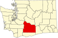
| County | Yakima |
| Elevation | 2,474 ft (754 m) |
| Time zone | UTC-8 (Pacific (PST)) |
| • Summer (DST) | UTC-7 (PDT) |
| ZIP code | 98929 |
| Area code | 509 |
| FIPS code | 53-13015 [2] |
| GNIS feature ID | 2584961 [1] |
Cliffdell is an unincorporated community in Yakima County, Washington, United States, located approximately 23 miles west of Ellensburg.
The community, located on SR 410 and the Naches River, was originally named Spring Flats. In 1920, it was renamed Cliffdell in honor of Cliff and Della Schott of Seattle. The Schotts were friends of homesteader Russell Davison, who developed much of the area for summer homes. Cliffdell was the site of a temporary army camp once used by Captain William O. Slaughter in 1855. [3]