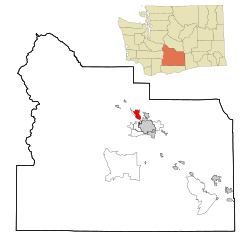
Yakima County is a county in the U.S. state of Washington. As of the 2020 census, its population was 256,728. The county seat and most populous city is Yakima. The county was formed out of Ferguson County in January 1865 and is named for the Yakama tribe of Native Americans.

Pemberton Heights is an unincorporated community and census-designated place (CDP) located within Pemberton Township, in Burlington County, in the U.S. state of New Jersey. As of the 2010 United States Census, the CDP's population was 2,423.

Washington Heights is a census-designated place (CDP) in Orange County, New York, United States. The population was 2,205 at the 2020 census.

Green Valley is a census-designated place (CDP) and unincorporated community in Pennington County, South Dakota, United States. The population was 1,051 at the 2020 census.

Union Hill-Novelty Hill is a census-designated place (CDP) in King County, Washington, United States. The area was first recognized by the Census Bureau in the 2000 census. The population was 22,683 at the 2020 census.

Easton is an unincorporated community and census-designated place (CDP) in Kittitas County, Washington, United States. The population was 478 at the 2010 census. Easton is the annual site of the start/finish line for the Cascade Crest 100-mile ultra-running race.

Frederickson is a census-designated place (CDP) in Pierce County, Washington, United States. The population was 24,906 at the 2020 census.

Ahtanum is a census-designated place (CDP) in Yakima County, Washington. The population was 4,046 at the time of the 2020 census.

Eschbach is a census-designated place (CDP) in Yakima County, Washington, United States. The population was 441 at the 2020 census.

Granger is a city in Yakima County, Washington, United States. The population was 3,624 at the 2020 census. Although it was classified as a town in 2000, it has since been reclassified as a city.

Naches is a town in Yakima County, Washington, United States. The population was 1,084 at the 2020 census. The town is located along the Naches River west of Yakima near the eastern foothills of the Cascade Range.

Satus is a census-designated place (CDP) in Yakima County, Washington, United States, located on the eastern corner of the Yakama Indian Reservation. The population was 746 at the 2000 census. It is southwest from the Toppenish National Wildlife Refuge. The community was not recognized in the 2010 census. The area was first settled and established as a post office location in 1890.

Selah is a city in Yakima County, Washington, United States. It is north of Yakima and part of its metropolitan area. The city's population was 8,153 at the 2020 census.

Summitview is a census-designated place (CDP) in Yakima County, Washington, United States. The population was 2,066 at the 2020 census, a dramatic increase of 967 from the 2010 census.

Terrace Heights is a census-designated place (CDP) in Yakima County, Washington, United States. The population was 9,244 at the 2020 census. It is essentially a suburb of the city of Yakima.

Union Gap is a city in Yakima County, Washington, United States. The population was 6,568 at the 2020 census. Union Gap has become the retail hub for the entire Yakima Valley as a result of Valley Mall and other thriving businesses being located here. Part of the city is within the Yakama Nation.

Wapato is a town in Yakima County, Washington, United States. The population was 4,607 at the 2020 census. It has a Hispanic majority.

West Valley is a former census-designated place (CDP) in Yakima County, Washington, United States. The area has been annexed by the city of Yakima. The population was 10,433 at the 2000 census.

White Swan is a census-designated place (CDP) in Yakima County, Washington, United States. The population was 789 at the 2020 census.

Zillah is a city in Yakima County, Washington, United States, with a population of 3,179 as of the 2020 census.


