Byron, Washington | |
|---|---|
 Byron, Washington Location of Byron, Washington  Byron, Washington Byron, Washington (Washington (state)) | |
| Coordinates: 46°11′18″N119°52′41″W / 46.1884655°N 119.8780924°W [1] | |
| Country | United States |
| State | Washington |
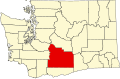
| County | Yakima |
| Elevation | 696 ft (212 m) |
| Time zone | UTC-8 (Pacific (PST)) |
| • Summer (DST) | UTC-7 (PDT) |
| ZIP code | 98935 |
| Area code | 509 |
| GNIS feature ID | 1510854 [2] |
Byron is an unincorporated community in Yakima County, Washington, United States, located approximately three miles west of Prosser.