
The Cascade Range or Cascades is a major mountain range of western North America, extending from southern British Columbia through Washington and Oregon to Northern California. It includes both non-volcanic mountains, such as many of those in the North Cascades, and the notable volcanoes known as the High Cascades. The small part of the range in British Columbia is referred to as the Canadian Cascades or, locally, as the Cascade Mountains. The highest peak in the range is Mount Rainier in Washington at 14,411 feet (4,392 m).
Palmer is an unincorporated community in King County, Washington, United States. It is located along the Green River next to the Kanaskat-Palmer State Park.

Hot Springs is a ghost town in King County, Washington, United States. Properly Green River Hot Springs, the town was first settled under the name Kendon by the Northern Pacific Railway in 1886. Hot Springs was at one time home to a large sanatorium built around the natural hot springs in the area, and by 1907–1908 had a population of 225 with two doctors. The sanatorium was reported to have been an impressive facility, having nice suites, bowling alleys and pool tables. A 1904 envelope has a return address, "The Kloeber, J. S. Kloeber, M.D. Green River Hot Springs, Wash.". The area was also home to Harvey Dean's mill. By 1913–14 the town's population had dropped to 65, with no businesses mentioned. Evidence points to the fact that sometime before 1913–14 the sanatorium had burned down. By 1918, the town had virtually vanished, only being listed as a "Discontinued Post Office."
Parker is a census-designated place and unincorporated community in central Yakima County, Washington, United States. It is located on U.S. Route 97 between the cities of Union Gap and Wapato on the Yakama Indian Reservation. The town had a population of 154 at the 2010 census.

State Route 823 (SR 823) is a state highway in Yakima County, Washington, United States. It runs for 5.6 miles (9.0 km) from an interchange with U.S. Route 12 (US 12) and through the city of Selah to a junction with SR 821. A portion of the highway runs in the median of Interstate 82 (I-82), its parent route, as it crosses the Naches River.

Kanaskat, Washington is an unincorporated community in King County, Washington, United States.

Whitstran is a small, unincorporated community in Benton County, Washington, located approximately four miles Northeast of Prosser and approximately ten miles west of Benton City. The focal point of the community is at the intersection of North Rothrock Road and Foisy Road, where there is a small grocery store, and nearby Whitstran Elementary School.

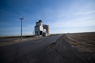
Tyler is an unincorporated community in Spokane County, Washington, United States. Tyler is located on Washington State Route 904 near Interstate 90, 10.4 miles (16.7 km) west-southwest of Cheney.
Donald is a census-designated place and unincorporated community in Yakima County, Washington, United States. The population was 91 at the 2010 census.
Byron is an unincorporated community in Yakima County, Washington, United States, located approximately three miles west of Prosser.
East Selah is an unincorporated community in Yakima County, Washington, United States, located east of Selah adjacent to the Yakima River.
Fruitvale is an unincorporated community in Yakima County, Washington, United States, located within the north city limits of Yakima.
Badger is an unincorporated community in Benton County, Washington, United States, located approximately three miles southwest of Richland, near Badger Springs and Badger Canyon.
Berrian was an unincorporated community in Benton County, Washington, located approximately nine miles east of Umatilla, Oregon, on the north bank of the Columbia River.

Gibbon is an unincorporated community in Benton County, Washington, United States, between Prosser and Benton City.
Longview is an unincorporated historic community in Benton County, Washington, United States, located approximately three miles west of Umatilla, Oregon on the north bank of the Columbia River, just above Devil's Bend Rapids.
North Prosser is an unincorporated community in Benton County, Washington, United States, located approximately one mile north of Prosser.
Yellepit was an unincorporated community in Benton County, Washington, United States, located approximately three miles southwest of Wallula on the west bank of the Columbia River.
Paha is an unincorporated community in Adams County, Washington, United States. It is located along BNSF Railway's Lakeside Subdivision. Paha is assigned the ZIP code 99169.
Tokio is a rural location and former rural community in Adams County, in the Palouse region of eastern Washington. It is located along Interstate 90 northeast of Ritzville.

