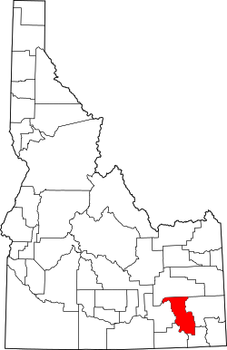
Bannock County, Idaho

Last updated

Bannock County
Bannock County Courthouse.jpg
Bannock County Courthouse in Pocatello
BannockCountySeal-Transparent.png
Map of Idaho highlighting Bannock County.svg
Location within the U.S. state of Idaho
Idaho in United States.svg
Idaho's location within the U.S.
Coordinates: 42°40′N112°13′W / 42.67°N 112.22°W / 42.67; -112.22
CountryFlag of the United States.svg United States
StateFlag of Idaho.svg  Idaho
FoundedMarch 6, 1893
Named for Bannock tribe
Seat Pocatello
Largest cityPocatello
Area
  Total1,147 sq mi (2,970 km2)
  Land1,112 sq mi (2,880 km2)
  Water35 sq mi (90 km2)  3.1%
Population
 (2020)
  Total87,018
  Estimate 
(2022)
89,517 Increase2.svg
  Density76/sq mi (29/km2)
Time zone UTC−7 (Mountain)
  Summer (DST) UTC−6 (MDT)
Congressional district 2nd
Website www.bannockcounty.us

Bannock County is a county in the southeastern part of Idaho. As of the 2020 census, the population was 87,018, [1] making it the sixth-most populous county in Idaho. The county seat and largest city is Pocatello. [2] The county was established in 1893 and named after the local Bannock tribe. [3] It is one of the counties with territories included in the Fort Hall Indian Reservation of the federally recognized Shoshone-Bannock Tribes.

Contents

Geography

According to the United States Census Bureau, the county has a total area of 1,147 square miles (2,970 km2), of which 1,112 square miles (2,880 km2) is land and 35 square miles (91 km2) (3.1%) is water. [4] The Portneuf River flows through the county, meeting the Snake River (the American Falls Reservoir) at the county's lowest point, its northwestern corner. Bonneville Peak, on the eastern border in the Portneuf Range, is the county's highest point at 9,271 feet (2,826 m) ASL; on its western slopes is the Pebble Creek ski area.

Adjacent counties

Highways

National protected area

Demographics

Historical population
CensusPop.Note
1900 11,702
1910 19,24264.4%
1920 27,53243.1%
1930 31,26613.6%
1940 34,75911.2%
1950 41,74520.1%
1960 49,34218.2%
1970 52,2005.8%
1980 65,42125.3%
1990 66,0260.9%
2000 75,56514.4%
2010 82,8399.6%
2020 87,0185.0%
2023 (est.)90,400 [5] 3.9%
U.S. Decennial Census [6]
1790–1960, [7] 1900–1990, [8]
1990–2000, [9] 2010–2020 [1]

Bannock County is part of the Pocatello, Idaho Metropolitan Statistical Area.

2010 census

As of the 2010 census, there were 82,839 people, 30,682 households, and 20,836 families in the county. [10] The population density was 74.5 inhabitants per square mile (28.8/km2). There were 33,191 housing units at an average density of 29.8 per square mile (11.5/km2). [11] The racial makeup of the county was 89.8% white, 3.2% American Indian, 1.3% Asian, 0.8% black or African American, 0.2% Pacific Islander, 2.1% from other races, and 2.7% from two or more races. Those of Hispanic or Latino origin made up 6.7% of the population. [10] In terms of ancestry, 23.4% were English, 16.9% were German, 9.3% were Irish, and 7.0% were American. [12]

Of the 30,682 households, 35.5% had children under the age of 18 living with them, 52.2% were married couples living together, 10.7% had a female householder with no husband present, 32.1% were non-families, and 24.9% of all households were made up of individuals. The average household size was 2.64 and the average family size was 3.17. The median age was 31.4 years. [10]

The median income for a household in the county was $44,848 and the median income for a family was $54,650. Males had a median income of $43,538 versus $28,870 for females. The per capita income for the county was $21,275. About 10.6% of families and 14.0% of the population were below the poverty line, including 16.6% of those under age 18 and 4.2% of those aged 65 or over. [13]

2000 census

As of the 2000 census, there were 75,565 people, 27,192 households, and 19,224 families in the county. The population density was 68 inhabitants per square mile (26/km2). There were 29,102 housing units at an average density of 26 per square mile (10/km2). The racial makeup of the county was 91.29% White, 0.59% Black or African American, 2.91% Native American, 0.99% Asian, 0.16% Pacific Islander, 2.08% from other races, and 1.98% from two or more races. 4.68% of the population were Hispanic or Latino of any race. 23.1% were of English, 14.2% German, 11.1% American, and 7.4% Irish ancestry.

There were 27,192 households, out of which 36.50% had children under the age of 18 living with them, 56.70% were married couples living together, 10.00% had a female householder with no husband present, and 29.30% were non-families. 22.80% of all households were made up of individuals, and 7.60% had someone living alone who was 65 years of age or older. The average household size was 2.69 and the average family size was 3.20.

The county population contained 28.10% under the age of 18, 14.60% from 18 to 24, 27.20% from 25 to 44, 20.00% from 45 to 64, and 10.10% who were 65 years of age or older. The median age was 30 years. For every 100 females, there were 97.70 males. For every 100 females aged 18 and over, there were 94.40 males.

The median income for a household in the county was $36,683, and the median income for a family was $44,192. Males had a median income of $36,056 versus $23,595 for females. The per capita income for the county was $17,148. About 9.80% of families and 13.90% of the population were below the poverty line, including 15.60% of those under age 18 and 7.60% of those aged 65 or over.

Government and politics

The last Democratic candidate for President to win the county was Lyndon B. Johnson in 1964, [14] although subsequent Republican victories have been by smaller margins than those in neighboring counties, due to the presence of Idaho State University.

United States presidential election results for Bannock County, Idaho [15]
Year Republican Democratic Third party
No.%No.%No.%
2020 23,33158.65%14,68236.91%1,7704.45%
2016 17,18051.41%10,34230.95%5,89417.64%
2012 21,01059.14%13,21437.20%1,2993.66%
2008 19,35654.62%14,79241.74%1,2893.64%
2004 21,47961.64%12,90337.03%4621.33%
2000 18,22359.07%10,89235.30%1,7375.63%
1996 14,05844.80%12,80640.81%4,51314.38%
1992 12,01637.30%11,09134.43%9,10428.26%
1988 14,98652.40%13,07445.71%5411.89%
1984 18,74265.77%9,39932.98%3551.25%
1980 18,47761.88%8,63928.93%2,7439.19%
1976 13,17253.65%10,26141.80%1,1174.55%
1972 12,85657.93%7,84035.33%1,4956.74%
1968 10,23447.97%9,08442.58%2,0169.45%
1964 7,82536.72%13,48363.28%00.00%
1960 9,15742.11%12,58657.89%00.00%
1956 10,47653.51%9,10146.49%00.00%
1952 10,86455.25%8,77144.61%270.14%
1948 5,58035.86%9,67962.20%3011.93%
1944 5,41335.84%9,68164.09%110.07%
1940 5,41934.05%10,49365.94%10.01%
1936 3,83028.60%9,44370.51%1200.90%
1932 4,67635.81%8,27163.34%1120.86%
1928 5,29753.22%4,60246.24%540.54%
1924 4,52044.99%1,61216.05%3,91438.96%
1920 4,87162.00%2,98638.00%00.00%
1916 2,95040.10%4,08455.52%3224.38%
1912 2,31648.04%1,48630.82%1,01921.14%
1908 2,69056.75%1,89239.92%1583.33%
1904 2,82668.58%1,06325.79%2325.63%
1900 1,68451.58%1,58148.42%00.00%
1896 22814.27%1,36385.29%70.44%

Similar to other Idaho counties, an elected three-member county commission heads the county government. Other elected officials include clerk, treasurer, sheriff, assessor, coroner, and prosecutor. [16]

Like other eastern Idaho counties, Bannock County has a significant Latter Day Saint population which tends to strongly vote Republican. However, a substantial trade union presence in the county - as well as the Idaho State University community - often gives Democrats an overall advantage, especially in local races. Bannock County routinely elects more Democrats than Republicans to county-level offices.

At the state level, Bannock County is located in Legislative Districts 28 and 29. [17] Democrats currently control two of these six seats in the Idaho Legislature. [18] In 2016, Republicans were able to win House Seat A in District 29.

Idaho Department of Correction operates the Pocatello Women's Correctional Center (PWCC) in Pocatello and in Bannock County. [19]

Communities

Cities

Census-designated places

Unincorporated communities

Education

School districts include: [24]

There is also a Bureau of Indian Education (BIE)-affiliated school, Shoshone Bannock Jr./Sr. High School.

See also

Related Research Articles

<span class="mw-page-title-main">Power County, Idaho</span> County in Idaho, United States

Power County is a county located in the U.S. state of Idaho. As of the 2020 Census, the county had a population of 7,878. The county seat and largest city is American Falls. The county was created by the Idaho Legislature on January 30, 1913, by a partition of Cassia County. It is named for an early hydroelectric power plant (1902) at the American Falls.

<span class="mw-page-title-main">Franklin County, Idaho</span> County in Idaho, United States

Franklin County is a county located in the U.S. state of Idaho. As of the 2020 Census the county had a population of 14,194. The county seat and largest city is Preston. The county was established in 1913 and named after Franklin D. Richards, an Apostle of the Church of Jesus Christ of Latter-day Saints. It is the only Franklin County in the United States that is not named after Benjamin Franklin. Franklin County is part of the Logan, UT-ID Metropolitan Statistical Area.

<span class="mw-page-title-main">Caribou County, Idaho</span> County in Idaho, United States

Caribou County is a county located in the U.S. state of Idaho. As of the 2020 Census the county had a population of 7,027. The county seat and largest city is Soda Springs.

<span class="mw-page-title-main">Camas County, Idaho</span> County in Idaho, United States

Camas County is a county in the southern portion of the U.S. state of Idaho. The county seat and largest city is Fairfield. The county was established 107 years ago in 1917 by the Idaho Legislature with a partition of Blaine County on February 6. It is named for the camas root, or Camassia, a lily-like plant with an edible bulb found in the region, that Native Americans and settlers used as a food source. As of the 2020 census, the population was 1,077, making it the second-least populous county in the state, after Clark County.

<span class="mw-page-title-main">Bingham County, Idaho</span> County in Idaho, United States

Bingham County is a county in the U.S. state of Idaho. As of the 2020 census, the population was 47,992. The county seat and largest city is Blackfoot.

<span class="mw-page-title-main">Arimo, Idaho</span> City in Bannock County, Idaho, United States

Arimo is a city in the Marsh Valley in central Bannock County, Idaho, United States, that is part of the 'Pocatello Metropolitan Statistical Area'. The population was 354 at the 2020 census.

<span class="mw-page-title-main">Chubbuck, Idaho</span> City in Idaho, United States

Chubbuck is a city in Bannock County, Idaho. It is part of the Pocatello Metropolitan Statistical Area. The population was 13,922 at the 2010 census. Chubbuck is located immediately north of Pocatello, Idaho, and has opposed several consolidation proposals since the 1960s.

<span class="mw-page-title-main">Downey, Idaho</span> City in Bannock County, Idaho, United States

Downey is a city in the Marsh Valley in southern Bannock County, Idaho, United States. It is part of the Pocatello Metropolitan Statistical Area. The population was 625 at the 2010 census.

<span class="mw-page-title-main">Fort Hall, Idaho</span> Census-designated place in Idaho, United States

Fort Hall is a census-designated place (CDP) in the southeastern part of the U.S. state of Idaho which is split between Bannock County in the south and Bingham County in the north. It is located on the Fort Hall Indian Reservation along the Snake River north of Pocatello and near the site of the original Fort Hall in the Oregon Country. The population was 3,201 at the 2010 census.

<span class="mw-page-title-main">Inkom, Idaho</span> City in Idaho, United States

Inkom is a city in Bannock County, Idaho. It is part of the Pocatello, Idaho Metropolitan Statistical Area. The population was 854 at the time of the 2010 census. It is the home of the smallest airport in the world, Simko Field Airport 1ID9, with a runway length of 122 meters.

<span class="mw-page-title-main">Lava Hot Springs, Idaho</span> City in Bannock County, Idaho, United States

Lava Hot Springs is a city along the Portneuf River in eastern Bannock County, Idaho, United States. It is part of the Pocatello, Idaho metropolitan area. The population was 407 at the 2010 census, down from 521 in 2000. Located in the mountainous valley of the Portneuf River on the old route of the Oregon Trail and California Trail, the city has become a popular resort location, noted for its numerous hot springs amenable to bathing and a turbulent inner tube run through part of the town.

<span class="mw-page-title-main">McCammon, Idaho</span> City in Idaho, United States

McCammon is a city in Bannock County, Idaho, United States. It is part of the Pocatello, Idaho Metropolitan Statistical Area'. The population was 809 at the 2010 census. In 1892, McCammon became the junction point between the Oregon Short Line Railroad and Utah and Northern Railway, and city gained the nickname Junction City.

<span class="mw-page-title-main">Pocatello, Idaho</span> City in the United States

Pocatello is the county seat and largest city of Bannock County, with a small portion on the Fort Hall Indian Reservation in neighboring Power County, in the southeastern part of the U.S. state of Idaho. It is the principal city of the Pocatello metropolitan area, which encompasses all of Bannock County.

<span class="mw-page-title-main">Aberdeen, Idaho</span> City in Bingham County, Idaho, United States

Aberdeen is a city in Bingham County, Idaho, United States. The community was named after Aberdeen, in Scotland. The population was 1,756 at the 2020 census.

<span class="mw-page-title-main">Dubois, Idaho</span> City in Idaho, United States

Dubois is a city in Clark County, Idaho, United States. The population was 511 at the 2020 census. The city is the county seat of Clark County.

<span class="mw-page-title-main">Hamer, Idaho</span> City in Idaho, United States

Hamer is a city in Jefferson County, Idaho, United States. It is part of the Idaho Falls Metropolitan Statistical Area. The population was 48 at the 2010 census.

<span class="mw-page-title-main">Rigby, Idaho</span> City in Idaho, United States

Rigby is a city in and the county seat of Jefferson County, Idaho, United States. The population was 5,038 at the 2020 census, up from 3,945 in 2010.

<span class="mw-page-title-main">Minidoka, Idaho</span> City in Idaho, United States

Minidoka is a city in Minidoka County, Idaho, United States. The population was 86 at the 2020 census, down from 112 in 2010. It is part of the Burley, Idaho Micropolitan Statistical Area.

<span class="mw-page-title-main">Arbon Valley, Idaho</span> Census-designated place in Power County, Idaho, United States

Arbon Valley is a census-designated place (CDP) in Power County, Idaho, in the United States. As of the 2010 census, the CDP population was 599. It lies within the Fort Hall Indian Reservation, just west of the city of Pocatello.

<span class="mw-page-title-main">Pocatello, Idaho metropolitan area</span>

The Pocatello Metropolitan Statistical Area, as defined by the United States Census Bureau, is an area consisting of Bannock and Power counties in eastern Idaho, anchored by the city of Pocatello. As of the 2010 census, the MSA had a population of 82,839. Power County was added back to the Pocatello MSA as of April 10, 2018. It is just south of the Idaho Falls metropolitan area.

References

  1. 1 2 "State & County QuickFacts". United States Census Bureau. Retrieved January 16, 2024.
  2. "Find a County". National Association of Counties. Archived from the original on May 31, 2011. Retrieved June 7, 2011.
  3. Idaho.gov - Bannock County Archived August 10, 2009, at the Wayback Machine - accessed May 31, 2009
  4. "US Gazetteer files: 2010, 2000, and 1990". United States Census Bureau. February 12, 2011. Retrieved April 23, 2011.
  5. "Annual Estimates of the Resident Population for Counties: April 1, 2020 to July 1, 2023". United States Census Bureau. Retrieved March 31, 2024.
  6. "U.S. Decennial Census". United States Census Bureau. Retrieved June 28, 2014.
  7. "Historical Census Browser". University of Virginia Library. Retrieved June 28, 2014.
  8. "Population of Counties by Decennial Census: 1900 to 1990". United States Census Bureau. Retrieved June 28, 2014.
  9. "Census 2000 PHC-T-4. Ranking Tables for Counties: 1990 and 2000" (PDF). United States Census Bureau. Archived (PDF) from the original on March 27, 2010. Retrieved June 28, 2014.
  10. 1 2 3 "Profile of General Population and Housing Characteristics: 2010 Demographic Profile Data". United States Census Bureau. Archived from the original on February 13, 2020. Retrieved January 4, 2016.
  11. "Population, Housing Units, Area, and Density: 2010 - County". United States Census Bureau. Archived from the original on February 13, 2020. Retrieved January 4, 2016.
  12. "Selected Social Characteristics in the US – 2006-2010 American Community Survey 5-Year Estimates". United States Census Bureau. Archived from the original on February 13, 2020. Retrieved January 4, 2016.
  13. "Selected Economic Characteristics – 2006-2010 American Community Survey 5-Year Estimates". United States Census Bureau. Archived from the original on February 13, 2020. Retrieved January 4, 2016.
  14. Dave Leip's Atlas of US Presidential Elections
  15. Leip, David. "Atlas of US Presidential Elections". uselectionatlas.org. Retrieved April 4, 2018.
  16. Bannock County Elections
  17. Idaho Legislative District Map Archived November 17, 2011, at the Wayback Machine
  18. Idaho Legislative Districts Archived November 10, 2008, at the Wayback Machine
  19. Static Printable Map of Pocatello & Chubbuck Archived September 27, 2011, at the Wayback Machine . City of Pocatello. Retrieved June 4, 2011.
  20. Blackrock ID Google Maps (accessed January 16, 2019)
  21. Portneuf ID Google Maps (accessed January 16, 2019)
  22. Robin ID Google Maps (accessed January 16, 2019)
  23. Zenda ID Google Maps (accessed January 16, 2019)
  24. "2020 CENSUS - SCHOOL DISTRICT REFERENCE MAP: Bannock County, ID" (PDF). United States Census Bureau. Archived (PDF) from the original on July 21, 2021. Retrieved July 21, 2022. - Text list

Further reading

42°40′N112°13′W / 42.67°N 112.22°W / 42.67; -112.22