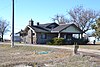
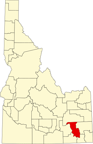
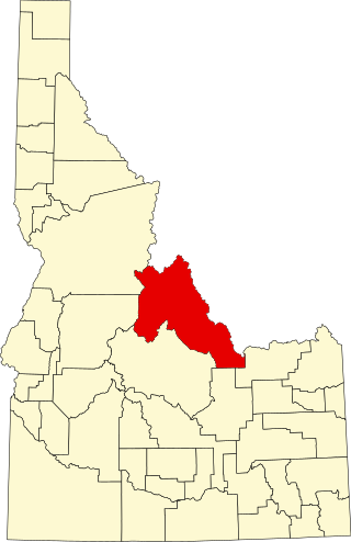
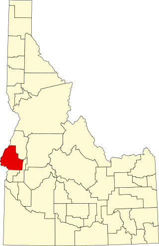
[4] Name on the Register [5] Image Date listed [6] Location City or town Description 1 Allton Building Upload image September 8, 1983 (# 83002299 160 E. Main St. 42°43′28″N 114°30′58″W / 42.724444°N 114.516111°W / 42.724444; -114.516111 (Allton Building ) Jerome 2 Tom Barnes Barn Upload image September 8, 1983 (# 83002317 East of Jerome 42°39′53″N 114°17′46″W / 42.664722°N 114.296111°W / 42.664722; -114.296111 (Tom Barnes Barn ) Jerome 3 Bethune-Ayres House Upload image September 8, 1983 (# 83002318 East of Jerome 42°41′00″N 114°21′50″W / 42.683333°N 114.363889°W / 42.683333; -114.363889 (Bethune-Ayres House ) Jerome 4 Carl Blessing Outbuildings Upload image September 8, 1983 (# 83002319 Northwest of Jerome 42°45′11″N 114°35′26″W / 42.753056°N 114.590556°W / 42.753056; -114.590556 (Carl Blessing Outbuildings ) Jerome 5 James Bothwell Water Tank House James Bothwell Water Tank House September 8, 1983 (# 83002320 North of Jerome 42°46′06″N 114°31′00″W / 42.768333°N 114.516667°W / 42.768333; -114.516667 (James Bothwell Water Tank House ) Jerome 6 Charles Bower House Upload image September 8, 1983 (# 83002321 North of Jerome 42°48′58″N 114°32′14″W / 42.816111°N 114.537222°W / 42.816111; -114.537222 (Charles Bower House ) Jerome 7 Frank J. Brick House Frank J. Brick House September 8, 1983 (# 83002322 300 N. Fillmore St. 42°43′35″N 114°30′28″W / 42.726389°N 114.507778°W / 42.726389; -114.507778 (Frank J. Brick House ) Jerome 8 Caldron Linn Caldron Linn June 27, 1972 (# 72000442 2 miles east of Murtaugh and 6 Miles south of Hazelton, Idaho 42°29′53″N 114°09′46″W / 42.498056°N 114.162778°W / 42.498056; -114.162778 (Caldron Linn ) Murtaugh and Hazelton Extends into Twin Falls County 9 Dick Callen House Dick Callen House September 8, 1983 (# 83002323 South of Jerome 42°40′36″N 114°31′02″W / 42.676667°N 114.517222°W / 42.676667; -114.517222 (Dick Callen House ) Jerome 10 Canyonside School Canyonside School October 14, 1983 (# 83003579 South of Jerome 42°40′00″N 114°31′05″W / 42.666667°N 114.518056°W / 42.666667; -114.518056 (Canyonside School ) Jerome 11 William H. Cook Water Tank House William H. Cook Water Tank House September 8, 1983 (# 83004211 Southeast of Jerome 42°40′00″N 114°24′25″W / 42.666667°N 114.406944°W / 42.666667; -114.406944 (William H. Cook Water Tank House ) Jerome 12 E. V. Cooke House Upload image September 8, 1983 (# 83002324 Northeast of Jerome 42°45′19″N 114°28′16″W / 42.755278°N 114.471111°W / 42.755278; -114.471111 (E. V. Cooke House ) Jerome 13 O. J. Daniels House O. J. Daniels House September 8, 1983 (# 83002325 South of Jerome 42°39′16″N 114°31′04″W / 42.654444°N 114.517778°W / 42.654444; -114.517778 (O. J. Daniels House ) Jerome 14 George V. Doughty House and Garage George V. Doughty House and Garage September 15, 1983 (# 83002326 Northeast of Jerome 42°46′58″N 114°28′40″W / 42.782778°N 114.477778°W / 42.782778; -114.477778 (George V. Doughty House and Garage ) Jerome The house has been demolished, but the garage is still standing. 15 George Epperson House George Epperson House September 8, 1983 (# 83002354 Southeast of Jerome 42°40′12″N 114°27′47″W / 42.67°N 114.463056°W / 42.67; -114.463056 (George Epperson House ) Jerome 16 G. H. Erdman House Upload image September 8, 1983 (# 83002353 West of Jerome 42°43′31″N 114°36′06″W / 42.725278°N 114.601667°W / 42.725278; -114.601667 (G. H. Erdman House ) Jerome 17 Falls City School House Falls City School House September 8, 1983 (# 83002352 Southeast of Jerome 42°40′51″N 114°25′24″W / 42.680833°N 114.423333°W / 42.680833; -114.423333 (Falls City School House ) Jerome 18 Merritt Fry Farm Merritt Fry Farm September 8, 1983 (# 83002351 West of Jerome 42°41′58″N 114°36′51″W / 42.699444°N 114.614167°W / 42.699444; -114.614167 (Merritt Fry Farm ) Jerome 19 E. C. Gleason House E. C. Gleason House September 8, 1983 (# 83002350 209 E. Ave. A 42°43′22″N 114°30′54″W / 42.722778°N 114.515°W / 42.722778; -114.515 (E. C. Gleason House ) Jerome 20 Hugh and Susie Goff House Upload image September 8, 1983 (# 83002349 Northeast of Jerome 42°48′42″N 114°28′19″W / 42.811667°N 114.471944°W / 42.811667; -114.471944 (Hugh and Susie Goff House ) Jerome 21 Lulu Graves Farm Upload image September 8, 1983 (# 83002348 Northwest of Jerome 42°45′34″N 114°32′15″W / 42.759444°N 114.5375°W / 42.759444; -114.5375 (Lulu Graves Farm ) Jerome 22 Greenwood School Greenwood School July 27, 2020 (# 100005364 2398 East 990 South 42°34′35″N 114°03′00″W / 42.5765°N 114.0499°W / 42.5765; -114.0499 (Greenwood School ) Hazelton 23 Edward M. Gregg Farm Upload image September 8, 1983 (# 83002347 Southeast of Jerome 42°40′49″N 114°30′02″W / 42.680278°N 114.500556°W / 42.680278; -114.500556 (Edward M. Gregg Farm ) Jerome 24 Bert and Fay Havens House Upload image September 8, 1983 (# 83002346 North of Hazelton 42°36′18″N 114°07′58″W / 42.605°N 114.132778°W / 42.605; -114.132778 (Bert and Fay Havens House ) Hazelton 25 Hazelton Presbyterian Church Hazelton Presbyterian Church April 26, 1991 (# 91000459 310 Park Ave. 42°35′42″N 114°08′05″W / 42.595°N 114.134722°W / 42.595; -114.134722 (Hazelton Presbyterian Church ) Hazelton 26 Heuer Well House/Water Tank Heuer Well House/Water Tank September 8, 1983 (# 83002345 Northeast of Jerome 42°46′02″N 114°26′38″W / 42.767222°N 114.443889°W / 42.767222; -114.443889 (Heuer Well House/Water Tank ) Jerome 27 Jerome City Pump House Jerome City Pump House September 8, 1983 (# 83002344 600 block of E. B St. 42°43′22″N 114°30′32″W / 42.722778°N 114.508889°W / 42.722778; -114.508889 (Jerome City Pump House ) Jerome It is a water works building built in 1922 by stonemason H.T. Pugh . 28 Jerome Cooperative Creamery Jerome Cooperative Creamery September 8, 1983 (# 83002338 313 S. Birch St. 42°43′21″N 114°31′18″W / 42.7225°N 114.521667°W / 42.7225; -114.521667 (Jerome Cooperative Creamery ) Jerome 29 Jerome County Courthouse Jerome County Courthouse September 28, 1987 (# 87001600 N. Lincoln 42°43′36″N 114°31′01″W / 42.726667°N 114.516944°W / 42.726667; -114.516944 (Jerome County Courthouse ) Jerome 30 Jerome First Baptist Church Jerome First Baptist Church September 8, 1983 (# 83002339 1st Ave., E. 42°43′32″N 114°30′50″W / 42.725556°N 114.513889°W / 42.725556; -114.513889 (Jerome First Baptist Church ) Jerome 31 Jerome National Bank Jerome National Bank January 9, 1978 (# 78001069 100 E. Main St. 42°43′27″N 114°31′06″W / 42.72414°N 114.51842°W / 42.72414; -114.51842 (Jerome National Bank ) Jerome 32 Edgar Johnson House Edgar Johnson House September 8, 1983 (# 83002340 South of Jerome 42°40′50″N 114°30′27″W / 42.680556°N 114.5075°W / 42.680556; -114.5075 (Edgar Johnson House ) Jerome 33 Clarence Keating House Clarence Keating House September 8, 1983 (# 83002341 Northeast of Jerome 42°45′26″N 114°27′41″W / 42.757222°N 114.461389°W / 42.757222; -114.461389 (Clarence Keating House ) Jerome 34 Thomas J. Kehrer House Thomas J. Kehrer House September 8, 1983 (# 83002342 North of Jerome 42°48′59″N 114°31′42″W / 42.816389°N 114.528333°W / 42.816389; -114.528333 (Thomas J. Kehrer House ) Jerome 35 Marion and Julia Kelley House Marion and Julia Kelley House September 8, 1983 (# 83002343 450 4th St., E. 42°35′31″N 114°07′56″W / 42.591944°N 114.132222°W / 42.591944; -114.132222 (Marion and Julia Kelley House ) Hazelton 36 Ben Laughlin Water Tank House-Garage Upload image September 8, 1983 (# 83002337 East of Jerome 42°40′29″N 114°23′06″W / 42.674722°N 114.385°W / 42.674722; -114.385 (Ben Laughlin Water Tank House-Garage ) Jerome 37 George Lawshe Well House Upload image September 8, 1983 (# 83002336 Southeast of Jerome 42°39′59″N 114°25′27″W / 42.666389°N 114.424167°W / 42.666389; -114.424167 (George Lawshe Well House ) Jerome 38 J. O. Lee House J. O. Lee House September 8, 1983 (# 83002335 5th Ave., E. 42°43′45″N 114°30′46″W / 42.729167°N 114.512778°W / 42.729167; -114.512778 (J. O. Lee House ) Jerome 39 J. O. Lee Honey House J. O. Lee Honey House September 8, 1983 (# 83002334 5th Ave., E. 42°43′45″N 114°30′47″W / 42.729167°N 114.513056°W / 42.729167; -114.513056 (J. O. Lee Honey House ) Jerome 40 Joseph Mandl House Joseph Mandl House September 8, 1983 (# 83002333 800 N. Fillmore St. 42°43′52″N 114°30′28″W / 42.731111°N 114.507778°W / 42.731111; -114.507778 (Joseph Mandl House ) Jerome 41 Milner Dam and the Twin Falls Main Canal Milner Dam and the Twin Falls Main Canal July 10, 1986 (# 86001720 Twin Falls Main Canal between Murtaugh and Milner Lakes 42°29′58″N 114°04′50″W / 42.499444°N 114.080556°W / 42.499444; -114.080556 (Milner Dam and the Twin Falls Main Canal ) Milner Butte Extends into Twin Falls County 42 Minidoka Internment National Monument Minidoka Internment National Monument July 10, 1979 (# 79000791 Hunt Rd. 42°40′42″N 114°15′00″W / 42.678333°N 114.25°W / 42.678333; -114.25 (Minidoka Internment National Monument ) Hunt 43 J. W. and Rachel Newman House and Bunkhouse Upload image September 8, 1983 (# 83002332 East of Jerome 42°39′53″N 114°19′28″W / 42.664722°N 114.324444°W / 42.664722; -114.324444 (J. W. and Rachel Newman House and Bunkhouse ) Jerome 44 North Side Canal Company Slaughter House Upload image September 8, 1983 (# 83002331 Northeast of Jerome 42°44′46″N 114°30′51″W / 42.746111°N 114.514167°W / 42.746111; -114.514167 (North Side Canal Company Slaughter House ) Jerome 45 Jessie Osborne House Upload image September 8, 1983 (# 83002329 West of Jerome 42°43′33″N 114°36′28″W / 42.725833°N 114.607778°W / 42.725833; -114.607778 (Jessie Osborne House ) Jerome 46 Greer and Jennie Quay House Greer and Jennie Quay House September 8, 1983 (# 83002330 Northeast of Jerome 42°45′50″N 114°30′03″W / 42.763889°N 114.500833°W / 42.763889; -114.500833 (Greer and Jennie Quay House ) Jerome 47 Julian T. Ricketts House Julian T. Ricketts House September 8, 1983 (# 83002328 Southeast of Jerome 42°40′51″N 114°25′15″W / 42.680833°N 114.420833°W / 42.680833; -114.420833 (Julian T. Ricketts House ) Jerome 48 John F. Schmerschall House John F. Schmerschall House September 8, 1983 (# 83002327 248 E. Ave. A 42°43′27″N 114°30′53″W / 42.724167°N 114.514722°W / 42.724167; -114.514722 (John F. Schmerschall House ) Jerome 49 L. Fay Shepard House Upload image September 8, 1983 (# 83002300 South of Hazelton 42°30′41″N 114°08′57″W / 42.511389°N 114.149167°W / 42.511389; -114.149167 (L. Fay Shepard House ) Hazelton 50 Shoshone Falls Power Plant Caretaker's House Upload image September 8, 1983 (# 83002301 Southeast of Jerome 42°35′50″N 114°24′08″W / 42.597222°N 114.402222°W / 42.597222; -114.402222 (Shoshone Falls Power Plant Caretaker's House ) Jerome 51 W. H. Silbaugh House Upload image September 8, 1983 (# 83002302 West of Jerome 42°43′26″N 114°35′31″W / 42.723889°N 114.591944°W / 42.723889; -114.591944 (W. H. Silbaugh House ) Jerome 52 Edward S. Spencer House and Garage and the Fred Nelson Barn Edward S. Spencer House and Garage and the Fred Nelson Barn September 8, 1983 (# 83002303 North of Jerome 42°49′27″N 114°30′10″W / 42.824167°N 114.502778°W / 42.824167; -114.502778 (Edward S. Spencer House and Garage and the Fred Nelson Barn ) Jerome 53 Arnold Stevens House Arnold Stevens House September 8, 1983 (# 83002304 West of Jerome 42°43′32″N 114°35′12″W / 42.725556°N 114.586667°W / 42.725556; -114.586667 (Arnold Stevens House ) Jerome 54 John Stickel House Upload image September 8, 1983 (# 83002305 West of Jerome 42°42′42″N 114°34′39″W / 42.711667°N 114.5775°W / 42.711667; -114.5775 (John Stickel House ) Jerome 55 Sugarloaf School Sugarloaf School September 8, 1983 (# 83002306 East of Jerome 42°41′26″N 114°21′54″W / 42.690556°N 114.365°W / 42.690556; -114.365 (Sugarloaf School ) Jerome 56 Rice Thomason Barn Rice Thomason Barn September 8, 1983 (# 83002307 East of Jerome 42°41′40″N 114°23′00″W / 42.694444°N 114.383333°W / 42.694444; -114.383333 (Rice Thomason Barn ) Jerome 57 Don Tooley House Don Tooley House September 8, 1983 (# 83002308 Northeast of Jerome 42°46′35″N 114°28′30″W / 42.776389°N 114.475°W / 42.776389; -114.475 (Don Tooley House ) Jerome 58 Jay Van Hook Potato Cellar Upload image September 8, 1983 (# 83002309 South of Jerome 42°41′50″N 114°31′05″W / 42.697222°N 114.518056°W / 42.697222; -114.518056 (Jay Van Hook Potato Cellar ) Jerome 59 Jacob B. Van Wagener Barn Jacob B. Van Wagener Barn September 8, 1983 (# 83002310 Southeast of Jerome 42°40′53″N 114°26′38″W / 42.681389°N 114.443889°W / 42.681389; -114.443889 (Jacob B. Van Wagener Barn ) Jerome 60 Jacob B. Van Wagener Caretaker's House Upload image September 8, 1983 (# 83002311 Southeast of Jerome 42°41′01″N 114°26′35″W / 42.683611°N 114.443056°W / 42.683611; -114.443056 (Jacob B. Van Wagener Caretaker's House ) Jerome 61 William T. and Clara H. Veazie House Upload image September 8, 1983 (# 83002312 Southwest of Jerome 42°40′30″N 114°34′33″W / 42.675°N 114.575833°W / 42.675; -114.575833 (William T. and Clara H. Veazie House ) Jerome 62 Charles C. Vineyard House Charles C. Vineyard House September 8, 1983 (# 83002313 Southwest of Eden 42°35′29″N 114°19′36″W / 42.591389°N 114.326667°W / 42.591389; -114.326667 (Charles C. Vineyard House ) Eden 63 Thomas Vipham House Thomas Vipham House September 8, 1983 (# 83002314 313 E. Ave. D 42°43′12″N 114°30′47″W / 42.72°N 114.513056°W / 42.72; -114.513056 (Thomas Vipham House ) Jerome 64 Archie Webster House Archie Webster House September 8, 1983 (# 83002316 West Ave. and W. Ave. B 42°43′19″N 114°31′50″W / 42.721944°N 114.530556°W / 42.721944; -114.530556 (Archie Webster House ) Jerome 65 William Weigle House and Water Tank William Weigle House and Water Tank September 8, 1983 (# 83002315 Northwest of Jerome 42°45′36″N 114°35′45″W / 42.76°N 114.595833°W / 42.76; -114.595833 (William Weigle House and Water Tank ) Jerome 66 Wilson Butte Cave Wilson Butte Cave November 21, 1974 (# 74000741 Address Restricted Hunt