In 2010, the center of Idaho's population was in Boise County.[4]
History
The county was established on February 4, 1864, with its county seat at Idaho City.[5] It was named for the Boise River, which was named by French-Canadian explorers and trappers for the great variety of trees growing along its banks in the lower desert valley. The county is one of four Idaho counties that also existed under Washington Territory. On January 12, 1863, The Washington territorial legislature established the county containing most of Idaho below 114° 30', excluding the territory lying west of the Payette River. They established its county seat at what later became Idaho City.[6]
The Boise Basin, which contains Idaho City, was one of the nation's richest gold mining districts; gold was discovered in 1862,[5] and more of it was pulled from present-day Boise County than from the entire state of Alaska. At its peak in the mid-1860s, Idaho City was the largest city in the Northwest, and it was this rapid population influx that led to the establishment of the Idaho Territory in 1863.[5] The lower–elevation communities of Horseshoe Bend (Payette River) and Boise (Boise River) were staging areas for the Boise Basin mines.[7][8]
The county's boundaries changed several times during Idaho's territorial period. Owyhee County (Idaho's oldest) and a portion of Oneida County were carved from the southern and eastern portion of the county as it existed under Washington Territory in late December 1863 and January 1864. When Idaho Territory established the county in February 1864, it contained all of present Ada, Canyon, and Payette counties. It also included most of present Boise and Gem Counties, the southern half of Washington County, and small portions of Adams, Custer, Owyhee, and Valley counties.
When Ada County was created in December 1864, most of that territory was transferred to Ada County, leaving only small portions of Custer, Gem, Payette, Valley, and Washington counties together with most of present-day Boise County. The Boise River portion of the current western boundary was established by 1866. The southern boundary common to present Ada County was defined the following year. The northern boundary was most volatile Between 1873 and 1887 with the boundary shifting further north into Valley County, back south below Cascade, and then again north to include the North Fork of Payette River Basin. The county obtained its current boundary after Gem County was created in 1915 and Valley County in 1918.[9]
In March 2011, the county filed a Chapter 9 bankruptcy petition due to judgment against the county for violating the Fair Housing Act.[10] The county's petition for Chapter 9 relief was denied.[11]
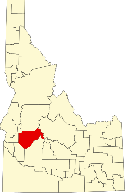
Geography
According to the U.S. Census Bureau, the county has an area of 1,907 square miles (4,940km2), of which 1,899 square miles (4,920km2) is land and 7.4 square miles (19km2) (0.4%) is water.[12] The highest point in the county is Thompson Peak at 10,751 feet (3,277m), on its eastern border in the Sawtooth Wilderness. The county's lowest point is on the Payette River, on its western border with Gem County, at approximately 2,500 feet (760m).
The elevated central basin area rises 1,700 feet (520m) higher than Horseshoe Bend for instance and thus receives significantly more snow during the winter. Star Ranch, Placerville, and Centerville average 4,300 feet (1,310m) above sea level whereas Horseshoe Bend is 1,700 feet (520m) lower, Garden Valley is 1,157 feet (355m) lower, and Idaho City is 400 feet (120m) lower. Snow volumes around the county are best illustrated by the county Snow Load Map. Placerville roofs must be designed to withstand 150 pounds per square foot of snow whereas Horseshoe Bend is a third of that at 52.
The closest thing to a traffic signal in Boise County is a flashing red light for Highway 52 where it meets Highway 55, in Horseshoe Bend. Highway 55 has a flashing yellow.
US Decennial Census[16] 1790–1960,[17] 1900–1990,[18] 1990–2000,[19] 2010–2020[1]
2020 census
As of the 2020 census, the county had a population of 7,610. The median age was 53.9 years. 16.5% of residents were under the age of 18 and 26.7% of residents were 65 years of age or older. For every 100 females there were 109.2 males, and for every 100 females age 18 and over there were 109.1 males.[20]
0.0% of residents lived in urban areas, while 100.0% lived in rural areas.[22]
There were 3,364 households in the county, of which 20.6% had children under the age of 18 living with them and 15.5% had a female householder with no spouse or partner present. About 26.5% of all households were made up of individuals and 13.5% had someone living alone who was 65 years of age or older.[20]
There were 5,443 housing units, of which 38.2% were vacant. Among occupied housing units, 85.6% were owner-occupied and 14.4% were renter-occupied. The homeowner vacancy rate was 1.0% and the rental vacancy rate was 10.7%.[20]
2010 census
As of the 2010 United States census, there were 7,028 people, 2,974 households, and 2,051 families in the county.[23] The population density was 3.7 inhabitants per square mile (1.4/km2). There were 5,292 housing units at an average density of 2.8 unitsper square mile (1.1 units/km2).[24] The racial makeup of the county was 95.4% white, 0.8% American Indian, 0.4% Asian, 0.2% black or African American, 0.1% Pacific islander, 0.8% from other races, and 2.3% from two or more races. Those of Hispanic or Latino origin made up 3.5% of the population.[23] In terms of ancestry, 26.0% were German, 17.4% were English, 10.9% were Irish, 8.6% were American, and 6.0% were Scottish.[25]
Of the 2,974 households, 24.6% had children under the age of 18 living with them, 59.5% were married couples living together, 5.6% had a female householder with no husband present, 31.0% were non-families, and 25.3% of all households were made up of individuals. The average household size was 2.35 and the average family size was 2.80. The median age was 48.4 years.[23]
The median income for a household in the county was $48,789 and the median income for a family was $60,042. Males had a median income of $48,676 versus $36,919 for females. The per capita income for the county was $24,288. About 8.9% of families and 16.3% of the population were below the poverty line, including 23.4% of those under age 18 and 9.6% of those age 65 or over.[26]
There were 2,616 households, out of which 30.70% had children under the age of 18 living with them, 62.50% were married couples living together, 5.80% had a female householder with no husband present, and 27.40% were non-families. 21.80% of all households were made up of individuals, and 6.10% had someone living alone who was 65 years of age or older. The average household size was 2.52 and the average family size was 2.93.
The county population contained 26.90% under the age of 18, 4.70% from 18 to 24, 27.10% from 25 to 44, 30.30% from 45 to 64, and 11.00% who were 65 years of age or older. The median age was 40 years. For every 100 females, there were 105.40 males. For every 100 females age 18 and over, there were 106.30 males[citation needed].
The median income for a household in the county was $38,651, and the median income for a family was $43,138. Males had a median income of $35,802 versus $26,250 for females. The per capita income for the county was $18,787. About 9.00% of families and 12.90% of the population were below the poverty line, including 16.40% of those under age 18 and 7.70% of those age 65 or over.
Hattie F. Noble was the first woman to represent Boise in 1898, after Idaho had given voting rights to women in 1896.[35]
Like Idaho as a whole, Boise County voters are reliably Republican. In only one national election since 1948 has the county selected the Democratic Party candidate.
United States presidential election results for Boise County, Idaho[36]
↑"Census of 1863"(PDF). Idaho State Historical Society. Reference Series, # 129. Archived from the original(PDF) on January 24, 2013. Retrieved June 22, 2013.
↑"Census of 1864"(PDF). Idaho State Historical Society. Reference Series, # 130. Archived from the original(PDF) on February 3, 2013. Retrieved June 22, 2013.
This page is based on this Wikipedia article Text is available under the CC BY-SA 4.0 license; additional terms may apply. Images, videos and audio are available under their respective licenses.