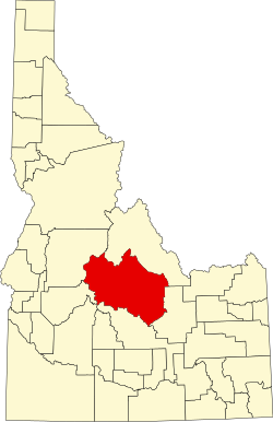
Custer County, Idaho

Last updated

Custer County
Yankeeforkstamp.jpg
Mill used to process gold and silver ore at Yankee Fork mining operations.
Custer County, Idaho seal.png
Map of Idaho highlighting Custer County.svg
Location within the U.S. state of Idaho
Idaho in United States.svg
Idaho's location within the U.S.
Coordinates: 44°14′N114°17′W / 44.23°N 114.29°W / 44.23; -114.29
CountryFlag of the United States.svg United States
StateFlag of Idaho.svg  Idaho
FoundedJanuary 8, 1881
Named for General Custer gold mine
Seat Challis
Largest cityChallis
Area
  Total4,937 sq mi (12,790 km2)
  Land4,921 sq mi (12,750 km2)
  Water16 sq mi (40 km2)  0.3%
Population
 (2020)
  Total4,249 Decrease2.svg
  Density0.88/sq mi (0.34/km2)
Time zone UTC−7 (Mountain)
  Summer (DST) UTC−6 (MDT)
Congressional district 2nd
Website www.co.custer.id.us
Leatherman Peak, 12,228 feet (3,727 m), second highest in Idaho, in the Lost River Range in eastern Custer County Leatherman peak2 id.jpg
Leatherman Peak, 12,228 feet (3,727 m), second highest in Idaho, in the Lost River Range in eastern Custer County

Custer County is a rural mountain county in the center of the U.S. state of Idaho. As of the 2020 census, the population was 4,275, [1] making it the fifth-least populous county in Idaho. The county seat is Challis. [2] Established in 1881, the county was named for the General Custer Mine, where gold was discovered five years earlier. Custer County relies on ranching, mining, and tourism as its main resources. [3]

Contents

Geography

According to the U.S. Census Bureau, the county has a total area of 4,937 square miles (12,790 km2), of which 4,721 square miles (12,230 km2) is land and 16 square miles (41 km2) (0.3%) is water. [4] It is the third-largest county in Idaho by area.

The Lost River Range, the state's highest mountains, are located in eastern Custer County. The highest is Borah Peak, the highest natural point in Idaho at 12,662 feet (3,859 m). On the western border of the county is Idaho's famous Sawtooth Range; the tallest is Thompson Peak in Custer County, above picturesque Redfish Lake. Twenty miles (32 km) east are the White Cloud Mountains, the tallest of which is Castle Peak at 11,815 feet (3,601 m).

The Salmon River and Big Lost River flow through Custer County.

Adjacent counties

Major highways

National protected areas

Demographics

Historical population
CensusPop.Note
1890 1,870
1900 2,0499.6%
1910 3,00146.5%
1920 3,55018.3%
1930 3,162−10.9%
1940 3,54912.2%
1950 3,318−6.5%
1960 2,996−9.7%
1970 2,967−1.0%
1980 3,38514.1%
1990 4,13322.1%
2000 4,3425.1%
2010 4,3680.6%
2020 4,275−2.1%
2023 (est.)4,523 [5] 5.8%
U.S. Decennial Census [6]
1790–1960 [7] 1900–1990 [8]
1990–2000 [9] 2010–2020 [1]

2000 census

As of the census [10] of 2000, there were 4,342 people, 1,770 households, and 1,196 families living in the county. The population density was 0.88 people per square mile (0.34 people/km2). There were 2,983 housing units at an average density of 0.60 units per square mile (0.23 units/km2). The racial makeup of the county was 97.28% White, 0.55% Native American, 0.02% Asian, 0.02% Pacific Islander, 1.17% from other races, and 0.94% from two or more races. 4.21% of the population were Hispanic or Latino of any race. 18.6% were of English, 17.0% German, 10.9% Irish and 9.9% American ancestry.

There were 1,770 households, out of which 29.90% had children under the age of 18 living with them, 60.10% were married couples living together, 4.40% had a female householder with no husband present, and 32.40% were non-families. 27.70% of all households were made up of individuals, and 11.30% had someone living alone who was 65 years of age or older. The average household size was 2.41 and the average family size was 2.96.

In the county, the population was spread out, with 25.50% under the age of 18, 4.80% from 18 to 24, 25.90% from 25 to 44, 29.30% from 45 to 64, and 14.50% who were 65 years of age or older. The median age was 41 years. For every 100 females there were 104.50 males. For every 100 females age 18 and over, there were 106.80 males.

The median income for a household in the county was $32,174, and the median income for a family was $39,551. Males had a median income of $32,255 versus $21,463 for females. The per capita income for the county was $15,783. About 10.70% of families and 14.30% of the population were below the poverty line, including 16.70% of those under age 18 and 12.80% of those age 65 or over.

2010 census

As of the 2010 United States Census, there were 4,368 people, 1,936 households, and 1,244 families living in the county. [11] The population density was 0.9 inhabitants per square mile (0.35/km2). There were 3,103 housing units at an average density of 0.6 units per square mile (0.23 units/km2). [12] The racial makeup of the county was 96.4% white, 0.6% American Indian, 0.2% black or African American, 0.2% Asian, 0.1% Pacific islander, 1.5% from other races, and 1.0% from two or more races. Those of Hispanic or Latino origin made up 4.0% of the population. [11] In terms of ancestry, 34.3% were English, 25.6% were German, 19.5% were Irish, and 2.8% were American. [13]

Of the 1,936 households, 24.2% had children under the age of 18 living with them, 55.7% were married couples living together, 4.8% had a female householder with no husband present, 35.7% were non-families, and 30.2% of all households were made up of individuals. The average household size was 2.25 and the average family size was 2.74. The median age was 48.0 years. [11]

The median income for a household in the county was $41,910 and the median income for a family was $56,710. Males had a median income of $42,865 versus $27,317 for females. The per capita income for the county was $22,625. About 10.1% of families and 13.8% of the population were below the poverty line, including 19.2% of those under age 18 and 13.2% of those age 65 or over. [14]

Politics

Custer County is overwhelmingly Republican. The last Democrat to carry the county was John F. Kennedy in 1960, since 1968 no Democrat has passed 37 percent of the county's vote, and the last to pass 28 percent was Michael Dukakis in 1988. However, unusually for so Republican a county, the westernmost precincts adjacent to Blaine County give Democratic majorities in most statewide elections. In the 2008 Presidential election, it supported Republican John McCain over Democrat Barack Obama by a margin of 71 percent to 25 percent. In 2012, the county gave Mitt Romney a first ballot victory in the Republican primary caucus [15] and subsequently voted 74.1 percent for him in the Presidential election. [16] In 2016, Donald Trump won the Republican primaries with 41.8 percent of support in the county although Ted Cruz won the state with 45.5 percent. [17]

United States presidential election results for Custer County, Idaho [18]
Year Republican Democratic Third party
No.%No.%No.%
2020 2,08976.27%60322.02%471.72%
2016 1,77773.61%42717.69%2108.70%
2012 1,74474.06%53022.51%813.44%
2008 1,69471.99%61125.97%482.04%
2004 1,76274.72%55923.71%371.57%
2000 1,79477.00%41617.85%1205.15%
1996 1,24953.93%63527.42%43218.65%
1992 82938.31%56426.06%77135.63%
1988 1,25366.09%61632.49%271.42%
1984 1,65377.10%46121.50%301.40%
1980 1,39873.50%39820.93%1065.57%
1976 85060.33%51636.62%433.05%
1972 98969.06%27419.13%16911.80%
1968 71149.96%38527.06%32722.98%
1964 72050.21%71449.79%00.00%
1960 65143.72%83856.28%00.00%
1956 81160.34%53339.66%00.00%
1952 1,05869.74%45229.80%70.46%
1948 61248.69%62549.72%201.59%
1944 56547.96%61352.04%00.00%
1940 76045.81%89453.89%50.30%
1936 53037.30%87561.58%161.13%
1932 44033.77%83964.39%241.84%
1928 64755.25%51644.06%80.68%
1924 58545.99%39430.97%29323.03%
1920 80867.22%39432.78%00.00%
1916 45432.22%87962.38%765.39%
1912 32627.42%50142.14%36230.45%
1908 52143.09%59849.46%907.44%
1904 49651.29%42944.36%424.34%
1900 26130.67%59069.33%00.00%

Communities

Grand View Canyon (US-93) between Mackay and Challis Grand view canyon1 id.jpg
Grand View Canyon (US-93) between Mackay and Challis
Grand View Canyon (US-93) Grandview canyon2 id.jpg
Grand View Canyon (US-93)

Cities

Unincorporated communities

Ghost towns

Education

School districts include: [19]

College of Eastern Idaho includes this county in its catchment zone; however this county is not in its taxation zone. [20]

See also

Related Research Articles

<span class="mw-page-title-main">Nez Perce County, Idaho</span> County in Idaho, United States

Nez Perce County is a county located in the U.S. state of Idaho. As of the 2020 census, the population was 42,090. The county seat is Lewiston. The county is named after the Native American Nez Perce tribe. Nez Perce County is part of the Lewiston, Idaho–WA Metropolitan Statistical Area.

<span class="mw-page-title-main">Custer County, South Dakota</span> County in South Dakota, United States

Custer County is a county in the U.S. state of South Dakota. As of the 2020 census, the population was 8,318. Its county seat is Custer. The county was created in 1875, and was organized in 1877.

<span class="mw-page-title-main">Valley County, Idaho</span> County in Idaho, United States

Valley County is a rural county located in the U.S. state of Idaho. As of the 2020 census, the population was 11,746. The county seat is Cascade, and the largest city is McCall. Established in 1917, it was named after the Long Valley of the North Fork of the Payette River, which extends over 30 miles (50 km) from Payette Lake at McCall south to Cascade to Round Valley. The valley was formerly a summer pasture for livestock from the Boise Valley. Since the completion of the Cascade Dam in 1948, much of the northern valley has been covered by the Cascade Reservoir.

<span class="mw-page-title-main">Twin Falls County, Idaho</span> County in Idaho, United States

Twin Falls County is a county in the south central part of the U.S. state of Idaho. As of the 2020 census, the population was 90,046, making it the fifth-most populous county in Idaho. The county seat and largest city is Twin Falls. Twin Falls County is part of the Twin Falls, ID Twin Falls Metropolitan Statistical Area.

<span class="mw-page-title-main">Power County, Idaho</span> County in Idaho, United States

Power County is a county located in the U.S. state of Idaho. As of the 2020 Census, the county had a population of 7,878. The county seat and largest city is American Falls. The county was created by the Idaho Legislature on January 30, 1913, by a partition of Cassia County. It is named for an early hydroelectric power plant (1902) at the American Falls.

<span class="mw-page-title-main">Oneida County, Idaho</span> County in Idaho, United States

Oneida County is a county located in the U.S. state of Idaho. As of the 2020 Census the county had a population of 4,564. The county seat and largest city is Malad City. Most of the county's population lives in Malad City and the surrounding Malad Valley.

<span class="mw-page-title-main">Lincoln County, Idaho</span> County in Idaho, United States

Lincoln County is a county located in the U.S. state of Idaho. As of the 2020 census, the population was 5,127. The county seat and largest city is Shoshone. The county is named after President Abraham Lincoln. The Idaho Territory was created in 1863, during the Lincoln Administration of 1861–65.

<span class="mw-page-title-main">Lemhi County, Idaho</span> County in Idaho, United States

Lemhi County is a county located in the U.S. state of Idaho. As of the 2020 census, the population was 7,974. The largest city and county seat is Salmon. The county was established in 1869 and named after Fort Lemhi, a remote Mormon missionary settlement from 1855 to 1858 in Bannock and Shoshone territory.

<span class="mw-page-title-main">Idaho County, Idaho</span> County in Idaho, United States

Idaho County is a county in the U.S. state of Idaho, and the largest by area in the state. As of the 2020 census, the population was 16,541. The county seat is Grangeville. Previous county seats of the area were Florence (1864–68), Washington (1868–75), and Mount Idaho (1875–1902).

<span class="mw-page-title-main">Elmore County, Idaho</span> County in Idaho, United States

Elmore County is a county in the U.S. state of Idaho. As of the 2020 census, the population was 28,666. The largest city and county seat is Mountain Home.

<span class="mw-page-title-main">Butte County, Idaho</span> County in Idaho, United States

Butte County is a rural county located in the U.S. state of Idaho. As of the 2020 census, the population was 2,574, making it the third-least populous county in Idaho. Its county seat and largest city is Arco. The county was established in 1917 from parts of Bingham, Blaine, and Jefferson counties. The county gained territory in the Clyde area from Custer County in 1937 to reach its present boundary.

<span class="mw-page-title-main">Boise County, Idaho</span> County in Idaho, United States

Boise County is a rural mountain county in the U.S. state of Idaho. As of the 2020 United States Census, the population was 7,610. The county seat is historic Idaho City, which is connected through a series of paved and unpaved roads to Lowman, Centerville, Placerville, Pioneerville, Star Ranch, Crouch, Garden Valley, and Horseshoe Bend.

<span class="mw-page-title-main">Blaine County, Idaho</span> County in Idaho, United States

Blaine County is a county in the U.S. state of Idaho. As of the 2020 United States Census, the population was 24,272. The county seat and largest city is Hailey. It is also home to the Sun Valley ski resort, adjacent to Ketchum.

<span class="mw-page-title-main">Bellevue, Idaho</span> City in Idaho, United States

Bellevue is a city in Blaine County in the central part of the U.S. state of Idaho. The population was 2,287 at the 2010 census, up from 1,876 in 2000.

<span class="mw-page-title-main">Arco, Idaho</span> City in Idaho, United States

Arco is a city in Butte County, Idaho, United States. The population was 879 as of the 2020 United States census, down from 995 at the 2010 census. Arco is the county seat and largest city in Butte County.

<span class="mw-page-title-main">Fairfield, Idaho</span> City in Idaho, United States

Fairfield is the county seat of and the only village in Camas County, Idaho. The population was 410 at the time of 2010 census, nearly half of the rural county's population.

<span class="mw-page-title-main">Challis, Idaho</span> City in Idaho, United States

Challis is the largest city in Custer County, Idaho, United States. It is the county seat and its population was 1,081 at the 2010 census. The 2020 census shows 902 residents, a 16.6% drop.

<span class="mw-page-title-main">Clayton, Idaho</span> City in Idaho, United States

Clayton is a city in Custer County, Idaho, United States. The population was 7 at the 2010 census, down from 27 in 2000. It is adjacent to the Salmon River.

<span class="mw-page-title-main">Mackay, Idaho</span> Town in Idaho, United States

Mackay is a town in Custer County, Idaho, United States. The population was 439 at the 2020 census. The town is pronounced "Mackie" with the accent on the first syllable.

<span class="mw-page-title-main">Stanley, Idaho</span> Town in Idaho, United States

Stanley is a town in the Sawtooth Valley in Custer County, Idaho, United States. The population was 116 at the 2020 census; up from 63 in 2010. The center of population of Idaho in 2000 was located in Stanley.

References

  1. 1 2 "State & County QuickFacts". United States Census Bureau. Retrieved September 17, 2022.
  2. "Find a County". National Association of Counties. Archived from the original on May 31, 2011. Retrieved June 7, 2011.
  3. "Custer County, Idaho". custercountyidaho.org. Retrieved September 17, 2022.
  4. "US Gazetteer files: 2010, 2000, and 1990". United States Census Bureau. February 12, 2011. Retrieved April 23, 2011.
  5. "Annual Estimates of the Resident Population for Counties: April 1, 2020 to July 1, 2023". United States Census Bureau. Retrieved March 31, 2024.
  6. "U.S. Decennial Census". United States Census Bureau. Retrieved June 28, 2014.
  7. "Historical Census Browser". University of Virginia Library. Archived from the original on August 11, 2012. Retrieved June 28, 2014.
  8. "Population of Counties by Decennial Census: 1900 to 1990". United States Census Bureau. Retrieved June 28, 2014.
  9. "Census 2000 PHC-T-4. Ranking Tables for Counties: 1990 and 2000" (PDF). United States Census Bureau. Archived (PDF) from the original on March 27, 2010. Retrieved June 28, 2014.
  10. "U.S. Census website". United States Census Bureau . Retrieved January 31, 2008.
  11. 1 2 3 "DP-1 Profile of General Population and Housing Characteristics: 2010 Demographic Profile Data". United States Census Bureau. Archived from the original on February 13, 2020. Retrieved January 9, 2016.
  12. "Population, Housing Units, Area, and Density: 2010 - County". United States Census Bureau. Archived from the original on February 13, 2020. Retrieved January 9, 2016.
  13. "DP02 SELECTED SOCIAL CHARACTERISTICS IN THE UNITED STATES – 2006-2010 American Community Survey 5-Year Estimates". United States Census Bureau. Archived from the original on February 13, 2020. Retrieved January 9, 2016.
  14. "DP03 SELECTED ECONOMIC CHARACTERISTICS – 2006-2010 American Community Survey 5-Year Estimates". United States Census Bureau. Archived from the original on February 13, 2020. Retrieved January 9, 2016.
  15. "Idaho County Map". CNN.
  16. "2016 Presidential election results". The New York Times.
  17. "Idaho Presidential Primaries". Fox News.
  18. Leip, David. "Dave Leip's Atlas of U.S. Presidential Elections". uselectionatlas.org. Retrieved April 4, 2018.
  19. "2020 CENSUS - SCHOOL DISTRICT REFERENCE MAP: Custer County, ID" (PDF). United States Census Bureau . Retrieved March 12, 2024. - Text list
  20. "Community Colleges" (PDF). Budget Hearing. Idaho Legislature. 2020. p. 1-73 (PDF p. 8/14). Retrieved March 12, 2024.

Further reading

44°14′N114°17′W / 44.23°N 114.29°W / 44.23; -114.29