Redfish Lake | |
---|---|
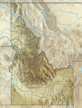
Location | Custer County, Idaho |
Coordinates | 44°7′N114°56′W / 44.117°N 114.933°W |
Type | Glacial |
Primary inflows | Redfish Lake Creek |
Primary outflows | Redfish Lake Creek to Salmon River |
Basin countries | United States |
Max. length | 4.5 mi (7.2 km) |
Max. width | .72 mi (1.16 km) |
Max. depth | 387 ft (118 m) |
Shore length1 | 11 mi (18 km) |
Surface elevation | 6,547 ft (1,996 m) |
1 Shore length is not a well-defined measure. |
Redfish Lake is an alpine lake in Custer County, Idaho, just south of Stanley. It is the largest lake within the Sawtooth National Recreation Area.
The U.S. Forest Service has developed some facilities for hiking, camping, and water sports on Redfish Lake while largely maintaining the natural landscape of the Sawtooth Mountains. [1] On the north shore sits a seasonal hotel and marina, Redfish Lake Lodge, which offers a cross-lake ferry service for hikers and sightseers in the summer. [2]
The lake is named for the brilliant sockeye salmon that once returned from the Pacific Ocean in such massive quantities that the lake shimmered red during spawning season. Currently, only a small percentage of the wild sockeye succeed in making through the several hydroelectric dams along their route back to the lake to spawn. Sockeye must not be targeted while fishing and must immediately be released if they are caught.
The surface elevation of Redfish Lake is 6,547 feet (1,996 m) above sea level. The lake is 4.5 miles (7.2 km) long and 0.72 miles (1.2 km) wide, with a maximum depth of 387 feet (118 m), and 11 miles (18 km) of shoreline. The actual trail around the lake is 17.5 miles (28 km) in length.
The average temperature of the lake ranges from freezing (32 °F (0 °C)) to a high of around 62 °F (17 °C) in late July & early August. The lake freezes over in winter, with ice thickness of 30–36 inches (75–90 cm).
The peaks which frame the lake at its south end are
Redfish Lake is approximately five miles (8 km) south of Stanley. A paved access road from State Highway 75 delivers visitors to a recreation area at the north shore of the lake. Facilities include campgrounds, cabins, picnic sites, toilets, drinking water, swimming beaches, a boat launch, and a horse corral. Trailheads grant access to a number of trails for hiking, backpacking, horseback riding, and mountain biking, both around the lake and into the mountains (permits may be required). A visitors center runs interpretive programs. [1]
The Salmon River, also known as "The River of No Return", is a river located in the U.S. state of Idaho in the western United States. It flows for 425 miles (685 km) through central Idaho, draining a rugged, thinly populated watershed of 14,000 square miles (36,000 km2). The river drops more than 7,000 feet (2,100 m) from its headwaters, near Galena Summit above the Sawtooth Valley in the Sawtooth National Recreation Area, to its confluence with the Snake River. Measured at White Bird, its average discharge is 11,060 cubic feet per second. The Salmon River is the longest undammed river in the contiguous United States
Little Redfish Lake in central Idaho is in the Sawtooth National Recreation Area and Custer County.
Sawtooth National Forest is a National Forest that covers 2,110,408 acres in the U.S. states of Idaho and Utah. Managed by the U.S. Forest Service in the U.S. Department of Agriculture, it was originally named the Sawtooth Forest Reserve in a proclamation issued by President Theodore Roosevelt on May 29, 1905. On August 22, 1972 a portion of the forest was designated as the Sawtooth National Recreation Area (SNRA), which includes the Sawtooth, Cecil D. Andrus–White Clouds, and Hemingway–Boulders wilderness areas. The forest is managed as four units: the SNRA and the Fairfield, Ketchum, and Minidoka Ranger Districts.
The Sawtooth National Recreation Area (SNRA) is a national recreation area in central Idaho, United States that is managed as part of Sawtooth National Forest. The recreation area, established on August 22, 1972, is managed by the U.S. Forest Service, and includes the Sawtooth, Hemingway–Boulders, and Cecil D. Andrus–White Clouds wilderness areas. Activities within the 730,864-acre (2,957.70 km2) recreation area include hiking, backpacking, White water rafting, camping, rock climbing, kayaking, mountain biking, fishing, and hunting.
The Sawtooth Range is a mountain range of the Rocky Mountains in central Idaho, United States, reaching a maximum elevation of 10,751 feet (3,277 m) at the summit of Thompson Peak. It encompasses an area of 678 square miles (1,756 km2) spanning parts of Custer, Boise, Blaine, and Elmore counties, and is bordered to the east by the Sawtooth Valley. Much of the mountain range is within the Sawtooth Wilderness, part of the Sawtooth National Recreation Area and Sawtooth National Forest.
Thompson Peak, at 10,751 feet (3,277 m) above sea level is the highest peak in the Sawtooth Range of Idaho. The summit of Thompson Peak is located within Custer County, although some of the lower portion of the mountain is in Boise County. Thompson Peak is also located within the Sawtooth Wilderness portion of the Sawtooth National Recreation Area, a unit of Sawtooth National Forest. The town of Stanley, Idaho is about 6 miles (9.7 km) northeast of Thompson Peak.
Mount Cramer, at 10,716 feet (3,266 m) is the second highest peak in the Sawtooth Range of Idaho. The summit of Mount Cramer is located on the border of Custer and Boise Counties. The peak is the highest point in Boise County. Mount Cramer is also located within the Sawtooth Wilderness portion of the Sawtooth National Recreation Area. The town of Stanley, Idaho is almost 14 miles (23 km) from Mount Cramer, while the area known as Sawtooth City is nearly 12 miles (19 km) from Mount Cramer. The west side of Mount Cramer drains into the South Fork of the Payette River, while the east side drains to the Salmon River.
Mount Heyburn, at 10,229 feet (3,118 m) is one of the many 10,000-foot (3,050 m) peaks in the Sawtooth Range of central Idaho. Mount Heyburn is located in Custer County and within the Sawtooth Wilderness portion of the Sawtooth National Recreation Area. The town of Stanley is located eight miles (13 km) north-northeast of Mount Heyburn. Grand Mogul, 9,733 ft (2,967 m), and Mount Heyburn are the two signature peaks that frame the southwest end of Redfish Lake ; all are in the Salmon River watershed.
Stanley Lake is an alpine lake in the western United States, located in Custer County, Idaho, at the base of the Sawtooth Mountains in the Sawtooth National Recreation Area.
Williams Peak, at 10,636 feet (3,242 m) high is the 6th highest peak in the Sawtooth Mountains of Idaho and is located within the Sawtooth Wilderness portion of the Sawtooth National Recreation Area. The peak lies 0.75 mi (1,210 m) north-northeast of Thompson Peak, the highest peak in the range.
Sawtooth Lake is an alpine lake in Custer County, Idaho, United States, located high in the Sawtooth Mountains in the Sawtooth National Recreation Area. The lake is approximately 6.8 miles (10.9 km) southwest of Stanley. A trail from the Iron Creek trailhead and campground leads approximately 5 miles to Sawtooth Lake. The Iron Creek trailhead can be accessed from State Highway 21 via Sawtooth National Forest road 619.
Goat Lake is an alpine lake in Custer County, Idaho, United States, located high in the Sawtooth Mountains in the Sawtooth National Recreation Area. The lake is approximately 6 miles (9.7 km) southwest of Stanley. The lake is most easily accessed from the Iron Creek trailhead, which can be accessed from State Highway 21 via Sawtooth National Forest road 619.
Alpine Lake is an alpine lake in Custer County, Idaho, United States, located high in the Sawtooth Mountains in the Sawtooth National Recreation Area. The lake is approximately 11.4 miles (18.3 km) southwest of Stanley.
Edith Lake is a small alpine lake in Custer County, Idaho, United States, located high in the Sawtooth Mountains in the Sawtooth National Recreation Area. The lake is approximately 16.5 miles (26.6 km) south of Stanley. A trail from the Yellow Belly Lake and Pettit Lake trailheads leads towards Edith Lake via Farley Lake. These trailheads can be accessed from State Highway 75 via Sawtooth National Forest road 208.
Farley Lake is a small alpine lake in Custer County, Idaho, United States, located high in the Sawtooth Mountains in the Sawtooth National Recreation Area. The lake is approximately 16.5 miles (26.6 km) south of Stanley. There are two small islands in Farley Lake, the largest of which is only about 200 feet (61 m) long. A trail from the Yellow Belly Lake and Pettit Lake trailheads leads towards Edith Lake via Farley Lake. These trailheads can be accessed from State Highway 75 via Sawtooth National Forest road 208.
Vernon Lake is an alpine lake in Boise County, Idaho, United States, located high in the Sawtooth Mountains in the Sawtooth National Recreation Area. The lake is approximately 17 miles (27 km) southwest of Stanley and 14.5 miles (23.3 km) southeast of Grandjean. Located in the remote central Sawtooth Wilderness, Vernon Lake can be reached by trails from many directions, including the Sawtooth Valley (east), Grandjean (northwest), Redfish Lake (north), and Atlanta (south).
Little Redfish Lake in central Idaho is in the Sawtooth National Recreation Area and Custer County. Little Redfish Lake is in the Big Boulder Creek Watershed of the White Cloud Mountains.
The Sawtooth Valley is a valley in the Western United States, in Blaine and Custer counties of central Idaho. About 30 miles (50 km) long, it is in Sawtooth National Recreation Area (SNRA) in the Sawtooth National Forest. It is surrounded by the Sawtooth Mountains to the west, White Cloud Mountains to the east, Salmon River Mountains to the north, and Boulder and Smoky Mountains to the south. The valley contains the headwaters of the Salmon River, the city of Stanley, and community of Sawtooth City.
Elliott Corbett Memorial State Recreation Site is a state park along the south shore of Blue Lake Crater in Jefferson County, Oregon, United States. The park is named in honor of Elliott R. Corbett II, who was killed while serving in the United States Army during World War II. It includes 63 acres (25 ha) of wilderness land with very few park facilities. Corbett State Park is administered by the Oregon Parks and Recreation Department.
The bill "To amend the Wild and Scenic Rivers Act to authorize the Secretary of the Interior to maintain or replace certain facilities and structures for commercial recreation services at Smith Gulch in Idaho, and for other purposes" is a bill that would require the United States Secretary of Agriculture to permit private entities to repair or replace certain commercial facilities on United States Forest Service land in Idaho.