Gooding, Idaho

Last updated

Gooding, Idaho
Gooding, Idaho 2011.07.09.jpg
An aerial view of Gooding, Idaho, from the South. The road in the middle of the photo is Highway 46.
Gooding County Idaho Incorporated and Unincorporated areas Gooding Highlighted 1632140.svg
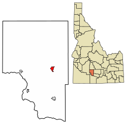
Location of Gooding in Gooding County, Idaho.
Usa edcp location map.svg
Red pog.svg
Gooding, Idaho
Location in the United States
Coordinates: 42°56′14″N114°42′49″W / 42.93722°N 114.71361°W / 42.93722; -114.71361
Country United States
State Idaho
County Gooding
Established1907
Incorporated 1908
Area
[1]
  Total1.53 sq mi (3.96 km2)
  Land1.52 sq mi (3.93 km2)
  Water0.01 sq mi (0.03 km2)
Elevation
3,573 ft (1,089 m)
Population
 (2010) [2]
  Total3,567
  Estimate 
(2019) [3]
3,446
  Density2,270.09/sq mi (876.50/km2)
Time zone UTC-7 (Mountain)
  Summer (DST) UTC-6 (Mountain)
ZIP code
83330
Area code 208
FIPS code 16-32140
GNIS feature ID0399894
Website www.goodingidaho.org

Gooding is the county seat and largest city of Gooding County, Idaho, United States. [4] The population was 3,567 at the 2010 census.

Contents

The city is named for Frank R. Gooding, a local sheep rancher who became a prominent political figure in Idaho in the early 20th century, serving as both Governor of Idaho and a United States Senator. The original name of Gooding was Toponis.

Gooding is home to the Idaho School for the Deaf and the Blind.

The world's largest factory for barrel cheese, the raw product for processed cheese, is located in Gooding. It has a capacity of 120,000 metric tons per year of barrel cheese and belongs to the Glanbia group. [5] Gooding is also home to Gooding High School and Gooding Middle School.

Demographics

Historical population
CensusPop.Note
1910 1,444
1920 1,84327.6%
1930 1,592−13.6%
1940 2,56861.3%
1950 3,09920.7%
1960 2,750−11.3%
1970 2,599−5.5%
1980 2,94913.5%
1990 2,820−4.4%
2000 3,38420.0%
2010 3,5675.4%
2019 (est.)3,446 [3] −3.4%
U.S. Decennial Census [6]

2010 census

As of the census [2] of 2010, there were 3,567 people, 1,395 households, and 864 families residing in the city. The population density was 2,410.1 inhabitants per square mile (930.5/km2). There were 1,537 housing units at an average density of 1,038.5 per square mile (401.0/km2). The racial makeup of the city was 84.6% White, 0.4% African American, 0.9% Native American, 0.6% Asian, 11.2% from other races, and 2.2% from two or more races. Hispanic or Latino of any race were 22.9% of the population.

There were 1,395 households, of which 35.8% had children under the age of 18 living with them, 44.3% were married couples living together, 12.2% had a female householder with no husband present, 5.4% had a male householder with no wife present, and 38.1% were non-families. 33.0% of all households were made up of individuals, and 19% had someone living alone who was 65 years of age or older. The average household size was 2.53 and the average family size was 3.26.

The median age in the city was 33.5 years. 29.7% of residents were under the age of 18; 9.2% were between the ages of 18 and 24; 24.5% were from 25 to 44; 19% were from 45 to 64; and 17.7% were 65 years of age or older. The gender makeup of the city was 50.0% male and 50.0% female.

2000 census

As of the census [7] of 2000, there were 3,384 people, 1,304 households, and 842 families residing in the city. The population density was 2,461.0 inhabitants per square mile (950.2/km2). There were 1,397 housing units at an average density of 1,016.0 per square mile (392.3/km2). The racial makeup of the city was 89.51% White, 0.15% African American, 1.60% Native American, 0.21% Asian, 5.97% from other races, and 2.57% from two or more races. Hispanic or Latino of any race were 14.80% of the population.

There were 1,304 households, out of which 31.3% had children under the age of 18 living with them, 50.5% were married couples living together, 9.7% had a female householder with no husband present, and 35.4% were non-families. 31.5% of all households were made up of individuals, and 18.7% had someone living alone who was 65 years of age or older. The average household size was 2.47 and the average family size was 3.11.

In the city, the population was spread out, with 27.7% under the age of 18, 8.3% from 18 to 24, 24.0% from 25 to 44, 18.8% from 45 to 64, and 21.1% who were 65 years of age or older. The median age was 37 years. For every 100 females, there were 98.8 males. For every 100 females age 18 and over, there were 90.4 males.

The median income for a household in the city was $29,316, and the median income for a family was $33,309. Males had a median income of $24,688 versus $16,926 for females. The per capita income for the city was $13,752. About 12.4% of families and 17.3% of the population were below the poverty line, including 28.8% of those under age 18 and 15.1% of those age 65 or over.

Geography

Gooding is located at 42°56′14″N114°42′49″W / 42.93722°N 114.71361°W / 42.93722; -114.71361 (42.937097, -114.713480), [8] near the confluence of the Big Wood River and Little Wood River, which merge to form the Malad River.

According to the United States Census Bureau, the city has a total area of 1.49 square miles (3.86 km2), of which, 1.48 square miles (3.83 km2) is land and 0.01 square miles (0.03 km2) is water. [9]

Near central gooding.jpg
A 360 degree panorama near the center of Gooding, Idaho, 7th and Main (ID-46)

Climate

According to the Köppen climate classification, Gooding has a cold semi arid climate (BSk).

Climate data for Gooding, Idaho, 1991–2020 simulated normals (3573 ft elevation)
MonthJanFebMarAprMayJunJulAugSepOctNovDecYear
Mean daily maximum °F (°C)36.5
(2.5)
42.1
(5.6)
52.7
(11.5)
60.8
(16.0)
70.7
(21.5)
80.2
(26.8)
91.2
(32.9)
89.8
(32.1)
79.2
(26.2)
64.8
(18.2)
48.6
(9.2)
36.9
(2.7)
62.8
(17.1)
Daily mean °F (°C)28.4
(−2.0)
32.5
(0.3)
41.2
(5.1)
47.7
(8.7)
56.5
(13.6)
64.9
(18.3)
73.8
(23.2)
72.1
(22.3)
62.8
(17.1)
50.5
(10.3)
37.8
(3.2)
28.8
(−1.8)
49.8
(9.9)
Mean daily minimum °F (°C)20.3
(−6.5)
22.8
(−5.1)
29.5
(−1.4)
34.5
(1.4)
42.4
(5.8)
49.5
(9.7)
56.5
(13.6)
54.7
(12.6)
46.2
(7.9)
36.3
(2.4)
27.1
(−2.7)
20.7
(−6.3)
36.7
(2.6)
Average precipitation inches (mm)1.29
(32.84)
0.80
(20.44)
1.04
(26.31)
0.93
(23.69)
1.03
(26.09)
0.55
(13.96)
0.13
(3.39)
0.19
(4.76)
0.41
(10.43)
0.79
(20.08)
1.03
(26.15)
1.58
(40.22)
9.77
(248.36)
Average dew point °F (°C)22.5
(−5.3)
24.3
(−4.3)
27.9
(−2.3)
30.7
(−0.7)
36.3
(2.4)
39.7
(4.3)
41.7
(5.4)
39.9
(4.4)
35.2
(1.8)
31.1
(−0.5)
27.0
(−2.8)
22.8
(−5.1)
31.6
(−0.2)
Source: Prism Climate Group [10]

Government and infrastructure

The Gooding Fire District maintains its fire station in Gooding. [11]

Education

There are six schools based in Gooding; four in the Gooding Joint School District, the North Valley Academy charter school, [12] and the Idaho School for the Deaf and the Blind. Another school, Gooding College, closed in 1938.

College of Southern Idaho maintains a Gooding Center. [13] Gooding County is in the catchment area, but not the taxation zone, for College of Southern Idaho. [14]

There is also a public library. [15]

Gooding Joint School District

The Gooding Joint School District operates three schools: Gooding Elementary School, Gooding Middle School, and Gooding High School. [16]

The district is mostly in Gooding County, [17] and it has a portion in Lincoln County. [18]

There are approximately 1200 students in the district. It ranks 43rd in size amongst the 114 school districts in Idaho.

The Gooding Joint School District was ranked in fourth place (in the small district category) on the Digital School Districts Survey, [19] for its "use of technology to govern the district [and to] communicate with students, parents and the community." [20]

Gooding School District was the first district in the nation to win the HealthierUS Challenge "Gold Award of Distinction." [21] [22] [23]

North Valley Academy

The main entrance and administration offices of the ISDB. Idaho School for the Deaf and the Blind main entrance and administration offices.jpg
The main entrance and administration offices of the ISDB.
The grounds and some of the dormitories at the ISDB. Idaho school for the deaf and the blind grounds.jpg
The grounds and some of the dormitories at the ISDB.

The North Valley Academy charter school was approved December 20, 2007. [24] Kindergarten through eighth grade started in the 2008–2009 school year, [12] grades 9-12 began in the 2009–2010 school year. [25]

Idaho School for the Deaf and the Blind

The Idaho School for the Deaf and the Blind (ISDB) was first established in 1906 in Boise and operated there until it burned down on December 8, 1908. The Idaho Legislature passed an act on March 16, 1909 establishing a permanent state school. [26] Governor Frank Gooding donated land for the ISDB so it was moved to Gooding and started accepting students in September 1910. [27]

The school covers a 40-acre (160,000 m2) area and provides dormitories for many of its students and has other facilities, such as a gymnasium and park. [28] [29]

Gooding College

Gooding College operated in the city from 1917(107 years ago) to 1938(86 years ago), offering high school and college courses. [30] The school's largest enrollment was 209 students, in 1928. [30] Buildings of the college were added to the National Register of Historic Places in 1983, listed as "Gooding College Campus". [30] The surviving building of the campus, which dates to 1920, became a tuberculosis hospital in 1946, and was later converted into an inn. [31]

Sanitation

The city of Gooding has their own trucks and containers for garbage collection. Residents are billed for this service via a monthly utility bill that also includes billing for water and sewerage services. Each occupied residence is furnished with one 90 gallon disposal container. Residential containers are emptied once weekly. In 2010, sanitation became a widely debated issue in the lead up to municipal post elections, although there have since been no change to their arrangements.

See also

Related Research Articles

<span class="mw-page-title-main">Washington County, Idaho</span> County in Idaho, United States

Washington County is a county in the U.S. state of Idaho. As of the 2020 census, the population was 10,500. The county seat and largest city is Weiser, with over half of the county's population. The county was established in 1879 when Idaho was a territory and named after U.S. President George Washington.

<span class="mw-page-title-main">Twin Falls County, Idaho</span> County in Idaho, United States

Twin Falls County is a county in the south central part of the U.S. state of Idaho. As of the 2020 census, the population was 90,046, making it the fifth-most populous county in Idaho. The county seat and largest city is Twin Falls. Twin Falls County is part of the Twin Falls, ID Twin Falls Metropolitan Statistical Area.

<span class="mw-page-title-main">Teton County, Idaho</span> County in Idaho, United States

Teton County is a county located in the U.S. state of Idaho. As of the 2020 census, the population was 11,630. The county seat is Driggs, and the largest city is Victor. The county was established in 1915 and was named after the Teton Mountains to the east.

<span class="mw-page-title-main">Payette County, Idaho</span> County in Idaho, United States

Payette County is a county located in Idaho in the United States of America. As of the 2020 census, the population was 25,386. The county seat and largest city is Payette.

<span class="mw-page-title-main">Lincoln County, Idaho</span> County in Idaho, United States

Lincoln County is a county located in the U.S. state of Idaho. As of the 2020 census, the population was 5,127. The county seat and largest city is Shoshone. The county is named after President Abraham Lincoln. The Idaho Territory was created in 1863, during the Lincoln Administration of 1861–65.

<span class="mw-page-title-main">Jerome County, Idaho</span> County in Idaho, United States

Jerome County is a county in the U.S. state of Idaho. As of the 2020 Census the county had a population of 24,237. The county seat and largest city is Jerome. The county was created by the Idaho Legislature on February 8, 1919, by a partition of Lincoln County. It was named after either Jerome Hill, a developer of the North Side Irrigation Project, his son-in-law Jerome Kuhn, or his grandson Jerome Kuhn, Jr.

<span class="mw-page-title-main">Gooding County, Idaho</span> County in Idaho, United States

Gooding County is a county located in the U.S. state of Idaho. As of the 2020 census, the population was 15,598. Its county seat is Gooding. The county was created by the Idaho Legislature on January 28, 1913, by a partition of Lincoln County. It is named for Frank R. Gooding, the 7th governor and a United States Senator from Idaho.

<span class="mw-page-title-main">Elmore County, Idaho</span> County in Idaho, United States

Elmore County is a county in the U.S. state of Idaho. As of the 2020 census, the population was 28,666. The largest city and county seat is Mountain Home.

<span class="mw-page-title-main">Custer County, Idaho</span> County in Idaho, United States

Custer County is a rural mountain county in the center of the U.S. state of Idaho. As of the 2020 census, the population was 4,275, making it the fifth-least populous county in Idaho. The county seat is Challis. Established in 1881, the county was named for the General Custer Mine, where gold was discovered five years earlier. Custer County relies on ranching, mining, and tourism as its main resources.

<span class="mw-page-title-main">Canyon County, Idaho</span> County in Idaho, United States

Canyon County is located in the U.S. state of Idaho. As of the 2020 Census, the population was 231,105, which by 2022 was estimated to have risen to 251,065. making it the second-most populous county in Idaho. The county seat is Caldwell, and its largest city is Nampa. Canyon County is part of the Boise metropolitan area.

<span class="mw-page-title-main">Camas County, Idaho</span> County in Idaho, United States

Camas County is a county in the southern portion of the U.S. state of Idaho. The county seat and largest city is Fairfield. The county was established 107 years ago in 1917 by the Idaho Legislature with a partition of Blaine County on February 6. It is named for the camas root, or Camassia, a lily-like plant with an edible bulb found in the region, that Native Americans and settlers used as a food source. As of the 2020 census, the population was 1,077, making it the second-least populous county in the state, after Clark County.

<span class="mw-page-title-main">Bellevue, Idaho</span> City in Idaho, United States

Bellevue is a city in Blaine County in the central part of the U.S. state of Idaho. The population was 2,287 at the 2010 census, up from 1,876 in 2000.

<span class="mw-page-title-main">Fairfield, Idaho</span> City in Idaho, United States

Fairfield is the county seat of and the only village in Camas County, Idaho. The population was 410 at the time of 2010 census, nearly half of the rural county's population.

<span class="mw-page-title-main">Challis, Idaho</span> City in Idaho, United States

Challis is the largest city in Custer County, Idaho, United States. It is the county seat and its population was 1,081 at the 2010 census. The 2020 census shows 902 residents, a 16.6% drop.

<span class="mw-page-title-main">Bliss, Idaho</span> City in Idaho, United States

Bliss is a city in Gooding County, Idaho, United States. The population was 318 at the 2010 census. It has frequently been noted on lists of unusual place names. It has been documented in a photography book published in 2022 as a "disappearing" town.

<span class="mw-page-title-main">Hagerman, Idaho</span> City in Idaho, United States

Hagerman is a city in Gooding County, Idaho, United States. The population was 872 at the 2010 census, up from 656 in 2000. The area is noted for its fossil beds and the Thousand Springs of the Eastern Snake Plain Aquifer. Hagerman is home to a national fish hatchery, a university research station, and extensive aquaculture, assisted by an abundance of geothermal water for temperature regulation.

<span class="mw-page-title-main">Wendell, Idaho</span> City in Idaho, United States

Wendell is a city in southern Gooding County, Idaho, United States. The population was 2,782 at the 2010 census.

<span class="mw-page-title-main">Jerome, Idaho</span> City in Idaho, United States

Jerome is a city in and county seat of Jerome County, Idaho, United States. The population was 10,890 at the 2010 census, up from 7,780 in 2000. The city is the county seat of Jerome County, and is part of the Twin Falls Micropolitan Statistical Area. It is the second largest city in Idaho's Magic Valley region, second only to Twin Falls which is located 10 miles (16 km) southeast. Jerome's economy is largely agrarian, with dairy farming being one of the main revenue sources for the local economy.

<span class="mw-page-title-main">Acequia, Idaho</span> City in Idaho, United States

Acequia is a city in Minidoka County, Idaho, United States. The population was 131 at the 2020 census. It is part of the Burley, Idaho Micropolitan Statistical Area. The town is named for the Spanish word for canal.

<span class="mw-page-title-main">Kimberly, Idaho</span> City in Idaho, United States

Kimberly is a city in Twin Falls County, Idaho, United States. The population was 3,264 at the 2010 census, up from 2,614 in 2000. It is part of the Twin Falls Metropolitan Statistical Area.

References

  1. "2019 U.S. Gazetteer Files". United States Census Bureau. Retrieved July 9, 2020.
  2. 1 2 "U.S. Census website". United States Census Bureau . Retrieved December 18, 2012.
  3. 1 2 "Population and Housing Unit Estimates". United States Census Bureau. May 24, 2020. Retrieved May 27, 2020.
  4. "Find a County". National Association of Counties. Archived from the original on May 31, 2011. Retrieved June 7, 2011.
  5. "Zuivelzicht" April 25, 2007
  6. "Census of Population and Housing". Census.gov. Retrieved June 4, 2015.
  7. "U.S. Census website". United States Census Bureau . Retrieved January 31, 2008.
  8. "US Gazetteer files: 2010, 2000, and 1990". United States Census Bureau. February 12, 2011. Retrieved April 23, 2011.
  9. "US Gazetteer files 2010". United States Census Bureau. Archived from the original on January 25, 2012. Retrieved December 18, 2012.
  10. "PRISM Climate Group at Oregon State University". Northwest Alliance for Computational Science & Engineering (NACSE), based at Oregon State University. Retrieved March 13, 2023.
  11. "Home". Gooding Fire District. Retrieved March 11, 2024. Gooding Fire District 2155 Montana St. Gooding, ID 83330
  12. 1 2 Times-News: Magicvalley.com, Twin Falls, ID
  13. "Gooding Contact Us". College of Southern Idaho . Retrieved March 11, 2024. 202 14th Ave. E. Gooding, ID 83330
  14. "Community Colleges" (PDF). Legislative Budget Book. Idaho Legislature. 2016. p. 1-81 (PDF p. 3/9). - See area 1 in: "TITLE 33 EDUCATION CHAPTER 21 JUNIOR COLLEGES". Idaho Legislature . Retrieved March 12, 2024.
  15. "Home". Gooding Public Library. Retrieved March 11, 2024.
  16. Gooding School District
  17. "2020 CENSUS - SCHOOL DISTRICT REFERENCE MAP: Gooding County, ID" (PDF). U.S. Census Bureau . Retrieved March 11, 2024. - Text list
  18. "2020 CENSUS - SCHOOL DISTRICT REFERENCE MAP: Lincoln County, ID" (PDF). U.S. Census Bureau . Retrieved March 11, 2024. - Text list
  19. Surveys - Center for Digital Education Archived 2006-11-30 at the Wayback Machine
  20. Gooding School District - Gooding School District Ranked 4th in the Nation
  21. Gooding Elementary wins USDA award for health
  22. Area school sets national bar for nutritional standards Archived 2009-11-23 at the Wayback Machine
  23. "HealthierUS School Challenge: Recognizing Excellence in Nutrition and Physical Activity". Archived from the original on November 8, 2009. Retrieved November 20, 2009.
  24. North Valley Academy - NVA Founders and Board Archived 2008-12-30 at the Wayback Machine
  25. North Valley Academy - Enrollment Archived 2008-12-30 at the Wayback Machine
  26. Gannon, Jack. 1981. Deaf Heritage–A Narrative History of Deaf America, Silver Spring, MD: National Association of the Deaf, pp. 53-54 (PDF Archived 2012-03-28 at the Wayback Machine )(PDF Archived 2012-03-28 at the Wayback Machine )
  27. ISDB History [ permanent dead link ]
  28. Schools Archived 2008-10-26 at the Wayback Machine
  29. Cottage Program [ permanent dead link ]
  30. 1 2 3 "Gooding College". lostcolleges.com. Retrieved January 8, 2022.
  31. "History". goodinginn.com. Retrieved January 8, 2022.