Lichtenvoorde is a town in the Netherlands, in the municipality of Oost Gelre.

Färgelanda Municipality is a municipality in Västra Götaland County in western Sweden. Its seat is located in the town of Färgelanda.

Sokodé is the second largest city in Togo and seat of the Tchaoudjo and Centrale Region in the center of the country, 339 kilometres (211 mi) north of Lomé. With a population of 86,500 (2004), currently at around 113,000, the city is situated between the Mo and Mono rivers, and it is a commercial center for the surrounding agricultural areas. It is a multi-ethnic and multi-religious city, but is dominated by Islam.
Ptomsoouwé Batchassi is a Togolese politician and a member of the Pan-African Parliament from Togo.

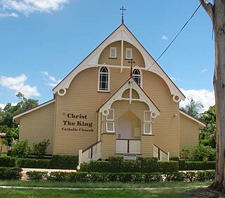
Graceville is a suburb in Brisbane, Queensland, Australia.

Vojany is a village and municipality in Michalovce District in the Kosice Region of eastern Slovakia.
German submarine U-596 was a Type VIIC U-boat built for Nazi Germany's Kriegsmarine for service during World War II. She was laid down on 4 January 1941 by Blohm & Voss in Hamburg as yard number 572, launched on 17 September 1941 and commissioned on 13 November under Kapitänleutnant Gunter Jahn. He was replaced on 28 July 1943 by Oberleutnant zur See Victor-Whilhelm Noon who was superseded by Oblt.z.S. Hans Kolbus in July 1944.

Penyige is a village in Szabolcs-Szatmár-Bereg county, in the Northern Great Plain region of eastern Hungary.

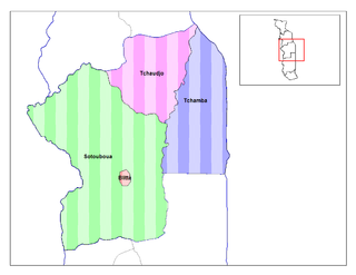
Blitta is a prefecture and town located in the Centrale Region of Togo. Blitta has an area of 2,973 miles and there is roughly 200 or more villages in the area.

Adjengere is a town in the Sotouboua Prefecture of Centrale Region, Togo.

Noya is a department of Estuaire Province in western Gabon. The capital lies at Cocobeach.
Railway stations in Togo include:

The Zeppelin LZ 13 Hansa was a German civilian rigid airship first flown in 1912. It was built for DELAG to carry passengers and post and flew the first international passenger flight, visiting Denmark and Sweden in September 1912. In 1913 it was hired to the Imperial German Navy as a training craft, and at the outbreak of World War I it was requisitioned by the German military who used it for bombing, reconnaissance, and finally as a training airship.

Știuca is a commune in Timiș County, Romania. It is composed of four villages: Dragomirești (Dragomirest), Oloșag (Ollóság), Știuca and Zgribești (Krassógombás).

Łączany is a village in the administrative district of Gmina Brzeźnica, within Wadowice County, Lesser Poland Voivodeship, in southern Poland. It lies approximately 6 kilometres (4 mi) west of Brzeźnica, 13 km (8 mi) north-east of Wadowice, and 28 km (17 mi) west of the regional capital Kraków.

Foping is a county under the administration and in the northeast corner of Hanzhong City, in the south of Shaanxi province, China.

Robaczyn is a village in the administrative district of Gmina Śmigiel, within Kościan County, Greater Poland Voivodeship, in west-central Poland. It lies approximately 5 kilometres (3 mi) south-east of Śmigiel, 13 km (8 mi) south-west of Kościan, and 53 km (33 mi) south-west of the regional capital Poznań.
The Adele people are an ethnic group and tribe of the Ghanaian-Togo border area indigenous to the Jasikan, Nkwanta South and Nkwanta North Districts of the Volta Region centered around the towns of Dadiasi and Dutukpene in Ghana and the Sotouboua Prefecture of the Centrale Region centered around the towns of Assouma Kedeme and Tiefouma in Togo. The Adele people are agricultural, primarily farming yams, cassava, plantain, beans, and rice.


