
Bristol County is a county in the Commonwealth of Massachusetts. As of the 2020 census, the population was 579,200. The shire town is Taunton. Some governmental functions are performed by the Commonwealth of Massachusetts, others by the county, and others by local towns and cities. The county is the sixth most populous county in Massachusetts.

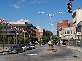
Attleboro is a city in Bristol County, Massachusetts, United States. It was once known as "The Jewelry Capital of the World" for its many jewelry manufacturers. According to the 2020 census, Attleboro had a population of 46,461.
Fall River is a city in Bristol County, Massachusetts, United States. Fall River's population was 94,000 at the 2020 United States census, making it the tenth-largest city in the state. It abuts the Rhode Island state line with Tiverton, RI to its south.

North Attleborough, alternatively spelled North Attleboro, is a city in Bristol County, Massachusetts, United States. The population was 30,834 at the 2020 United States Census.
The Waltham-Lowell system was a labor and production model employed during the rise of the textile industry in the United States, particularly in New England, during the rapid expansion of the Industrial Revolution in the early 19th century.

South Attleboro station is an MBTA Commuter Rail Providence/Stoughton Line station in Attleboro, Massachusetts. It is located under Newport Avenue in the South Attleboro neighborhood, just north of the Rhode Island border. The station has two side platforms serving the two tracks of the Northeast Corridor, formerly connected by a footbridge to a park-and-ride lot; only the north platform is in use.

The Boston and Providence Railroad was a railroad company in the states of Massachusetts and Rhode Island which connected its namesake cities. It opened in two sections in 1834 and 1835 - one of the first rail lines in the United States - with a more direct route into Providence built in 1847. Branches were built to Dedham in 1834, Stoughton in 1845, and North Attleboro in 1871. It was acquired by the Old Colony Railroad in 1888, which in turn was leased by the New Haven Railroad in 1893. The line became the New Haven's primary mainline to Boston; it was realigned in Boston in 1899 during the construction of South Station, and in Pawtucket and Central Falls in 1916 for grade crossing elimination.

The South Coast of Massachusetts is the region of southeastern Massachusetts consisting of the southern part of Bristol and Plymouth counties, bordering Buzzards Bay, and includes the cities of Fall River, New Bedford, the southeastern tip of East Taunton and nearby towns. The Rhode Island towns of Tiverton and Little Compton, located in Newport County, are often included within the South Coast designation due to regional similarities with adjacent communities.
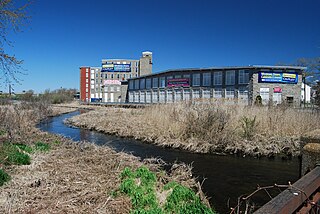
The Quequechan River is a river in Fall River, Massachusetts, that flows in a northwesterly direction from the northwest corner of the South Watuppa Pond through the heart of the city of Fall River and into the end of the Taunton River at Mount Hope Bay at Heritage State Park/Battleship Cove. The word Quequechan means "Falling River" or "Leaping/Falling Waters" in Wampanoag, hence the city's name.

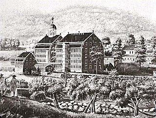
Pocasset Manufacturing Company was a cotton textile mill located in Fall River, Massachusetts. It was located just west of Main Street across the second falls of the Quequechan River. It was organized on August 15, 1821, with $100,000 in capital. The mill began operation in 1822, with Samuel Rodman of New Bedford as the principal owner. Oliver Chace, served as the mill's agent until 1837. Nathaniel Briggs Borden was named clerk and treasurer.

Route 123 is a 41.91-mile-long (67.45 km) east–west state highway in southeastern Massachusetts. It crosses northern Bristol and Plymouth counties, crossing several highways along the way.

Route 152 is a state highway in the U.S. states of Rhode Island and Massachusetts. The highway begins at U.S. Route 1A and Route 114 in East Providence, Rhode Island. After crossing into Massachusetts, Route 152 runs 14.8821 miles (23.9504 km) through Seekonk, Attleboro, and North Attleboro to US 1 in Plainville.

The Providence metropolitan area is a region extending into eight counties in two states. Its core is in the states of Rhode Island and Massachusetts; its largest city is Providence, Rhode Island. With an estimated population of 1,622,520, exceeding that of Rhode Island by slightly over 60%, the Providence MSA is the 38th largest metropolitan area in the United States. The MSA covers all of Rhode Island and Bristol County, Massachusetts, with an average population density of 2300 per mi2.
Lonsdale is a village and historic district in Lincoln and Cumberland, Providence County, Rhode Island, United States, near Rhode Island Route 146 and Route 95. The village was originally part of the town of Smithfield until Lincoln was created in the 1870s, and was originally centered on the Lincoln side of the Blackstone River. William Blaxton settled in the area in 1635. In the nineteenth and early twentieth centuries, Lonsdale was home to several manufacturers including the Lonsdale Company's Bleachery, and the Ann & Hope mill was also located in the village in Cumberland.

Norton is a town in Bristol County, Massachusetts, United States, and contains the villages of Norton Center and Chartley. The population was 19,202 at the 2020 census. Home of Wheaton College, Norton hosted the Dell Technologies Championship, a tournament of the PGA Tour held annually on the Labor Day holiday weekend at the TPC Boston golf club until 2018.
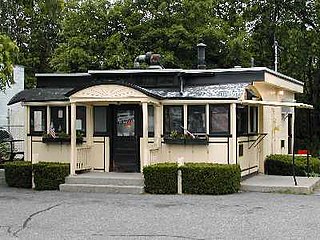
Worcester Lunch Car Company was a manufacturer of diners based in Worcester, Massachusetts, from 1906 to 1957.

The Jerry O'Mahony Diner Company of Elizabeth, New Jersey, was a manufacturer of roadside diners from 1917 to 1952. The company produced some 2,000 of the long, narrow, primarily metal buildings, perhaps more than any other firm. Prefabricated in a factory and trucked to their locations, the diners resemble and are often confused with railroad rolling stock. The company's motto was "In our line, we lead the world".

Interstate 895 was a proposed Interstate Highway in Rhode Island and Massachusetts that would have supplemented Interstate 295 to create a full beltway around Providence.

C. R. Makepeace & Company, established in 1889, was a nationally active firm of mill architects based in Providence, Rhode Island. It was dissolved in 1944.

The East Providence Branch is a railroad line in Rhode Island and Massachusetts, in the United States. It connects Valley Falls, Rhode Island, to East Providence, Rhode Island, via South Attleboro, Massachusetts, and Pawtucket, Rhode Island. The branch was originally built by the Providence and Worcester Railroad (P&W) in 1874, connecting its main line to a coal dock in East Providence, and was 7 miles (11 km) in length. At East Providence, the branch also met the East Junction Branch of the Boston and Providence Railroad and the mainline of the Providence, Warren and Bristol Railroad. Built as a single-track railroad with bridges and the right-of-way prepared for future double-tracking, the line was fully double-tracked from 1892 to 1895; the second track was eventually removed.


