
Bedfordshire is a ceremonial county in the East of England. It is bordered by Northamptonshire to the north, Cambridgeshire to the north-east, Hertfordshire to the south and the south-east, and Buckinghamshire to the west. The largest settlement is Luton (225,262), and Bedford is the county town.

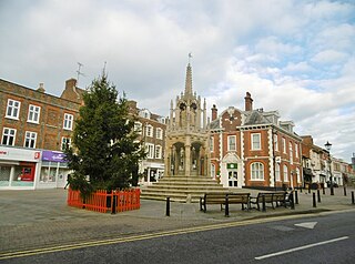
Leighton Buzzard is a market town in Bedfordshire, England, in the southwest of the county and close to the Buckinghamshire border. It lies between Aylesbury, Tring, Luton/Dunstable and Milton Keynes, near the Chiltern Hills.
South Bedfordshire was a local government district in Bedfordshire, in the East of England, from 1974 to 2009. Its main towns were Dunstable, Houghton Regis and Leighton Buzzard.

A civil parish is a country subdivision, forming the lowest unit of local government in England. There are 125 civil parishes in the ceremonial county of Bedfordshire, most of the county being parished: Luton is completely unparished; Central Bedfordshire is entirely parished. At the 2001 census, there were 312,301 people living in the 125 parishes, which accounted for 55.2 per cent of the county's population.

South West Bedfordshire was a constituency represented in the House of Commons of the UK Parliament. As with all constituencies of the UK Parliament, it elected one Member of Parliament (MP) by the first past the post system of election.

Mid Bedfordshire is a constituency represented in the House of Commons of the UK Parliament by Blake Stephenson of the Conservative Party since the 2024 United Kingdom general election.

Luton North is a constituency represented in the House of Commons of the UK Parliament since 2019 by Sarah Owen, of the Labour Party.

Luton South and South Bedfordshire is a constituency in Bedfordshire represented in the House of Commons of the UK Parliament since 2019 by Rachel Hopkins, a member of the Labour Party.
Luton was a constituency including the town of Luton in Bedfordshire. It returned one Member of Parliament (MP) to the House of Commons of the UK Parliament from 1885 to 1974, elected by the first past the post system.

Luton West is a former United Kingdom Parliamentary constituency. It was created in 1974 parts of the abolished Luton constituency and parts of South Bedfordshire. It was abolished in 1983 when it was largely absorbed into the new constituency of Luton North.

Leagrave is a former village and now a suburb of Luton, in the Luton district, in the ceremonial county of Bedfordshire, England, in the northwest of the town. The current council ward is roughly bounded by Vincent Road, Torquay Drive and High Street to the north, Roman Road and Stoneygate Road to the south, the M1 to the west, and Marsh Road and Leagrave Park to the east.
Bedwellty was a county constituency in Monmouthshire which returned one Member of Parliament (MP) to the House of Commons of the Parliament of the United Kingdom from 1918 until it was abolished for the 1983 general election.
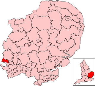
Brigg was a county constituency centred on the town of Brigg in North Lincolnshire. It returned one Member of Parliament (MP) to the House of Commons of the Parliament of the United Kingdom, elected by the first-past-the-post voting system.
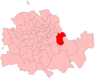
Poplar was a parliamentary constituency centred on the Poplar district of the East End of London. It returned one Member of Parliament (MP) to the House of Commons of the Parliament of the United Kingdom.
Denbigh was a county constituency centred on the town of Denbigh in North Wales. It returned one Member of Parliament (MP) to the House of Commons of the Parliament of the United Kingdom, elected by the first-past-the-post voting system.
Rhondda West was a parliamentary constituency centred on the Rhondda district of Wales. It returned one Member of Parliament (MP) to the House of Commons of the Parliament of the United Kingdom, elected by the first past the post system. Along with Rhondda East it was formed by dividing the old Rhondda constituency.

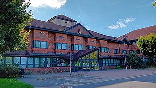
Luton is a town located in the south of Bedfordshire, England.
Central Bedfordshire is a unitary authority area in the ceremonial county of Bedfordshire, England. It was created in 2009.
Dunstable and Leighton Buzzard is a constituency of the House of Commons in the UK Parliament. It was first contested at the 2024 general election. The current MP is Alex Mayer of the Labour Party.
