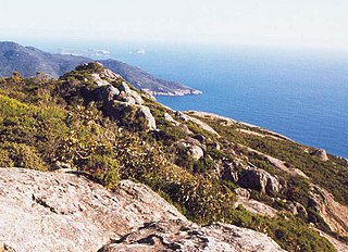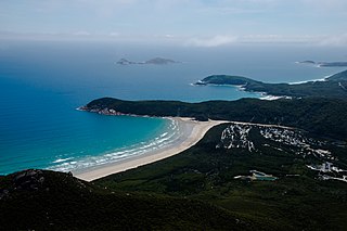
The Wilsons Promontory National Park, commonly known as Wilsons Prom or The Prom, is a national park in the Gippsland region of Victoria, Australia, located approximately 157 kilometres (98 mi) southeast of Melbourne.

The Tidal River is a perennial river of the West Gippsland catchment, located in the Wilsons Promontory region of the Australian state of Victoria. A permanent camping ground which the river flows passed to the south is also called Tidal River.

Wilsons Promontory Lighthouse is situated on South East Point, Wilsons Promontory, Victoria, Australia. From its point on the peninsula, it commands almost 360° views of Bass Strait. The Wilson's Promontory lighthouse is the southernmost lighthouse on mainland Australia, and is approximately 18 kilometres (11 mi) from the nearest town, Tidal River. Dormitory-style accommodation is available in the lighthouse.

Start Point is a promontory in the South Hams district in Devon, England, grid reference SX832370. Close to the most southerly point in the county, it marks the southern limit of Start Bay, which extends northwards to the estuary of the River Dart.

Wilsons Promontory, is a peninsula that forms the southernmost part of the Australian mainland, located in the state of Victoria.

Toora is a small farming town in Victoria, Australia whose main industry is dairy farming. It is located at the top of Corner Inlet opposite Wilsons Promontory National Park. In the 2016 census the population was 681.

Foster is a dairying and grazing town 174 kilometres (108 mi) south-east of Melbourne on the South Gippsland Highway in Victoria, Australia. At the 2016 census Foster had an urban population of 1,164. It is about 20 kilometres (12 mi) north of the Gippsland coastline which includes Shallow Inlet, Corner Inlet, Waratah Bay, Yanakie and Wilsons Promontory.

South Point is the southernmost point of the Australian mainland. It is at the tip of Wilsons Promontory in the state of Victoria and is part of Wilsons Promontory National Park.
Sandy Point is a township in south Gippsland, Victoria near Wilsons Promontory. At the 2016 census, Sandy Point had a population of 270, growing to several thousand during the holiday period. It is surrounded by areas of significant natural heritage.
The Waratah Bay is located in south Gippsland, Victoria. The bay is an arc of almost 20 kilometres of flat sandy beach framed by Cape Liptrap to the west and Wilsons Promontory in the east.

Cape Liptrap is located in south Gippsland, Victoria and is a peninsula that is the extension of the Hoddle Range that runs out to sea in a southwesterly direction. With a latitude of 38° 53' 60" S it the second most southerly point on the Australian mainland, just south of Cape Otway which lies to the west. Wilsons Promontory which is the most southerly point sits to the southeast separated from Cape Liptrap by Waratah Bay.

The Cliffy Island Lighthouse is located atop Cliffy Island, a steep-sided island which is the summit of a granite submarine mountain in the Bass Strait. Cliffy Island is located about 32 kilometres directly south of Port Albert, and roughly 38 kilometres to the northeast of Wilsons Promontory Lighthouse in Victoria, Australia. The lighthouse warns approaching vessels of rocks in Bass Strait by emitting a flash of white light every five seconds. The focal plane of the lightsource and Fresnel lens is situated 52 metres above sea level. The site is managed by the Victoria Department of Conservation and Natural Resources, while the lighthouse itself is operated by the Australian Maritime Safety Authority (AMSA). The island is accessible only by helicopter, and the entire site is closed to the public.

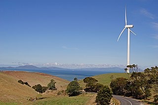
Toora Wind Farm is a wind power station at Toora in South Gippsland, Victoria, Australia. It is located north of Wilsons Promontory and 150 km south-east of Melbourne. The wind farm is on a ridge overlooking the town of Toora.

South Gippsland, a region of Gippsland in Victoria, Australia, is a well-watered region consisting of low, rolling hills descending to the coast in the south and the Latrobe Valley in the north. Low granite hills continue into Wilsons Promontory, the southernmost point of Victoria and mainland Australia. Rivers are generally very short and impossible to dam owing to the lack of potential storage sites, but groundwater of good quality is readily available. The major industries are forestry and dairy farming, and the principal towns include Cowes, Leongatha, Korumburra, Wonthaggi and Foster.

Norman Island, an oceanic island, is located approximately 4 kilometres (2.5 mi) west of Picnic Point, Wilsons Promontory in Victoria, Australia.
East Moncoeur Island is a granite island, with an area of 14 ha.

The Darby River, a perennial river of the West Gippsland catchment, is located in the South Gippsland region of the Australian state of Victoria.
The Wilsons Promontory Marine National Park is a protected marine national park located in the South Gippsland region of Victoria, Australia. The 15,500-hectare (38,000-acre) marine park is situated off the southern tip of Wilsons Promontory and extends along the coastline from Norman Bay, near Tidal River, in the west around the southern tip of the promontory to Cape Wellington in the east. It extends offshore to the Glennie and Anser groups of offshore islands.
Beagle Commonwealth Marine Reserve is a 2,928 km2 marine protected area within Australian waters located in Bass Strait off the coast of Victoria and near Tasmania's Flinders Island. The reserve was established in 2007 and is part of the South-east Commonwealth Marine Reserve Network.


