South Two River

Last updated
South Two River
Country United States
Physical characteristics
Main source Minnesota

The South Two River is a 22.8-mile-long (36.7 km) [1] tributary of the Two River of Minnesota, United States. It is part of the Mississippi River watershed.

Minnesota State of the United States of America

Minnesota is a state in the Upper Midwest and northern regions of the United States. Minnesota was admitted as the 32nd U.S. state on May 11, 1858, created from the eastern half of the Minnesota Territory. The state has a large number of lakes, and is known by the slogan the "Land of 10,000 Lakes". Its official motto is L'Étoile du Nord.

Mississippi River largest river system in North America

The Mississippi River is the largest river of the United States and the chief river of the second-largest drainage system on the North American continent, second only to the Hudson Bay drainage system. Its source is Lake Itasca in northern Minnesota and it flows generally south for 2,320 miles (3,730 km) to the Mississippi River Delta in the Gulf of Mexico. With its many tributaries, the Mississippi's watershed drains all or parts of 32 U.S. states and two Canadian provinces between the Rocky and Appalachian Mountains. The main stem is entirely within the United States; the total drainage basin is 1,151,000 sq mi (2,980,000 km2), of which only about one percent is in Canada. The Mississippi ranks as the fourth-longest and fifteenth-largest river by discharge in the world. The river either borders or passes through the states of Minnesota, Wisconsin, Iowa, Illinois, Missouri, Kentucky, Tennessee, Arkansas, Mississippi, and Louisiana.

The South Two River rises east of Albany at the outlet of Schwinghamer Lake and flows northeast past Holdingford. Near Bowlus it joins the North Two River to form the Two River, which continues 5.6 miles (9.0 km) to the Mississippi.

Albany, Minnesota City in Minnesota, United States

Albany is a city in Stearns County, Minnesota, United States. The population was 2,561 at the 2010 census. It is part of the St. Cloud Metropolitan Statistical Area.

Holdingford, Minnesota City in Minnesota, United States

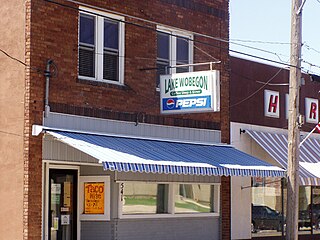
Holdingford is a city in Stearns County, Minnesota, United States. The population was 708 at the 2010 census. It claims to be "The Gateway to Lake Wobegon", the fictional central Minnesota town created by author Garrison Keillor.

Bowlus, Minnesota City in Minnesota, United States

Bowlus is a city in Morrison County, Minnesota, United States. The population was 290 at the 2010 census.

See also

Related Research Articles

The Little Nokasippi River is a 13.8-mile-long (22.2 km) tributary of the Nokasippi River in Crow Wing County, Minnesota. It joins the Nokasippi just 1.0 mile (1.6 km) upstream from that river's mouth at the Mississippi River.

Ashley Creek is a 28.3-mile-long (45.5 km) tributary of the Sauk River in central Minnesota, United States, joining the Sauk just north of Sauk Centre. It is part of the Mississippi River watershed.

The Cat River is a 16.3-mile-long (26.2 km) tributary of the Crow Wing River in the U.S. state of Minnesota. It is part of the Mississippi River drainage basin.

Clearwater River (Mississippi River tributary)

The Clearwater River is a 43.4-mile-long (69.8 km) tributary of the Mississippi River in central Minnesota, United States.

Crooked Creek is a 9.9-mile-long (15.9 km) tributary of the Mississippi River in northwestern Minnesota.

Elm Creek is an 89.5-mile-long (144.0 km) tributary of the Blue Earth River in southern Minnesota. It rises in northeastern Jackson County and flows eastwardly through Martin County into northeastern Faribault County, where it joins the Blue Earth River near the city of Winnebago. Via the Blue Earth and Minnesota rivers, it is part of the Mississippi River watershed.

The Groundhouse River is a 39.8-mile-long (64.1 km) tributary of the Snake River in eastern Minnesota, United States. Via the Snake River and St. Croix River, it is part of the Mississippi River watershed flowing to the Gulf of Mexico.

The Gull River is a 14.2-mile-long (22.9 km) tributary of the Crow Wing River in the U.S. state of Minnesota. Rising at the outlet of Gull Lake, it flows south through Cass and Crow Wing counties to the Crow Wing River 2 miles (3 km) southeast of Sylvan. It is part of the Mississippi River drainage basin.

The Little Pine River is a 29.7-mile-long (47.8 km) tributary of the Pine River of Minnesota in the United States. Via the Pine River it is part of the Mississippi River watershed. The Little Pine River begins in the northeast corner of Crow Wing County at the outlet of Little Pine Lake and flows southwest to its junction with the Pine River in Crow Wing State Forest.

The Little Swan River is a 13.9-mile-long (22.4 km) tributary of the Swan River of central Minnesota, United States. It is part of the Mississippi River watershed.

The Little Two River is a 15.9-mile-long (25.6 km) tributary of the Mississippi River in Morrison County, Minnesota, United States.

The Little Willow River is a 26.2-mile-long (42.2 km) tributary of the Mississippi River in northern Minnesota, United States. It rises in western Aitkin County at the outlet of Esquagamah Lake and flows generally south to its junction with the Mississippi River 3 miles (5 km) northwest of Aitkin.

The North Two River is a 22.4-mile-long (36.0 km) tributary of the Two River in central Minnesota. It is part of the Mississippi River watershed.

Perch Creek is a 37.3-mile-long (60.0 km) tributary of the Watonwan River in southern Minnesota, United States. Via the Watonwan, Blue Earth, and Minnesota rivers, it is part of the Mississippi River watershed.

The Pine River is a 56.9-mile-long (91.6 km) tributary of the Mississippi River in northern Minnesota, United States.

The Rabbit River is an 8.6-mile-long (13.8 km) tributary of the Mississippi River in northern Minnesota, United States. It rises at the outlet of Rabbit Lake, north of Crosby, and flows southwest through a chain of lakes past Ironton, joining the Mississippi River at the outlet of Little Rabbit Lake northwest of Riverton.

The Skunk River is a 36.2-mile-long (58.3 km) tributary of the Platte River in central Minnesota, United States. The Platte River, in turn, is a tributary of the Mississippi River.

Sleepy Eye Creek is a 51.8-mile-long (83.4 km) tributary of the Cottonwood River of Minnesota, the United States. Via the Cottonwood River, its water flows to the Minnesota River and eventually the Mississippi River.

The Swan River is a 37.0-mile-long (59.5 km) tributary of the Mississippi River that flows through Todd and Morrison counties of the U.S. state of Minnesota. It passes through Swanville and Sobieski before entering the Mississippi 4 miles (6 km) south of the city of Little Falls.

The Two River is a 5.6-mile-long (9.0 km) tributary of the Mississippi River in Morrison County, Minnesota, United States. It is formed by the confluence of the North Two River and South Two River south of Bowlus, Minnesota.

References

  1. U.S. Geological Survey. National Hydrography Dataset high-resolution flowline data. The National Map, accessed November 29, 2012

Coordinates: 45°48′20″N94°24′47″W / 45.80555°N 94.41298°W / 45.80555; -94.41298

Geographic coordinate system Coordinate system

A geographic coordinate system is a coordinate system that enables every location on Earth to be specified by a set of numbers, letters or symbols. The coordinates are often chosen such that one of the numbers represents a vertical position and two or three of the numbers represent a horizontal position; alternatively, a geographic position may be expressed in a combined three-dimensional Cartesian vector. A common choice of coordinates is latitude, longitude and elevation. To specify a location on a plane requires a map projection.