Interstate 95 (I-95) is the main north–south Interstate Highway on the East Coast of the United States, running from U.S. Route 1 (US 1) in Miami, Florida to the Houlton–Woodstock Border Crossing between Maine and the Canadian province of New Brunswick. The highway largely parallels the Atlantic coast and US 1, except for the portion between Savannah and Washington and the portion between Brunswick and Houlton, both of which follow a more direct inland route.
The Pennsylvania Turnpike is a toll highway operated by the Pennsylvania Turnpike Commission (PTC) in the U.S. state of Pennsylvania. A controlled-access highway, it runs for 360 miles (580 km) across the state. The turnpike begins at the Ohio state line in Lawrence County, where the road continues west as the Ohio Turnpike. It ends at the New Jersey border at the Delaware River–Turnpike Toll Bridge over the Delaware River in Bucks County, where the road continues east as the Pearl Harbor Memorial Extension of the New Jersey Turnpike.

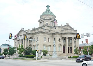
Somerset County is a county located in the U.S. state of Pennsylvania. As of the 2010 census, the population was 77,742. Its county seat is Somerset. The county was created from part of Bedford County on April 17, 1795, and named after the county of Somerset in England.

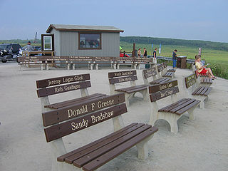
Shanksville is a borough in Somerset County, Pennsylvania, United States, with a population of 237, as of the 2010 census. It is part of the Somerset, Pennsylvania Metropolitan Statistical Area and is approximately 75 miles southeast of Pittsburgh.

Stonycreek Township is a township in Somerset County, Pennsylvania, United States. The township takes its name from the stony creek which for a part of its course flows through it and then becomes its western boundary. As a stream it takes its name from the rocky bed over which it flows in a great part of its course. Its Indian name was Sinne-Hanne or Achsin-Hanne. "Hanne" means a stream and especially a swift mountain stream." The population was 2,221 at the 2000 census. It is part of the Johnstown, Pennsylvania, Metropolitan Statistical Area.
Interstate 76 (I-76) is an east–west Interstate Highway in the Eastern United States, running about 434 miles (700 km) from an interchange with I-71 west of Akron, Ohio, east to I-295 in Bellmawr, New Jersey.

The Laurel Highlands is a region in southwestern Pennsylvania made up of Fayette County, Somerset County and Westmoreland County. It has a population of about 600,000 people.
Interstate 476 (I-476) is a 132.1-mile (212.59 km) auxiliary Interstate Highway of Interstate 76 in the U.S. state of Pennsylvania designated between Interstate 95 near Chester and Interstate 81 near Scranton, serving as the primary north–south Interstate corridor through eastern Pennsylvania. It consists of both the 20-mile (32.19 km) Mid-County Expressway, locally referred to as the "Blue Route", through the suburban Philadelphia-area counties of Delaware and Montgomery, and the tolled, 110.6-mile (177.99 km) Northeast Extension of the Pennsylvania Turnpike connecting the Philadelphia metropolitan area with the Lehigh Valley, the Pocono Mountains, and the Wyoming Valley. The Blue Route passes through suburban areas, while the Northeast Extension predominantly runs through rural areas of mountains, forest and farmland, with development closer to Philadelphia and in the Lehigh Valley and the Wyoming Valley. I-476 intersects many major roads including Interstate 76 in West Conshohocken, Interstate 276 in Plymouth Meeting, U.S. Route 22 near Allentown, and Interstate 80 near Hickory Run State Park.

Breezewood is an unincorporated town in East Providence Township, Bedford County in south-central Pennsylvania.

Sideling Hill Tunnel is one of three original Pennsylvania Turnpike tunnels abandoned after two massive realignment projects. The others are nearby Rays Hill Tunnel, and farther west, the Laurel Hill Tunnel. It was less expensive to realign the Turnpike than to bore a second tube for four lane traffic. Sideling Hill Tunnel is 6,782 feet (2,067 m) long. It was the longest of the original tunnels on the Pennsylvania Turnpike. The Ray's Hill Tunnel and Sideling Hill Tunnel are now part of the Pike2Bike Trail. Together, the two tunnels as well as the roadway are commonly known as the Abandoned Pennsylvania Turnpike.

Rays Hill Tunnel is one of three original Pennsylvania Turnpike tunnels which were abandoned after two massive realignment projects. The others included the Sideling Hill Tunnel, and farther west, the Laurel Hill Tunnel.

Laurel Hill Tunnel is one of three original tunnels on the Pennsylvania Turnpike which were abandoned after two massive realignment projects.

Blue Mountain, Blue Mountain Ridge, or the Blue Mountains of Pennsylvania is a ridge of the Appalachian Mountains in the U.S. state of Pennsylvania. Forming the southern and eastern edge of the Ridge-and-Valley Appalachians physiographic province in Pennsylvania, Blue Mountain extends 150 miles (240 km) from the Delaware Water Gap on the New Jersey border in the east to Big Gap in Franklin County, south-central Pennsylvania, at its southwestern end.
Interstate 95 (I-95) is a major Interstate Highway that traverses nearly the full extent of the East Coast of the United States, from Florida to Maine. In the state of New Jersey, it runs along much of the mainline of the New Jersey Turnpike, as well as the Pearl Harbor Memorial Extension, and the New Jersey Turnpike's I-95 Extension to the George Washington Bridge for a total of 77.96 mi (125.46 km). Located in the northeastern part of the state near New York City, the 11.03-mile (17.75 km) Western Spur of the New Jersey Turnpike, considered to be Route 95W by the New Jersey Department of Transportation (NJDOT), is also part of I-95.
The Abandoned Pennsylvania Turnpike is the common name of a 13-mile (21 km) stretch of the Pennsylvania Turnpike that was bypassed in 1968 when a modern stretch opened to ease traffic congestion in the tunnels. In this case, the Sideling Hill Tunnel and Rays Hill Tunnel were bypassed, as was one of the Turnpike's travel plazas. The bypass is located just east of the heavily congested Breezewood interchange for Interstate 70 (I-70) eastbound at what is now I-76 exit 161. The section of the turnpike was at one time part of the South Pennsylvania Railroad.

Pittsburgh, surrounded by rivers and hills, has a unique transportation infrastructure that includes roads, tunnels, bridges, railroads, inclines, bike paths, and stairways.

Buchanan State Forest is a Pennsylvania State Forest in Pennsylvania Bureau of Forestry District #2. The main office is located in McConnellsburg in Fulton County, Pennsylvania, in the United States. The forest also includes tracts in Franklin and Bedford Counties. It is named for James Buchanan of Pennsylvania, the fifteenth President of the United States.
Pennsylvania Route 31 is a 74-mile-long (119 km) state highway located in Western Pennsylvania, paralleling U.S. Route 30 and the Pennsylvania Turnpike for most of its length. The designation begins at PA 136 near West Newton and ends at US 30 near Bedford.
The Negro Mountain Tunnel is a tunnel located in Negro Mountain in Somerset County, Pennsylvania. It was built by New York Central Railroad as part of the proposed but never completed South Pennsylvania Railroad, which over time became known as "Vanderbilt's Folly". The tunnel is located near milepost 116.7 on the Pennsylvania Turnpike where it is ten miles east of the Quemahoning Tunnel, 16 miles east of the Laurel Hill Tunnel, and seven miles west of the Allegheny Mountain Tunnel currently used by the Turnpike.


