Sparnberg | |
---|---|
Ortsteil of Hirschberg | |
Coordinates: 50°24′46″N11°46′16″E / 50.41278°N 11.77111°E Coordinates: 50°24′46″N11°46′16″E / 50.41278°N 11.77111°E | |
Country | Germany |
State | Thuringia |
District | Saale-Orla-Kreis |
Town | Hirschberg |
Area | |
• Total | 3.3 km2 (1.3 sq mi) |
Population (2005) | |
• Total | 160 |
• Density | 48/km2 (130/sq mi) |
Time zone | CET/CEST (UTC+1/+2) |
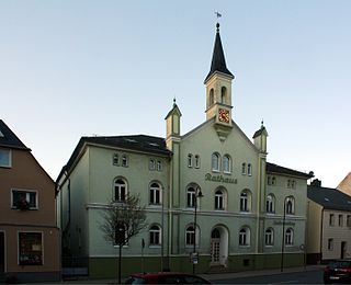
Sparnberg is a village in Thuringia, Germany. It was an independent municipality until 1994, when it became a district of the town Hirschberg. [1] It is situated on the right bank of the river Saale, at 440 m above sea level. It has an area of about 333 hectares. Sparnberg counted about 160 residents in 2005.
Thuringia, officially the Free State of Thuringia, is a state of Germany.
Germany, officially the Federal Republic of Germany, is a country in Central and Western Europe, lying between the Baltic and North Seas to the north, and the Alps to the south. It borders Denmark to the north, Poland and the Czech Republic to the east, Austria and Switzerland to the south, France to the southwest, and Luxembourg, Belgium and the Netherlands to the west.
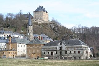
Hirschberg is a town in the Saale-Orla-Kreis district, in Thuringia, Germany. It is situated on the river Saale, 20 km south of Schleiz, 12 km northwest of Hof (Bavaria), and 25 km southwest of Plauen (Saxony).
From 1949 to 1990 the Saale formed the border between East (GDR) and West Germany (FRG) here, with Sparnberg on the GDR side.
The Inner German border was the border between the German Democratic Republic and the Federal Republic of Germany from 1949 to 1990. Not including the similar and physically separate Berlin Wall, the border was 1,393 kilometres (866 mi) long and ran from the Baltic Sea to Czechoslovakia.
East Germany, officially the German Democratic Republic, was a country that existed from 1949 to 1990, when the eastern portion of Germany was part of the Eastern Bloc during the Cold War. It described itself as a socialist "workers' and peasants' state", and the territory was administered and occupied by Soviet forces at the end of World War II — the Soviet Occupation Zone of the Potsdam Agreement, bounded on the east by the Oder–Neisse line. The Soviet zone surrounded West Berlin but did not include it; as a result, West Berlin remained outside the jurisdiction of the GDR. It bordered West Germany to the west, Poland and the Czechoslovakia to the east and it lied between the Baltic Sea.
West Germany is the common English name for the Federal Republic of Germany in the period between its creation on 23 May 1949 and German reunification on 3 October 1990. It lied between the North Sea to the north, and the Alps to the south. It bordered Denmark to the north, East Germany and Czechoslovakia to the east, Austria and Switzerland to the south, France to the southwest, and Luxembourg, Belgium and the Netherlands to the west. During this Cold War era, NATO-aligned West Germany and Warsaw Pact-aligned East Germany were divided by the Inner German border. After 1961 West Berlin was physically separated from East Berlin as well as from East Germany by the Berlin Wall. This situation ended when East Germany was dissolved and split into five states, which then joined the ten states of the Federal Republic of Germany along with the reunified city-state of Berlin. With the reunification of West and East Germany, the Federal Republic of Germany, enlarged now to sixteen states, became known simply as "Germany". This period is referred to as the Bonn Republic by historians, alluding to the interwar Weimar Republic and the post-reunification Berlin Republic.
Saxony-Anhalt is a state of Germany.
Jena is a German university city and the second largest city in Thuringia. Together with the nearby cities of Erfurt and Weimar, it forms the central metropolitan area of Thuringia with approximately 500,000 inhabitants, while the city itself has a population of about 110,000. Jena is a centre of education and research; the Friedrich Schiller University was founded in 1558 and had 18,000 students in 2017 and the Ernst-Abbe-Fachhochschule Jena counts another 5,000 students. Furthermore, there are many institutes of the leading German research societies.
The Saale, also known as the Saxon Saale and Thuringian Saale, is a river in Germany and a left-bank tributary of the Elbe. It is not to be confused with the smaller Franconian Saale, a right-bank tributary of the Main, or the Saale in Lower Saxony, a tributary of the Leine.
Werner Bruschke was an East German politician and member of the Socialist Unity Party of Germany. He was Minister-President of Saxony-Anhalt (GDR) from 13 August 1949 until the state was abolished on 23 July 1952.
Manfred Gerlach was a German jurist and politician (LDPD). He served as Chairman of the Council of State and was thus head of state of East Germany from 6 December 1989 to 5 April 1990.
The Deutsche Volkspolizei, commonly known as the Volkspolizei or VoPo, was the national police force of the German Democratic Republic from 1945 to 1990. The Volkspolizei was a highly-centralized agency responsible for most civilian law enforcement in East Germany, maintaining 257,500 personnel at its peak.
Gerald Götting was a German politician and chairman of the East German Christian Democratic Union (CDU) from 1966 until 1989. He served as President of the People's Chamber (Volkskammer) from 1969 to 1976 and deputy chairman of the State Council of East Germany from 1960 to 1989.
Bernburg (Saale) is a town in Saxony-Anhalt, Germany, capital of the Salzlandkreis district. The former residence of the Anhalt-Bernburg princes is known for its Renaissance castle.
The Rudelsburg is a ruined hill castle located on the east bank of the river Saale above Saaleck, a village in the borough of Naumburg in the county of Burgenlandkreis in Saxony-Anhalt, Germany. The Rudelsburg was built in the Middle Ages by the Bishop of Naumburg and served to secure trade routes such as the Via Regia through the Saale Valley.
Aschersleben is a town in the Salzlandkreis district, in Saxony-Anhalt, Germany. It is situated approximately 22 km east of Quedlinburg, and 45 km northwest of Halle (Saale).
Bundesautobahn 9 is an autobahn in Germany, connecting Berlin and Munich via Leipzig and Nuremberg. It's the fifth longest autobahn spanning 529 km (328.71 mi).
Gefell is a town in the Saale-Orla-Kreis district, in Thuringia, Germany.
Volker Braun is a German writer. His works include Provokation für mich – a collection of poems written between 1959 and 1964 and published in 1965, a play, Die Kipper, and Das ungezwungne Leben Kasts (1972).
The Social Democratic Party in the GDR was a reconstituted Social Democratic Party existing during the last phase of the East German state. Slightly less than a year after its creation it merged with the West German Social Democratic Party of Germany.
Tröbnitz is a municipality in the district Saale-Holzland, in eastern Thuringia, Germany.
Halle-Neustadt was a city in the German Democratic Republic. It was established as a new town on 12 May 1967, as an independent and autonomous city. The population in 1972 was 51,600 and in 1981 was more than 93,000. On 6 May 1990, Halle-Neustadt merged back into Halle again. The population has halved since then and was about 45,157 inhabitants on 31 December 2010. Halle Neustadt has been praised for being “sustainable” as a result of its urban planning, which includes high density living, a tram line serving the central corridor and the regional suburban rail system (S-Bahn).
The Mitteldeutsche Zeitung is a regional daily newspaper for southern Saxony-Anhalt, Germany. Published in Halle with several local versions, the paper is owned by M. DuMont Schauberg, Cologne.
The Elster-Saale Canal, renamed in 1999 by the Federal Waterways and Shipping Administration as the Saale-Leipzig Canal (Saale-Leipzig-Kanal) or SLK and on the Halle side also called the Saale-Elster Canal, was a canal project, started in 1933 and aborted in 1943, that was intended to link the White Elster river with the Saale near Leuna and thus enable the city of Leipzig to be joined to Germany's inland waterway network. The 11 kilometre long water-filled channel is one of the so-called special federal waterways.