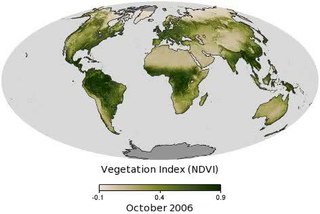
Vegetation is an assemblage of plant species and the ground cover they provide. It is a general term, without specific reference to particular taxa, life forms, structure, spatial extent, or any other specific botanical or geographic characteristics. It is broader than the term flora which refers to species composition. Perhaps the closest synonym is plant community, but vegetation can, and often does, refer to a wider range of spatial scales than that term does, including scales as large as the global. Primeval redwood forests, coastal mangrove stands, sphagnum bogs, desert soil crusts, roadside weed patches, wheat fields, cultivated gardens and lawns; all are encompassed by the term vegetation.

The Landsat program is the longest-running enterprise for acquisition of satellite imagery of Earth. It is a joint NASA / USGS program. On 23 July 1972, the Earth Resources Technology Satellite was launched. This was eventually renamed to Landsat 1 in 1975. The most recent, Landsat 9, was launched on 27 September 2021.
The USGS DEM standard is a geospatial file format developed by the United States Geological Survey for storing a raster-based digital elevation model. It is an open standard, and is used throughout the world. It has been superseded by the USGS's own SDTS format but the format remains popular due to large numbers of legacy files, self-containment, relatively simple field structure and broad, mature software support.
A GIS file format is a standard of encoding geographical information into a computer file. They are created mainly by government mapping agencies or by GIS software developers.

Ukrainian Ye is a character of the Cyrillic script. It is a separate letter in the Ukrainian alphabet, the Pannonian Rusyn alphabet, and both the Carpathian Rusyn alphabets; in all of these, it comes directly after Е. In modern Church Slavonic, it is considered a variant form of Ye (Е е). Until the mid-19th century, Є/є was also used in Romanian and Serbian. Other modern Slavonic languages may use Є/є shapes instead of Е/е for decorative purposes. Then, the letter is usually referred to by the older name Yest and the descriptive name Long E.

The elevation of a geographic location is its height above or below a fixed reference point, most commonly a reference geoid, a mathematical model of the Earth's sea level as an equipotential gravitational surface . The term elevation is mainly used when referring to points on the Earth's surface, while altitude or geopotential height is used for points above the surface, such as an aircraft in flight or a spacecraft in orbit, and depth is used for points below the surface.

The shapefile format is a geospatial vector data format for geographic information system (GIS) software. It is developed and regulated by Esri as a mostly open specification for data interoperability among Esri and other GIS software products. The shapefile format can spatially describe vector features: points, lines, and polygons, representing, for example, water wells, rivers, and lakes. Each item usually has attributes that describe it, such as name or temperature.

The United States National Grid (USNG) is a multi-purpose location system of grid references used in the United States. It provides a nationally consistent "language of location", optimized for local applications, in a compact, user friendly format. It is similar in design to the national grid reference systems used in other countries. The USNG was adopted as a national standard by the Federal Geographic Data Committee (FGDC) of the US Government in 2001.
Digital Earth is the name given to a concept by former US vice president Al Gore in 1998, describing a virtual representation of the Earth that is georeferenced and connected to the world's digital knowledge archives.

In computational geometry, the minimum bounding rectangle (MBR), also known as bounding box (BBOX) or envelope, is an expression of the maximum extents of a two-dimensional object or set of objects within its x-y coordinate system; in other words min(x), max(x), min(y), max(y). The MBR is a 2-dimensional case of the minimum bounding box.
Geospatial metadata is a type of metadata applicable to geographic data and information. Such objects may be stored in a geographic information system (GIS) or may simply be documents, data-sets, images or other objects, services, or related items that exist in some other native environment but whose features may be appropriate to describe in a (geographic) metadata catalog.
OMB Circular A-16, revised August 19, 2002, is a Government circular that was created by the United States Office of Management and Budget (OMB) to provide guidance for federal agencies that create, maintain or use spatial data directly or indirectly through the establishment of the National Spatial Data Infrastructure (NSDI) and the Federal Geographic Data Committee (FGDC).
A geoportal is a type of web portal used to find and access geographic information and associated geographic services via the Internet. Geoportals are important for effective use of geographic information systems (GIS) and a key element of Spatial Data Infrastructure (SDI).

The County Court Business Centre (CCBC) is a centre of the County Court of England and Wales created to deal with claims by the use of various electronic media. Unlike other County Court centres the CCBC does not physically hear cases. If any case might require a hearing it is transferred to another centre.
A feature, in the context of geography and geographic information science, is a discrete phenomenon that exists at a location in the space and scale of relevance to geography; that is, at or near the surface of Earth, at a moderate to global scale. It is one of the primary types of phenomena represented in geographic information, such as that represented in maps, geographic information systems, remote sensing imagery, statistics, and other forms of geographic discourse. Such representations of features consists of descriptions of their inherent nature, their spatial form and location, and their characteristics or properties.

A Digital Line Graph (DLG) is a cartographic map feature represented in digital vector form that is distributed by the U.S. Geological Survey (USGS). DLGs are collected from USGS maps and are distributed in large-, intermediate- and small-scale with up to nine different categories of features, depending on the scale. They come in optional and Spatial Data Transfer Standard (SDTS) format and are topologically structured for use in mapping and geographic information system (GIS) applications.
Global Mapper is a geographic information system (GIS) software package currently developed by Blue Marble Geographics that runs on Microsoft Windows. The GIS software competes with ESRI, GeoMedia, Manifold System, and MapInfo GIS products. Global Mapper handles both vector, raster, and elevation data, and provides viewing, conversion, and other general GIS features. Global Mapper has an active user community with a mailing list and online forums.

Mercury is a distributed metadata management, data discovery and access system. It is a scientific data search system to capture and manage biogeochemical and ecological data in support of the Earth science programs funded by the United States Department of Energy (DOE) and United States Geological Survey (USGS) - Department of Interior (DOI). Mercury was originally developed for NASA, but the consortium is now supported by USGS and the DOE. Ongoing development of Mercury is done through an informal consortium at Oak Ridge National Laboratory.
The Spatial Archive and Interchange Format was defined in the early 1990s as a self-describing, extensible format designed to support interoperability and storage of geospatial data.
Blue Marble Geographics is a developer and provider of geographic information system software products focused on data translation. They provide software products and services for working with GIS data in different formats.