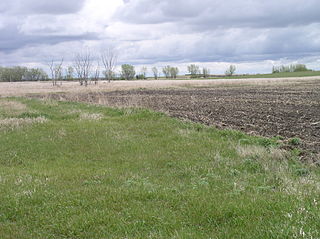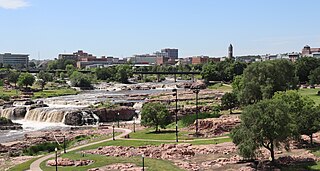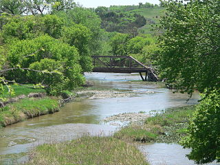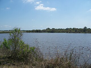
Clay County is a county in the U.S. state of South Dakota. As of the 2020 census, the population was 14,967. The county seat is Vermillion, which is also home to the University of South Dakota. The county is named for Henry Clay, American statesman, US Senator from Kentucky, and United States Secretary of State in the 19th century. Clay County comprises the Vermillion, SD Micropolitan Statistical Area, which is also included in the Sioux City-Vermillion, Iowa-SD-Nebraska Combined Statistical Area.

Effigy Mounds National Monument preserves more than 200 prehistoric mounds built by pre-Columbian Mound Builder cultures, mostly in the first millennium CE, during the later part of the Woodland period of pre-Columbian North America. Numerous effigy mounds are shaped like animals, including bears and birds.

Union County is the southernmost county in the U.S. state of South Dakota. As of the 2020 census, the population was 16,811, making it the 13th most populous county in South Dakota. Its county seat has been Elk Point since April 30, 1865. Originally named Cole County, its name was changed to Union on January 7, 1864, because of Civil War sentiment.

Minnehaha County is a county on the eastern border of the state of South Dakota. As of the 2020 census, the population was 197,214, making it the state's most populous county. It contains over 20% of the state's population. Its county seat is Sioux Falls, South Dakota's most populous city. The county was created in 1862 and organized in 1868. Its name was derived from the Sioux word Mnihaha, meaning "rapid water," or "waterfall".

Campbell County is a county in the U.S. state of South Dakota. As of the 2020 census, the population was 1,377, making it the fourth-least populous county in South Dakota. Its county seat is Mound City. The county was created in 1873 and organized in 1884. It was named for Norman B. Campbell, a Dakota Territory legislator in 1873 and son of General Charles T. Campbell.

Yellow Medicine County is a county in the southwestern part of the U.S. state of Minnesota. Its eastern border is formed by the Minnesota River. As of the 2020 census, the population was 9,528. Its county seat is Granite Falls.

Rock County is a county located in the southwestern corner of the U.S. state of Minnesota. According to the 2020 census, its population was 9,704. The county seat is Luverne. It is located within the Sioux Falls MSA.

The Big Sioux River is a tributary of the Missouri River in eastern South Dakota and northwestern Iowa in the United States. It flows generally southwardly for 419 mi (674 km), and its watershed is 9,006 sq mi (23,330 km2). The United States Board on Geographic Names settled on "Big Sioux River" as the stream's name in 1931. The river was named after the Lakota people which was known by them as Tehankasandata, or Thick Wooded River.

The Crow Creek Indian Reservation, home to Crow Creek Sioux Tribe is located in parts of Buffalo, Hughes, and Hyde counties on the east bank of the Missouri River in central South Dakota in the United States. It has a land area of 421.658 square miles (1,092.09 km2) and a 2000 census population of 2,225 persons. The major town and capital of the federally recognized Crow Creek Sioux Tribe is Fort Thompson.
Gitchie Manitou is a small nature preserve in Lyon County, in the extreme northwestern corner of Iowa just northwest of Granite, Iowa, or just southeast of Sioux Falls, South Dakota. This natural prairie preserve is noted for its ancient Native American burial mounds and precambrian Sioux Quartzite outcroppings, which are about 1.6 billion years old.

The Blood Run Site is an archaeological site on the border of the US states of Iowa and South Dakota. The site was essentially populated for 8,500 years, within which earthworks structures were built by the Oneota Culture and occupied by descendant tribes such as the Ioway, Otoe, Missouri, and shared with Quapaw and later Kansa, Osage, and Omaha people. The site was so named on account of the iron-stained soil.
Broken Kettle Creek is a 25-mile-long (40 km) stream in Plymouth County, Iowa. It is a tributary of the Big Sioux River. The creek rises in Preston Township, flows generally south by southwest, and meets the Big Sioux River in Hancock Township, approximately three miles northeast of Jefferson, South Dakota.

Spirit Mound Historic Prairie is a state park in Clay County, South Dakota, United States, featuring a prominent hill on the Great Plains. The Plains Indians of the region considered Spirit Mound the home of dangerous spirits or little people; members of the Lewis and Clark Expedition climbed it on August 25, 1804. The park was established in 2002. It is located about 6.5 miles (10.5 km) north of Vermillion, South Dakota.
The House at 1648 Riverside Drive, also known as the Graber Residence and as 1648 Viets Avenue, was a 1 acre (0.40 ha) property consisting of two buildings in Grand Forks, North Dakota, that was listed on the National Register of Historic Places in 1994 and delisted in 2023.

Ponca Creek is a stream that flows from southern South Dakota and into northern Nebraska. It is 139 miles (224 km) long. Its source is about 4 miles (6.4 km) west of U.S. 183, near Colome. It flows into the Missouri River 6 miles (9.7 km) northwest of Niobrara. Ponca Creek starts out going east, then takes a southeast direction, which continues until around Bristow, Nebraska, where it turns east again until it flows into the Missouri River. The entire Ponca Creek watershed drains 520,000 acres (2,100 km2). The watershed stretches from central Tripp County to central Gregory County.

Ortona is an unincorporated area and a populated place in Glades County, Florida.
Brule Creek is a stream in the U.S. state of South Dakota.
Cobb Creek is a stream in the U.S. states of Minnesota and South Dakota. It is a tributary of the Lac qui Parle River.
Union Creek is a stream in the U.S. state of South Dakota.


