Eritrea is located in the Horn of Africa and is bordered on the northeast and east by the Red Sea, on the west and northwest by Sudan, on the south by Ethiopia, and on the southeast by Djibouti. The country has a high central plateau that varies from 1,800 to 3,000 meters (5,906–9,843 ft) above sea level. A coastal plain, western lowlands, and some 350 islands comprise the remainder of Eritrea's land mass.

Zimbabwe is a landlocked country in southern Africa lying wholly within the tropics. It straddles an extensive high inland plateau that drops northwards to the Zambezi valley where the border with Zambia is and similarly drops southwards to the Limpopo valley and the border with South Africa. The country has borders with Botswana 813 km, Mozambique 1,231 km, South Africa 225 km, Zambia 797 km and almost meets Namibia at its westernmost point.

Polokwane, also known by its former name, Pietersburg, is a city and the capital of the Limpopo Province of South Africa. It is South Africa's largest urban centre north of Gauteng. Polokwane was one of the host cities of the 2010 FIFA World Cup.

South Africa occupies the southern tip of Africa, its coastline stretching more than 2,850 kilometres from the desert border with Namibia on the Atlantic (western) coast southwards around the tip of Africa and then northeast to the border with Mozambique on the Indian Ocean. The low-lying coastal zone is narrow for much of that distance, soon giving way to a mountainous escarpment that separates the coast from the high inland plateau. In some places, notably the province of KwaZulu-Natal in the east, a greater distance separates the coast from the escarpment. Although much of the country is classified as semi-arid, it has considerable variation in climate as well as topography. The total land area is 1,220,813 km2 (471,359 sq mi). It has the 23rd largest Exclusive Economic Zone of 1,535,538 km2 (592,875 sq mi).

The Drakensberg is the eastern portion of the Great Escarpment, which encloses the central Southern African plateau. The Great Escarpment reaches its greatest elevation – 2,000 to 3,482 metres within the border region of South Africa and Lesotho.

Veld, also spelled veldt, is a type of wide open rural landscape in Southern Africa. Particularly, it is a flat area covered in grass or low scrub, especially in the countries of South Africa, Lesotho, Eswatini, Zimbabwe and Botswana. A certain sub-tropical woodland ecoregion of Southern Africa has been officially defined as the Bushveld by the World Wide Fund for Nature. Trees are found only in a few places—frost, fire and grazing animals allow grass to grow but prevent the growth of trees.

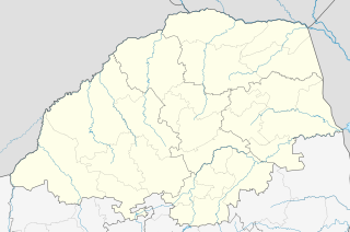
Mpumalanga is a province of South Africa. The name means "east", or literally "the place where the sun rises" in the Swazi, Xhosa, Ndebele and Zulu languages. Mpumalanga lies in eastern South Africa, bordering Eswatini and Mozambique. It constitutes 6.5% of South Africa's land area. It shares borders with the South African provinces of Limpopo to the north, Gauteng to the west, the Free State to the southwest, and KwaZulu-Natal to the south. The capital is Mbombela.

Limpopo is the northernmost province of South Africa. It is named after the Limpopo River, which forms the province's western and northern borders. The capital and largest city in the province is Polokwane.

Kuruman is a town with just over 13,000 inhabitants in the Northern Cape province of South Africa. It is known for its scenic beauty and the Eye of Kuruman, a geological feature that brings water from deep underground. The abundance of water produce an unexpected swathe of green amidst the barren plains and is known as the Oasis of the Kalahari. It was at first a mission station of the London Missionary Society founded by Robert Moffat in 1821. It was also the place where David Livingstone arrived for his first position as a missionary in 1841. The Kuruman River, which is dry except for flash floods after heavy rain, is named after the town.

The Karoo is a semi-desert natural region of South Africa. No exact definition of what constitutes the Karoo is available, so its extent is also not precisely defined. The Karoo is partly defined by its topography, geology and climate, and above all, its low rainfall, arid air, cloudless skies, and extremes of heat and cold. The Karoo also hosted a well-preserved ecosystem hundreds of million years ago which is now represented by many fossils.

Lephalale or Ellisras is a coal mining town in the Limpopo province of South Africa immediately east of the Waterberg Coalfield. The town was established as Ellisras in 1960 and named after Patrick Ellis and Piet Erasmus who settled on a farm there in the 1930s. In 2002, Ellisras was renamed Lephalale by the provincial government of Limpopo, after the main river that crosses the municipality. Lephalale is divided into three main subsections, Ellisras, Onverwacht and Marapong. Lephalale is derived from the setswana language meaning "to flow".

Bela-Bela is a town in the Limpopo Province of South Africa. Deriving its name from the geothermic hot springs around which the town was built, it was called Warmbaths, until 2002.

Tzaneen is a large tropical garden town situated in the Mopani District Municipality of the Limpopo province in South Africa. It is situated in a high rainfall fertile region with tropical and subtropical agriculture taking place in a 20,000 km2 region. It is Limpopo's second largest town after Polokwane.

The Bushveld is a sub-tropical woodland ecoregion of Southern Africa. It encompasses most of Limpopo Province and a small part of the North West Province of South Africa, the Central and North-East Districts of Botswana and the Matabeleland South and part of the Matabeleland North provinces of Zimbabwe. Kruger National Park in South Africa has a number of 'Bushveld' camps. The terms 'bushveld' and 'lowveld' are sometimes used interchangeably, and the line between the two is somewhat blurred, although the lowveld lies in Mpumalanga.

South Africa switched to a closed numbering system effective 16 January 2007. At that time, it became mandatory to dial the full 10-digit telephone number, including the zero in the three-digit area code, for local calls. Area codes within the system are generally organized geographically. All telephone numbers are 9 digits long, except for certain Telkom special services. When dialed from another country, the '0' is omitted and replaced with the appropriate international access code and the country code 27.

The Karoo National Park, founded in 1979, is a wildlife reserve in the Great Karoo area of the Western Cape, South Africa near Beaufort West. This semi-desert area covers an area of 750 square kilometres (290 sq mi). The Nuweveld portion of the Great Escarpment runs through the Park. It is therefore partly in the Lower Karoo, at about 850 m above sea level, and partly in the Upper Karoo at over 1300 m altitude.

Roedtan is a small town in the Limpopo province, South Africa, set in the midst of the Springbok Flats. Roedtan has a rail road station 85 km (53 mi) from Polokwane. At the road junction to Roedtan stands a monument to the battle of Moordrift in 1854 when 33 white people were killed in a skirmish with the local tribe headed by Makapane. The cave, Makapansgat, is now known to record early hominid occupation and is a national monument. The Springbok Flats is a reminder that great herds of Springbok once populated the plain, which was also frequented by lions and other wild animals.

Mabula Game Reserve is a private game reserve situated in the Limpopo province of South Africa. It is about 12,000 hectares in area and is about 47 km from Bela Bela (Warmbaths).

The Nyl River is a watercourse in Limpopo Province, South Africa. It flows at the head of the Mogalakwena River, being its southernmost tributary or uppermost section. It is located near Mookgophong (Naboomspruit) in the northern part of the Springbok Flats, a particular geological formation.
The proposed Springbok Flats mine will be located near Settlers in southern Limpopo province, South Africa. The Springbok Flats resource represents one of the largest uranium reserves in South Africa having estimated reserves of 195 million tonnes of ore with a grading of 0.042% uranium.


