Tippirajapuram is a village in Kumbakonam taluk, Thanjavur district, Tamil Nadu. It is located near the banks of the river Thirumalairajan and Mudikonndan in India. The nearest railway station is Kumbakonam which is 8 kilometres. The village is famous for its Vikrama Soleswarar and Varadaraja Perumal temples.
Nandavanampatti is a village in the Thanjavur taluk of Thanjavur district, Tamil Nadu, India.

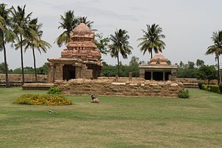
Thanjavur is a taluk of Thanjavur district of the Indian state of Tamil Nadu.
Papanasam taluk is a taluk of Thanjavur district of the Indian state of Tamil Nadu. The headquarters of the taluk is the town of Papanasam.
Kallapuliyur is a village in the Kumbakonam taluk of Thanjavur district, Tamil Nadu, India.
Marutadi is a village in the Kumbakonam taluk of Thanjavur district, Tamil Nadu, India.
Madurantakam taluk is a taluk of Kanchipuram district of the Indian state of Tamil Nadu. The headquarters of the taluk is the town of Madurantakam. Madurantakam taluk is bounded by Chengalpattu taluk in north, Uthiramerur taluk in West, Thirukklaukkundram Taluk in north east and Tindivanam lauk of Villupuram district in south.
Mayiladuthurai taluk is a taluk of Nagapattinam district of the Indian state of Tamil Nadu. The headquarters of the taluk is the town of Mayiladuthurai. Mozhaiyur is 1 of 113 villages in the taluk of Mayiladuthurai.
Vanur taluk is a taluk of Viluppuram district of the Indian state of Tamil Nadu. The headquarters of the taluk is the town of Vanur.
Viluppuram taluk is a taluk of Viluppuram district of the Indian state of Tamil Nadu. The headquarters of the taluk is the town of Viluppuram.
Ariyalur taluk is a taluk of Ariyalur district of the Indian state of Tamil Nadu. The headquarters of the taluk is the town of Ariyalur.
Vriddachalam taluk is a taluk of Cuddalore district of the Indian state of Tamil Nadu. The headquarters of the taluk is the town of Vriddachalam.
Pulimangalam is a village in the Papanasam taluk of Thanjavur district, Tamil Nadu, India.
Andami is a village in the Pattukkottai taluk of Thanjavur district, Tamil Nadu, India.
Pannaivayal is a village in the Pattukkottai taluk of Thanjavur district, Tamil Nadu, India.
Pillankuli is a village in the Pattukkottai taluk of Thanjavur district, Tamil Nadu, India.
Tirukkoyilur taluk is a taluk of Kallakurichi district of the Indian state of Tamil Nadu. The headquarters of the taluk is the town of Tirukkoyilur.
Uthiramerur Taluk is a taluk in Kanchipuram district of the Indian state of Tamil Nadu. The headquarters of the taluk is the town of Uthiramerur.
Walajabad taluk is a taluk in the Kanchipuram district of Tamil Nadu, India. At the 2011 Census of India, the taluk covered an area of 339.03 square kilometres (130.90 sq mi) with a population of 125,868. The headquarters of the taluk is the town of Walajabad.