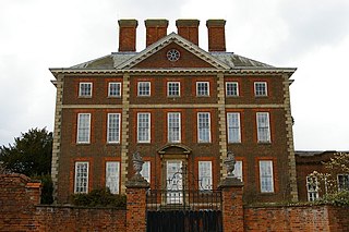
The Queen Anne style of British architecture refers to either the English Baroque architecture of the time of Queen Anne or the British Queen Anne Revival form that became popular during the last quarter of the 19th century and the early decades of the 20th century. In other English-speaking parts of the world, New World Queen Anne Revival architecture embodies entirely different styles.

The Municipality of Strathfield is a local government area in the inner west of Sydney, in the state of New South Wales, Australia.

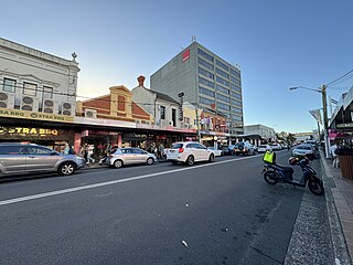
The Inner West of Sydney is an area directly west of the Sydney central business district, New South Wales, Australia. The suburbs that make up the Inner West are predominantly located along the southern shore of Port Jackson, stretching south to the shores of the Cooks River. The western boundary of the Inner West is approximately the A3 arterial road, which divides the Inner West from the Greater Western Sydney region. The Inner West is much larger than the Inner West Council local government area. The Inner West roughly corresponds with the Parish of Petersham and Parish of Concord, two cadastral divisions used for land titles.
Strathfield is a suburb in the Inner West of Sydney, in the state of New South Wales, Australia. It is located 12 kilometres west of the Sydney central business district and is the administrative centre of the Municipality of Strathfield. A small section of the suburb north of the railway line lies within the City of Canada Bay, while the area east of The Boulevard lies within the Municipality of Burwood. North Strathfield and Strathfield South are separate suburbs to the north and south, respectively.

Burwood is a suburb in the Inner West of Sydney, in the state of New South Wales, Australia. It is 10 kilometres (6.2 mi) west of the Sydney central business district and is the administrative centre for the local government area of Municipality of Burwood.

Strathfield railway station is a heritage-listed railway station located on the Main Suburban line in the Sydney suburb of Strathfield in the Municipality of Strathfield local government area of New South Wales, Australia. The station is served by Sydney Trains' T1 North Shore & Western Line, T9 Northern Line, T2 Leppington & Inner West Line, T3 Liverpool & Inner West Line suburban services as well as NSW TrainLink Intercity and regional services. The station is located on the Main Northern and Main Western railway lines, forming a major junction for regional and suburban rail services. The station and associated infrastructure was added to the New South Wales State Heritage Register on 2 April 1999.
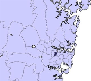
The Municipality of Burwood is a local government area in the inner-west of Sydney, in the state of New South Wales, Australia. The mayor of the Municipality is Cr. John Faker, a member of the Labor Party. The municipality is 7 km2, making it the second smallest Local Government Area in New South Wales, being larger than only Hunter's Hill.

Burwood railway station is a heritage-listed railway station located on the Main Suburban line in the Sydney suburb of Burwood, New South Wales, Australia. The station is served by Sydney Trains T9 Northern line, T2 Leppington & Inner West Line and T3 Liverpool & Inner West Line services.
Australian residential architectural styles have evolved significantly over time, from the early days of structures made from relatively cheap and imported corrugated iron to more sophisticated styles borrowed from other countries, such as the California bungalow from the United States, the Georgian style from Europe and Northern America, and the Victorian style from the United Kingdom. A common feature of the Australian home is the use of fencing in front gardens, also common in both the United Kingdom and the United States.

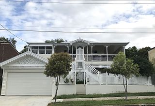
Federation architecture is the architectural style in Australia that was prevalent from around 1890 to 1915. The name refers to the Federation of Australia on 1 January 1901, when the British colonies of Australia collectively became the Commonwealth of Australia.

Appian Way is a street in the suburb of Burwood in Sydney.

St Patrick's Seminary, Manly is a heritage-listed former residence of the Archbishop of Sydney and Roman Catholic Church seminary at 151 Darley Road, Manly, Northern Beaches Council, New South Wales, Australia. The property was also known as St Patrick's Estate, St. Patricks Estate, St. Patrick's Seminary or College, Cardinal's Palace, Archbishop's Residence, St Pats, St Patricks and Saint Paul's Catholic College. It was designed by Sheerin & Hennessy, Hennessy & Hennessy, Scott Green & Scott and Sydney G Hirst & Kennedy and built from 1885 to 1889 by William Farley (Residence/Palace), W. H. Jennings (College/Seminary). The property is owned by the Catholic Archdiocese of Sydney. The property was added to the New South Wales State Heritage Register on 21 January 2011.

Woodstock is a heritage-listed mansion in the Sydney suburb of Burwood, New South Wales, Australia. It was built between c. 1866 and 1873 by Edwin Thomas Penfold and changed hands a number of times before being acquired by Burwood Council. During World War II the property was acquired by the Australian Government for military purposes. The Victorian Italianate villa is listed on the Australian Register of the National Estate and the Burwood Council local government heritage list.
Mary Immaculate Church is a heritage-listed Roman Catholic church and friary at 45 Victoria Street, Waverley, Sydney, New South Wales, Australia. It was designed by Sheerin & Hennessy and built from 1890 to 1929 by John Ptolomy and by W. J. Bolton (1929). It is also known as Mary Immaculate Group, St Charles Borromeo Church and Parish House and Minamurra Cottage (former). The property is owned by the Association of Franciscan Friars Bros. It was added to the New South Wales State Heritage Register on 2 April 1999.

Mount Wilga House is a heritage-listed former residence and rehabilitation hospital at 2a Manor Road, Hornsby in the Hornsby Shire local government area of New South Wales, Australia. Its design is attributed to Henry Marcus Clark and was built from 1913 to 1914. It is also known as Mt Wilga. The property is privately owned. It was added to the New South Wales State Heritage Register on 2 April 1999.

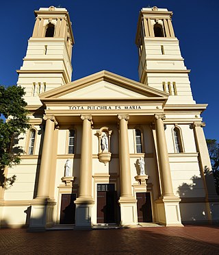
The Trinity Uniting Church is a heritage-listed Uniting church located at 62 The Boulevarde, in the Sydney suburb of Strathfield in the Municipality of Burwood local government area of New South Wales, Australia. It was designed by George Sydney Jones & Harry Thompson and built from 1889 to 1890 by Thomas Hanley of Balmain. It is also known as Trinity Congregational Church. The property is owned by the Uniting Church in Australia. It was added to the New South Wales State Heritage Register on 19 September 2003.

The Priory is a heritage-listed residence at 213 Burwood Road, in the Sydney suburb of Burwood in the Municipality of Burwood local government area of New South Wales, Australia. It was built in 1877. The Priory and its grounds was added to the New South Wales State Heritage Register on 2 April 1999.

St Paul's Anglican Church and Pipe Organ is a heritage-listed Anglican church building and pipe organ located at 205 Burwood Road in the Sydney suburb of Burwood in the Municipality of Burwood local government area of New South Wales, Australia. The church was designed by Edmund Blacket and the organ was designed by William Davidson, with some consultation from Montague Younger. The church and organ were built from 1889 to 1891. The church is also known as St. Paul's Anglican Church and Pipe Organ, St Paul's Anglican Church and Davidson Pipe Organ. The property is owned by Anglican Church Property Trust. It was added to the New South Wales State Heritage Register on 2 April 1999.
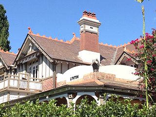
Lynton is a heritage-listed residence located at 4 Clarence Street in the Sydney suburb of Burwood in the Municipality of Burwood local government area of New South Wales, Australia. It was designed by Stanley Rickard and built from 1906. It was added to the New South Wales State Heritage Register on 2 April 1999.

Mount St Mary Campus of the Australian Catholic University is a major campus of the Australian Catholic University, located in Strathfield, Municipality of Strathfield, Sydney, New South Wales, Australia.


