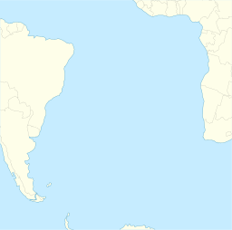
Saint Helena is an island in the South Atlantic Ocean, about midway between South America and Africa. St Helena has a land area of 122 square kilometres and is part of the territory of Saint Helena, Ascension and Tristan da Cunha which includes Ascension Island and the island group of Tristan da Cunha.

In marine geology, a guyot, also called a tablemount, is an isolated underwater volcanic mountain (seamount) with a flat top more than 200 m (660 ft) below the surface of the sea. The diameters of these flat summits can exceed 10 km (6.2 mi). Guyots are most commonly found in the Pacific Ocean, but they have been identified in all the oceans except the Arctic Ocean. They are analogous to tables on land.
The Pacific-Antarctic Ridge (PAR) is a divergent tectonic plate boundary located on the seafloor of the South Pacific Ocean, separating the Pacific Plate from the Antarctic Plate. It is regarded as the southern section of the East Pacific Rise in some usages, generally south of the Challenger Fracture Zone and stretching to the Macquarie Triple Junction south of New Zealand.

The Hawaiian–Emperor seamount chain is a mostly undersea mountain range in the Pacific Ocean that reaches above sea level in Hawaii. It is composed of the Hawaiian ridge, consisting of the islands of the Hawaiian chain northwest to Kure Atoll, and the Emperor Seamounts: together they form a vast underwater mountain region of islands and intervening seamounts, atolls, shallows, banks and reefs along a line trending southeast to northwest beneath the northern Pacific Ocean. The seamount chain, containing over 80 identified undersea volcanoes, stretches about 6,200 km (3,900 mi) from the Aleutian Trench in the far northwest Pacific to the Kamaʻehuakanaloa Seamount, the youngest volcano in the chain, which lies about 35 kilometres (22 mi) southeast of the Island of Hawaiʻi.

In geology, hotspots are volcanic locales thought to be fed by underlying mantle that is anomalously hot compared with the surrounding mantle. Examples include the Hawaii, Iceland, and Yellowstone hotspots. A hotspot's position on the Earth's surface is independent of tectonic plate boundaries, and so hotspots may create a chain of volcanoes as the plates move above them.
The Kula-Farallon Ridge was an ancient mid-ocean ridge that existed between the Kula and Farallon plates in the Pacific Ocean during the Jurassic period. There was a small piece of this ridge off the Pacific Northwest 43 million years ago. The rest of the ridge has since been subducted beneath Alaska.

Meiji Seamount, named after Emperor Meiji, the 122nd Emperor of Japan, is the oldest seamount in the Hawaiian-Emperor seamount chain, with an estimated age of 82 million years. It lies at the northernmost end of the chain, and is perched at the outer slope of the Kuril–Kamchatka Trench. Like the rest of the Emperor seamounts, it was formed by the Hawaii hotspot volcanism, grew to become an island, and has since subsided to below sea level, all while being carried first north and now northwest by the motion of the Pacific Plate. Meiji Seamount is thus an example of a particular type of seamount known as a guyot, and some publications refer to it as Meiji Guyot.
The Lord Howe Seamount Chain formed during the Miocene. It features many coral-capped guyots and is one of the two parallel seamount chains alongside the east coast of Australia; the Lord Howe and Tasmantid seamount chains both run north-south through parts of the Coral Sea and Tasman Sea. These chains have longitudes of approximately 159°E and 156°E respectively.
The Moai Seamount is a submarine volcano, the second most westerly in the Easter Seamount Chain or Sala y Gómez ridge. It is east of Pukao seamount and west of Easter Island. It rises over 2,500 metres from the ocean floor to within a few hundred metres of the sea surface. The Moai seamount is fairly young, having developed in the last few hundred thousand years as the Nazca Plate floats over the Easter hotspot.

The Kodiak–Bowie Seamount chain, also called the Pratt–Welker Seamount chain and the Kodiak Seamounts is a seamount chain in the southeastern Gulf of Alaska stretching from the Aleutian Trench in the north to Bowie Seamount, the youngest volcano in the chain, which lies 180 km (112 mi) west of Haida Gwaii, British Columbia, Canada. The oldest volcano in the chain is the Kodiak Seamount. Although the Kodiak Seamount is the oldest extant seamount in the Kodiak-Bowie chain, the adjacent lower slope contains transverse scars indicating earlier subduction of seamounts.
The Hawaiʻi hotspot is a volcanic hotspot located near the namesake Hawaiian Islands, in the northern Pacific Ocean. One of the best known and intensively studied hotspots in the world, the Hawaii plume is responsible for the creation of the Hawaiian–Emperor seamount chain, a 6,200-kilometer (3,900 mi) mostly undersea volcanic mountain range. Four of these volcanoes are active, two are dormant; more than 123 are extinct, most now preserved as atolls or seamounts. The chain extends from south of the island of Hawaiʻi to the edge of the Aleutian Trench, near the eastern coast of Russia.

Hodgkins Seamount is a seamount in the Kodiak-Bowie Seamount chain, located south of Pierce Seamount and north of Bowie Seamount. It has apparently experienced two generically different episodes of volcanism, separated by about 12 million years. Like the rest of the Kodiak-Bowie seamounts, it was formed by the Bowie hotspot.

The Louisville Ridge, also known as the Louisville Seamount Chain, is an underwater chain of over 70 seamounts located in the Southwest portion of the Pacific Ocean. As one of the longest seamount chains on Earth it stretches some 4,300 km (2,700 mi) from the Pacific-Antarctic Ridge northwest to the Tonga-Kermadec Trench, where it subducts under the Indo-Australian Plate as part of the Pacific Plate. The chain may have been formed by movement of the Pacific Plate over the Louisville hotspot or by leakage of magma from the shallow mantle up through the Eltanin fracture zone, which it follows closely.

The Louisville hotspot is a volcanic hotspot responsible for the volcanic activity that has formed the Louisville Ridge in the southern Pacific Ocean.
The St. Helena hotspot is a volcanic hotspot located in the southern Atlantic Ocean. It is responsible for the island of St. Helena and the St. Helena Seamount chain. It is one of the oldest known hotspots on Earth, which began to produce basaltic lava about 145 million years ago.
The Osbourn Seamount is a seamount in the south-west Pacific Ocean. It is the westernmost and oldest unsubducted seamount of the Louisville Ridge, with an estimated age of 78.8 ± 1.3 Ma. Like other seamounts comprising the Louisville Ridge, it was formed by the Louisville hotspot which is currently located 4,300 km (2,700 mi) away near the Pacific-Antarctic Ridge.
Koko Guyot is a 48.1-million-year-old guyot, a type of underwater volcano with a flat top, which lies near the southern end of the Emperor seamounts, about 200 km (124 mi) north of the "bend" in the volcanic Hawaiian-Emperor seamount chain. Pillow lava has been sampled on the north west flank of Koko Seamount, and the oldest dated lava is 40 million years old. Seismic studies indicate that it is built on a 9 km (6 mi) thick portion of the Pacific Plate. The oldest rock from the north side of Koko Seamount is dated at 52.6 and the south side of Koko at 50.4 million years ago. To the southeast of the bend is Kimmei Seamount at 47.9 million years ago and southeast of it, Daikakuji at 46.7.

The Seewarte Seamounts, also known as the Seewarte Seamount Chain, Atlantis-Great Meteor Seamount Chain and the Atlantis-Plato-Cruiser-Great Meteor Seamount Group, is a north-south trending group of extinct submarine volcanoes in the northern Atlantic Ocean south-southeast of the Corner Rise Seamounts.
The Tasmantid hotspot is a volcanic hotspot located in the South Pacific Ocean. Due to plate tectonics the hotspot was under different parts of the seabed in the past. It was initially centred under what is now the southern Coral Sea 60 million years ago where the first Tasmantid volcano was created. As the Indo-Australian Plate continued to drift northwards the hotspot was positioned in the northern Tasman Sea 20 million years ago, eventually reaching its current location east of Tasmania in response to ongoing northward plate motion.