
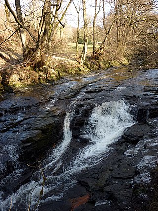
Malham Beck is a stream some 1.2 miles (2 km) long, running southwards through the valley beneath Malham Cove in the Yorkshire Dales, England. It originates in a cave beneath Malham Cove, and flows through Malham before joining Gordale Beck to become the River Aire just south of the village.

The River Swale in Yorkshire, England, is a major tributary of the River Ure, which becomes the River Ouse, that empties into the North Sea via the Humber Estuary. The river gives its name to Swaledale, the valley through which it flows.

Costa Beck is a small river in the Ryedale district of North Yorkshire, England. It also lends its name to an archaeological site.
The River Bleng is a tributary of the River Irt in the county of Cumbria in northern England.
The River Wenning is a tributary of the River Lune, flowing through North Yorkshire and Lancashire. The name derives from the Old English Wann, meaning dark river.
The River Wampool is a river flowing through north western Cumbria in England. It is in the Waver and Wampool catchment which includes the towns of Silloth and Wigton.

The River Waver is a river in Cumbria, England. The river rises at Wavergillhead . It is fed by the northwards flowing Thornthwaite Beck and Pow Gill either side of Bolton Wood Lane. The "Little Waver", rising at Catlands Hill, joins at Waterside near Woodrow. The river then takes a northward course via Waverton and Waverbridge, both of which are named for the river, before turning sharply westward at Abbeytown. The river then goes north, running into Moricambe Bay, an inlet of the Solway Firth.

The River Marron is a river of Cumbria, England.

The River Hindburn is a river in Lancashire, England. The Hindburn rises at Thrushgill where three smaller streams combine. The river proceeds northwards past Lowgill to Wray where it merges with the River Roeburn before carrying on to meet the River Wenning in Hornby Park.
Leck Beck is a watercourse in Lancashire with its source on Crag Hill in Cumbria between Leck Fell and Casterton Fell.
Artle Beck is a minor river of Lancashire, England.

The River Grizedale, also known as Grizedale Beck, is a river in Lancashire, England.
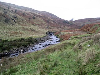
Risedale Beck is a small river that rises on Hipswell Moor, near Catterick Garrison in North Yorkshire, England. The name derives from Old Norse as meaning either Risi's Valley or translated as a valley overgrown with brushwood. Risedale Beck flows eastwards into Catterick Garrison as Leadmill Gill, which in turn flows into Colburn Beck, a tributary of the River Swale. The length of the beck from source to the River Swale is 6.5 miles (10.4 km).
The River Greta is a river in County Durham, England. It is a tributary of the River Tees and flows through the northern part of the old North Riding of Yorkshire. The name "Greta" derives from the Old Norse "Griótá", meaning "stony stream".
The River Lune is a river in County Durham, England.

Stonethwaite Beck is a minor river in Cumbria, England. It is a tributary of the River Derwent.

Naddle Beck is a minor river of Cumbria, England.

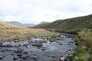
Arkle Beck is the stream running through the valley of Arkengarthdale in the Yorkshire Dales, England. It is a tributary of the River Swale, which it joins just past Reeth at Grinton Bridge. The beck itself has several tributaries which include:

The Black Dub is a stream in Cumbria, United Kingdom. It rises to the west of the village of Langrigg, in the civil parish of Bromfield, where it is known as Dub Stangs, and flows west past Scroggs Wood and the village of Westnewton. As it passes near the hamlets of New Cowper and Edderside it forms the southern boundary of the civil parish of Holme St. Cuthbert, and the northern boundary of the civil parish of Allonby, before entering the Solway Firth at Dubmill, at the northern end of Allonby Bay. It is seven miles in length.

Aldbrough Beck is a small beck in North Yorkshire, England.
