Related Research Articles

The Gulf of St. Lawrence fringes the shores of the provinces of Quebec, New Brunswick, Nova Scotia, Prince Edward Island, Newfoundland and Labrador, in Canada, plus the islands Saint-Pierre and Miquelon, possessions of France, in North America.

The Labrador Sea is an arm of the North Atlantic Ocean between the Labrador Peninsula and Greenland. The sea is flanked by continental shelves to the southwest, northwest, and northeast. It connects to the north with Baffin Bay through the Davis Strait. It is a marginal sea of the Atlantic.

Grand Bank or 'Grand Banc' as the first French settlers pronounced it, is a small rural town in the Canadian province of Newfoundland and Labrador, with a population of 2,580. It is located on the southern tip or "toe" of the Burin Peninsula, 360 km from the province's capital of St. John's.
Cartwright-L'Anse au Clair is a provincial electoral district for the House of Assembly of Newfoundland and Labrador, Canada. As of 2011, there are 3,131 eligible voters living within the district.

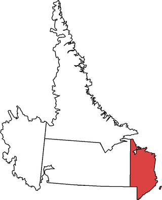
Ferryland is a provincial electoral district for the House of Assembly of Newfoundland and Labrador, Canada. As of 2011, there are 8,571 eligible voters living within the district.
The Burin Peninsula is a peninsula located on the south coast of the island of Newfoundland in the province of Newfoundland and Labrador. Marystown is the largest population centre on the peninsula.
Calvert is a local service district and designated place in the Canadian province of Newfoundland and Labrador in the Southern Shore region of the province. It is 72 kilometres south of the provincial capital St. John's, 7 kilometres south of Cape Broyle, and 3 kilometres north of Ferryland. The population in 2001 was 355, a decline of 17% since 1996.
Charlottetown is a town in Labrador with a population of 292 in the Canadian province of Newfoundland and Labrador. It was said to be founded by Benjamin Powell in 1950 and named for Charlottetown, Prince Edward Island: "I thought that maybe someday the place would be the capital of the bay, the same way Charlottetown is the capital of Prince Edward Island."
St. Lunaire Bay is a natural bay off the island of Newfoundland in the province of Newfoundland and Labrador, Canada.
Norman's Bay is a local service district and designated place in the Canadian province of Newfoundland and Labrador. It is an isolated community at the head of Norman Bay, an extension of Martin Bay. The population of the community was 15 in the 2021 census.

La Poile Bay is a natural bay in Newfoundland, Canada, in the southwestern area of the island, off the south coast. It subdivides into Northeast Arm and North Bay. The settlement of La Poile is located on the bay.
Isthmus Bay is a natural bay on the island of Newfoundland in the province of Newfoundland and Labrador, Canada. It is a sub-bay of St. George's Bay and flanked by the town of Port-au-Port. It is separated from Port au Port Bay by two narrow gravel isthmi.
St. Mein Bay is a natural bay off the island of Newfoundland in the province of Newfoundland and Labrador, Canada. It is located on the eastern side of the tip of the Great Northern Peninsula, and the village of St. Anthony is nearby.
Bay Bulls is a natural bay off the island of Newfoundland in the province of Newfoundland and Labrador, Canada.
Barren Bay is a natural bay on the coast of Labrador in the province of Newfoundland and Labrador, Canada. It is nearby to West Island, Drunken Cove Point and Salmon Bight Point. Barren Bay is also close to French Man Cove, Frenchman's Cove and Hauling Cove.
Caplin Bay is a natural bay on the coast of Labrador in the province of Newfoundland and Labrador, Canada.
Scrammy Bay is a natural bay on the coast of Labrador in the province of Newfoundland and Labrador, Canada. It is in the southeast reaches of St. Mary’s Bay to the east of lavander’s Arm.
Partridge Bay is a natural bay on the coast of Labrador in the province of Newfoundland and Labrador, Canada. It lies to the north of Rocky Bay and to the south of Shoal Bay, with several small uninhabited islands across its entrance from the Labrador Sea.
Bay St. George South is a local service district and designated place in the Canadian province of Newfoundland and Labrador on the south coast of Bay St. George, a large bay on the west coast of the island of Newfoundland. Bay St. George South consists nine communities, namely Heatherton, Robinsons, Cartyville, McKay's, Jeffrey's, St. David's, St. Fintan's, Lock Leven en Highlands.
Pensons Arm is a local service district and designated place in the Canadian province of Newfoundland and Labrador. Pensons Arm, is a coastal village in Labrador, 20 km southeast of Charlottetown. It has a population of 43 in the 2021 census.
References
- ↑ United States Hydrographic Office; Davenport, Richard G. (1884). Newfoundland and Labrador: The coast and banks of Newfoundland and the coast of Labador, from Grand Point to the Koksoak River, with the adjacent islands and banks (Public domain ed.). Govt. print. off. pp. 437–. Retrieved 20 November 2011.
- ↑ "Charlottetown Airport". Google Maps. Google, Inc. Retrieved 5 May 2022.
52°42′58″N55°53′49″W / 52.716°N 55.897°W
| | This Labrador location article is a stub. You can help Wikipedia by expanding it. |