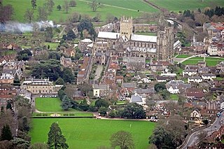
Wells is a cathedral city and civil parish in the Mendip district of Somerset, located on the southern edge of the Mendip Hills, 21 miles (34 km) south-east of Weston-super-Mare, 22 miles (35 km) south-west of Bath and 23 miles (37 km) south of Bristol. Although the population recorded in the 2011 census was only 10,536, and with a built-up area of just 3.244 square kilometres, Wells has had city status since medieval times, because of the presence of Wells Cathedral. Often described as England's smallest city, it is actually second smallest to the City of London in area and population, but unlike London it is not part of a larger urban agglomeration.
Shepton Mallet is an English town and civil parish in the Mendip District of Somerset, about 16 miles (26 km) south-west of Bath, 18 miles (29 km) south of Bristol and 5 miles (8.0 km) east of Wells, with an estimated population of 10,810 in 2019. Mendip District Council is based there. The Mendip Hills lie to the north and the River Sheppey runs through the town, as does the route of the Fosse Way, the main Roman road into south-west England. There is evidence of Roman settlement. Its medieval parish church is among many listed buildings. Shepton Mallet Prison was England's oldest until it closed in March 2013. The medieval wool trade gave way to industries such as brewing in the 18th century. The town remains noted for cider production. Shepton Mallet is the closest town to the Glastonbury Festival. Also nearby is the Royal Bath and West of England Society showground.

Aldhelm, Abbot of Malmesbury Abbey, Bishop of Sherborne, and a writer and scholar of Latin poetry, was born before the middle of the 7th century. He is said to have been the son of Kenten, who was of the royal house of Wessex. He was certainly not, as his early biographer Faritius asserts, the brother of King Ine. After his death he was venerated as a saint, his feast day being the day of his death, 25 May.

The Mendip Hills is a range of limestone hills to the south of Bristol and Bath in Somerset, England. Running east to west between Weston-super-Mare and Frome, the hills overlook the Somerset Levels to the south and the Chew Valley and other tributaries of the Avon to the north. The hills give their name to the local government district of Mendip, which administers most of the area. The higher, western part of the hills, covering 198 km2 (76 sq mi) has been designated an Area of Outstanding Natural Beauty (AONB), which gives it a level of protection comparable to a national park.

The Roman Baths are a well-preserved thermae in the city of Bath, Somerset, England. A temple was constructed on the site between 60-70CE in the first few decades of Roman Britain. Its presence led to the development of the small Roman urban settlement known as Aquae Sulis around the site. The Roman baths—designed for public bathing—were used until the end of Roman rule in Britain in the 5th Century CE. According to the Anglo-Saxon Chronicle, the original Roman baths were in ruins a century later. The area around the natural springs was redeveloped several times during the Early and Late Middle Ages.

Chewton Mendip is a village and civil parish in the Mendip district of Somerset, England. It is situated 4 miles (6 km) north of Wells, 16 miles (26 km) south of Bath and Bristol on the A39 very close to the A37. The village is in a valley on the Mendip Hills and is the source of the River Chew. The parish includes the hamlets of Bathway and Green Ore.
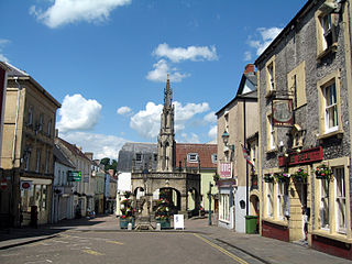
Nunney is a village and civil parish near Frome in the Mendip local government district within the English county of Somerset. The parish includes the hamlet of Holwell.

St Cuthbert Out, sometimes Wells St Cuthbert Out, is a civil parish in the Mendip district of Somerset, England. It entirely surrounds the city and parish of Wells. According to the 2011 census it had a population of 3,749.
Hinton Blewett is a village and civil parish in Somerset, England, 5 miles (8.0 km) north of Wells and 15 miles (24.1 km) south of Bristol on the northern slope of the Mendip Hills, within the designated Area of Outstanding Natural Beauty (AONB) and in the Chew Valley near the source of the River Chew. The parish has a population of 308.

Cranmore is a village and civil parish east of Shepton Mallet, in the Mendip district of Somerset, England. The parish includes the hamlets of Waterlip, East Cranmore and Dean where Dean farmhouse dates from the 17th century, as does The Old Smithy, just off the A361 which was originally two residential dwellings before being finally "knocked through" to just one.

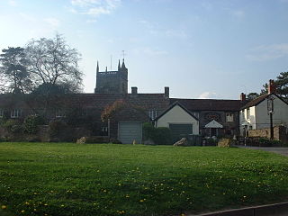
Doulting is a village and civil parish 1.5 miles (2 km) east of Shepton Mallet, on the A361, in the Mendip district of Somerset, England.
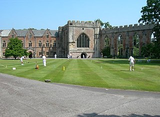
The Bishop's Palace and accompanying Bishops House at Wells in the English county of Somerset, is adjacent to Wells Cathedral and has been the home of the Bishops of the Diocese of Bath and Wells for 800 years. It has been designated by English Heritage as a Grade I listed building.

The River Sheppey has its source in a group of springs west of the village of Doulting, near Shepton Mallet in Somerset, England. It flows through the wetlands to the north of the Polden Hills and ultimately joins the River Brue.
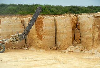
Doulting Stone Quarry is a limestone quarry at Doulting, on the Mendip Hills, Somerset, England.
The Anglican Church of St Bartholomew in Cranmore, Somerset, England, dates from the 15th century and has been designated as a Grade I listed building.

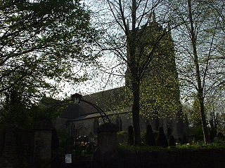
The Church of St Aldhelm in Doulting, Somerset, England, dates from the 12th century. It is a Grade I listed building.
The Tithe Barn at Manor Farm in Doulting, Somerset, England, was built in the 15th century, and has been designated as a Grade I listed building, and scheduled as an ancient monument.

The Cross Bath in Bath Street, Bath, Somerset, England is a historic pool for bathing. It was rebuilt, in the style of Robert Adam by Thomas Baldwin around 1789. It is recorded in the National Heritage List for England as a designated Grade I listed building, and was restored during the 1990s by Donald Insall Associates.

The River Banwell is a small river in Somerset, England.

The Whitelake River is a small river on the Somerset Levels, England.
