
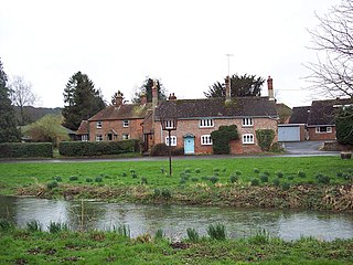
Odstock is a village and civil parish 3 miles (4.8 km) south of Salisbury in Wiltshire, England. The parish includes the village of Nunton with its nearby hamlet of Bodenham. The parish is in the valley of the River Ebble, which joins the Hampshire Avon near Bodenham.

Tidworth is a garrison town and civil parish in south-east Wiltshire, England, on the eastern edge of Salisbury Plain. Lying on both sides of the A338 about 3+1⁄2 miles (5.6 km) north of the A303 primary route, the town is approximately 8 miles (13 km) west of Andover, 12 miles (19 km) south of Marlborough, and 13 miles (21 km) north by north-east of Salisbury. The population of the parish at the 2011 census was approximately 10,600.

Combe is a village and civil parish in the English county of Berkshire. The parish is situated on the top of the North Hampshire Downs near Walbury Hill and Combe Gibbet, overlooking the village of Inkpen and the valley of the River Kennet. In Walbury Hill, it includes the highest natural point in South East England.
A royal peculiar is a Church of England parish or church exempt from the jurisdiction of the diocese and the province in which it lies, and subject to the direct jurisdiction of the monarch.

Deeping St James is a large village in the South Kesteven district of Lincolnshire, England. The population of the civil parish was reported as 7,051 at the 2011 census.

Ludgershall is a town and civil parish 16 miles (26 km) north east of Salisbury, Wiltshire, England. It is on the A342 road between Devizes and Andover. The parish includes Faberstown which is contiguous with Ludgershall, and the hamlet of Biddesden which lies 2 miles (3.2 km) to the east, on the border with Hampshire.
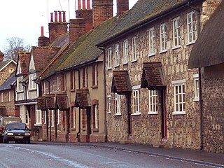
Southwick is a semi-rural village and civil parish 3 miles (4.8 km) south-west of the county town of Trowbridge, Wiltshire, England. It is separated from the south-west fringe of Trowbridge only by the Southwick Country Park, which consists of 380 acres (150 ha) of open fields. The majority of the village lies south of the A361, which runs through the village, linking Trowbridge with Frome.
Berwick St James is a village and civil parish on the River Till in Wiltshire, England, about 7 miles (11 km) northwest of Salisbury, on the southern edge of Salisbury Plain. The parish includes the hamlet of Asserton. At the 2021 census the parish had a population of 137.

Southwick is a village and former civil parish, now in the parish of Southwick and Widley, in the Winchester district, in Hampshire, England. 1 mile (1.6 km) north of the Portsmouth boundary measured from Portsea Island. Homes and farms in the village are influenced by the style of the Middle Ages apart from Church Lodge.

Kingston by Sea, also known as Kingston Buci, Kingston Bucii or simply Kingston, is a small area in the Adur district of West Sussex, England. Although it is now part of a continuous urban area, its origins lay in an ancient village and parish church between Southwick to the east, Shoreham-by-Sea to the west and the mouth of the River Adur to the south. St Julian's Church survives, and its parish perpetuates the ancient "Kingston Buci" name.
Southwick Priory or Our Lady at Southwick was a priory of Augustinian canons founded in Portchester Castle on Portsmouth Harbour and later transferred 2 miles (3.2 km) north to Southwick, Hampshire, England. It ceased at the Dissolution of the Monasteries in 1538.

Sparsholt (/ˈspɑːʃəʊlt/) is a village and civil parish in Hampshire, England, 2+1⁄2 miles (4 km) west of Winchester. In 1908 its area was 3,672 acres (1,486 ha). The 2011 Census recorded its population as 982.

The Church of St James and St Paul, south of the village of Marton, Cheshire, England, is recorded in the National Heritage List for England as a designated Grade I listed building. It is an active Anglican parish church in the diocese of Chester, the archdeaconry of Macclesfield and the deanery of Congleton. Its benefice is combined with those of Holy Trinity, Capesthorne, Christ Church, Eaton, and All Saints, Siddington. The church is an important location in the novel Strandloper by Alan Garner.

St James' Church is in the village of Ince, Cheshire, England. The church is recorded in the National Heritage List for England as a designated Grade II* listed building. It is an active Anglican parish church in the diocese of Chester, the archdeaconry of Chester and the deanery of Frodsham. Its benefice is united with that of St Mary, Thornton-le-Moors.
West Dean is a village and civil parish in southeast Wiltshire, England; the Wiltshire/Hampshire border runs through the eastern part of the village. The village is on the River Dun, about 7 miles (11 km) east of Salisbury and the same distance northwest of Romsey.
Colemore is a village and former civil parish, now in the parish of Colemore and Priors Dean, in the East Hampshire district, in the county of Hampshire, England. It is in the Hampshire Downs about 5 miles (8 km) northwest of Petersfield. In 1931 the parish had a population of 72. On 1 April 1932 the parish was abolished and merged with Priors Dean to form "Colemore and Priors Dean".

Priors Dean is a hamlet in the civil parish of Colemore and Priors Dean, in the East Hampshire district, in the county of Hampshire, England. It is in the Hampshire Downs about 3 miles (5 km) west of Liss and about 4 miles (6.4 km) north of Petersfield. It is a deserted medieval village first mentioned in the 1100s. Until 1932 it was a separate parish. The nearest railway station is at Liss.

Landford is a village and civil parish 10 miles (16 km) southeast of Salisbury in Wiltshire, England. To the south and east of the parish is the county of Hampshire and the New Forest National Park. The parish includes the small village of Nomansland and the hamlets of Hamptworth and Landfordwood.

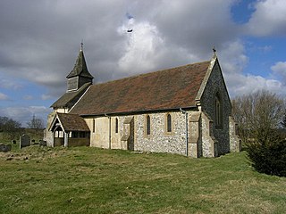
St Michael and All Angels Church is an Anglican church in the town of Southwick in the district of Adur, one of seven local government districts in the English county of West Sussex. Some Saxon-era structural work is still visible despite rebuilding work in the 12th and 13th centuries and in more recent times; and a church may have existed on the site as early as the 10th century—before the ancient settlement of Southwick even took that name. The church has been damaged by fire and bombing, but is still in active use as the area's parish church. English Heritage has listed it at Grade II* for its architectural and historical importance.

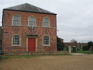
Rudge is a hamlet in the civil parish of Beckington in the Mendip district of Somerset, England. Its nearest town is Frome.

