

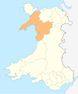
St Justinian (or St Justinian's [1] or St Justinians; Welsh: Porth Stinan) is a coastal location of indeterminate area in the extreme northwest of Pembrokeshire, Wales, in the community of St Davids and the Cathedral Close.
St Justinian (or St Justinian's [1] or St Justinians; Welsh: Porth Stinan) is a coastal location of indeterminate area in the extreme northwest of Pembrokeshire, Wales, in the community of St Davids and the Cathedral Close.
The area is named for Stinan (later Anglicised to Justinian), [2] a 6th-7th century monk who was a contemporary of St David. Legend says that he was murdered by beheading and that his skull had miraculous properties. [3]
There is a small harbour, Porthstinan, housing the current St Davids Lifeboat Station, two former lifeboat stations and a private residence. The harbour is used for boat trips to Ramsey Island, [4] and for kayaking and speedboat trips. It is a popular access point for the Pembrokeshire Coast Path. [5]
St Justinian (as Sct. Stenans) appears on a 1578 parish map of Pembrokeshire. [6]
The ruined chapel of St Justinian is a Grade I listed building. [7] [8] The 1870s old lifeboat house, [9] [10] 1911 lifeboat house, [11] [12] an early 20th century watchtower [13] [14] and St Justinian's Well (a 19th-century stone enclosure over an ancient spring), [15] [16] are all Grade II listed.
The bay on which St Justinian stands is known as Porthstinian. [17]

Spittal is both a village, a parish and a community in Pembrokeshire, Wales, on the A40 trunk road, approximately halfway between Haverfordwest and Fishguard.

Boncath is a village, community and postal district in north Pembrokeshire, Wales, about 5 miles (8.0 km) west of Newcastle Emlyn.

Jeffreyston is a village, parish and community in Pembrokeshire.

Warren is an ancient parish in the community of Stackpole and Castlemartin, in the most southerly part of Pembrokeshire, Wales. Its northern edge is 5 miles (8 km) south of Pembroke and its southern edge reaches the sea at Flimston Bay. It is bordered by Castlemartin to the west, St Twynnells to the east and Monkton to the north.

Cwm Gwaun is a community and valley in north Pembrokeshire, Wales. The community is centred around Pontfaen, a parish and hamlet 4 miles (6.4 km) southeast of Fishguard, and includes the ancient parish of Llanychaer. In 2011, the population was 313. The valley is known for its unspoilt nature and old-world pub, and there are numerous other listed buildings.

Caerfarchell is a small village in Pembrokeshire, Wales, 3 miles northeast of St Davids, close by the A487 road. It is in the community of St Davids and the Cathedral Close.

In the United Kingdom, the term listed building refers to a building or other structure officially designated as being of special architectural, historical, or cultural significance; Grade I structures are those considered to be "buildings of exceptional interest". Listing was begun by a provision in the Town and Country Planning Act 1947. Once listed, strict limitations are imposed on the modifications allowed to a building's structure or fittings. In Wales, the authority for listing under the Planning Act 1990 rests with Cadw.
In the United Kingdom, the term listed building refers to a building or other structure officially designated as being of special architectural, historical, or cultural significance; Grade I structures are those considered to be "buildings of exceptional interest". Listing was begun by a provision in the Town and Country Planning Act 1947. Once listed, strict limitations are imposed on the modifications allowed to a building's structure or fittings. In Wales, the authority for listing under the Planning Act 1990 rests with Cadw.

This is a list of Grade I-listed buildings in the county of Pembrokeshire, Wales.

In the United Kingdom, the term listed building refers to a building or other structure officially designated as being of special architectural, historical, or cultural significance; Grade I structures are those considered to be "buildings of exceptional interest". Listing was begun by a provision in the Town and Country Planning Act 1947. Once listed, strict limitations are imposed on the modifications allowed to a building's structure or fittings. In Wales, the authority for listing under the Planning Act 1990 rests with Cadw.

In the United Kingdom, the term listed building refers to a building or other structure officially designated as being of special architectural, historical, or cultural significance; Grade II* structures are those considered to be "particularly important buildings of more than special interest". Listing was begun by a provision in the Town and Country Planning Act 1947. Once listed, strict limitations are imposed on the modifications allowed to a building's structure or fittings. In Wales, the authority for listing under the Planning Act 1990 rests with Cadw.

In the United Kingdom, the term listed building refers to a building or other structure officially designated as being of special architectural, historical, or cultural significance; Grade II* structures are those considered to be "particularly important buildings of more than special interest". Listing was begun by a provision in the Town and Country Planning Act 1947. Once listed, strict limitations are imposed on the modifications allowed to a building's structure or fittings. In Wales, the authority for listing under the Planning Act 1990 rests with Cadw.
This is a list of Grade II*-listed buildings in the county of Pembrokeshire, Wales.
Rhondda Cynon Taf is a county borough in South Wales. It is located to the north-west of Cardiff and covers an area of 424 km2 (164 sq mi). In 2020 the population was approximately 241,900.
In the United Kingdom, the term listed building refers to a building or other structure officially designated as being of special architectural, historical, or cultural significance; Grade II* structures are those considered to be "particularly important buildings of more than special interest". Listing was begun by a provision in the Town and Country Planning Act 1947. Once listed, strict limitations are imposed on the modifications allowed to a building's structure or fittings. In Wales, the authority for listing under the Planning Act 1990 rests with Cadw.

Trecwn is a village in Pembrokeshire, west Wales, 1.6 miles (2.6 km) east of the A40 road in the community of Scleddau. It is in the parish of Llanstinan.

Scleddau is a village and a community in the county of Pembrokeshire, Wales, and is 2 miles (3.2 km) south of Fishguard on the main A40 road. The Western Cleddau river which lends its name to the village flows under the main road. There are several springs in the village.

Bethesda is a small village in the community of Llawhaden, Pembrokeshire, Wales. It lies on a bend of the B4313 road in the valley of the Eastern Cleddau river a few miles north north west of Narberth.

Brynberian is a small village in north Pembrokeshire, Wales, in the foothills of the Preseli Mountains in the Pembrokeshire Coast National Park. It is in the community of Eglwyswrw and the parish of Nevern, and is on the B4329 road between Crosswell and Tafarn y Bwlch. Afon Brynberian flows through the village under an ancient bridge and joins the River Nevern to the north.

St Justinian's Chapel in Pembrokeshire, Wales, is now a roofless shell; the current structure was probably erected in the 16th century on earlier foundations, which may date from the time of the 6th and 7th century Saint Justinian to whom it is dedicated. The chapel is a Grade I listed building.