Bradgate Park is a public park in Charnwood Forest, in Leicestershire, England, northwest of Leicester. It covers 850 acres. The park lies between the villages of Newtown Linford, Anstey, Cropston, Woodhouse Eaves and Swithland. The River Lin runs through the park, flowing into Cropston Reservoir which was constructed on part of the park. To the north-east lies Swithland Wood. The park's two well known landmarks, Old John and the war memorial, both lie just above the 210 m (690 ft) contour. The park is part of the 399.3 hectare Bradgate Park and Cropston Reservoir Site of Special Scientific Interest, which has been designated under both biological and geological criteria.

Whitwick is a village and civil parish in the North West Leicestershire district of Leicestershire, England, close to the town of Coalville in the northwest of the county. It lies in an ancient parish which formerly included the equally historic villages of Thringstone and Swannington.

Bottesford is a village and civil parish in the Borough of Melton in the ceremonial county of Leicestershire, England. It lies close to the borders of Nottinghamshire and Lincolnshire.

Anstey is a large village in Leicestershire, England, located north west of Leicester in the borough of Charnwood. Its population was 6,528 at the 2011 census. This figure is expected to increase due to the building of a new housing development off Groby Road. The village is separated from Leicester by the Rothley Brook, Castle Hill Park and the A46, and it borders the villages of Glenfield, Groby, Newtown Linford, Cropston and Thurcaston as well as the suburb of Beaumont Leys and Anstey Heights. To the north-west lies Bradgate Park.

Cropston is a village and former civil parish, now in the parish of Thurcaston and Cropston, part of the Borough of Charnwood in Leicestershire, England. It is on the edge of Charnwood Forest, and lies close to Bradgate Park. In 1931 the parish had a population of 404.

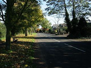
Newtown Linford is a linear village in Leicestershire, England. The population of the civil parish was 1,000 at the 2001 census, including Ulverscroft, increasing to 1,103 at the 2011 census.
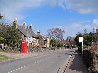
Swithland is a linear village in the Charnwood borough of Leicestershire, England. The civil parish population was put at 230 in 2004 and 217 in the 2011 census. It is in the old Charnwood Forest, between Cropston, Woodhouse and Woodhouse Eaves. It has a village hall, a parish church and a public house, the Griffin Inn. The village is known for the slate that was quarried in the area.
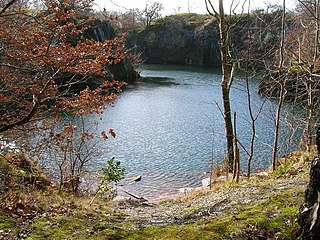
Swithland Wood and The Brand is a 87.9 hectares biological Site of Special Scientific Interest south of Woodhouse Eaves in Leicestershire. Swithland Wood is a Nature Conservation Review site, Grade II. The Brand is designated a Precambrian site in the Geological Conservation Review, but the dating has been changed due to the discovery of trace fossils from the succeeding Cambrian period.
Charnwood is a constituency in Leicestershire represented in the House of Commons of the UK Parliament since 2015 by Edward Argar, a Conservative.

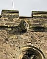
Old John is the highest hill in Bradgate Park, Leicestershire, England, on the southern edge of Charnwood Forest. It gives its name to the folly that stands at its top. The hill stands at 212 metres (696 ft) high, and is a prominent landmark across Leicester and Leicestershire.
Wanlip is a small village and civil parish in the Charnwood district of Leicestershire, with a population measured at 305 at the 2011 census. It is a countryside village, north of Birstall, and west of Watermead Country Park and the River Soar. The A46 road runs directly past the village. Wanlip won the 2008 Leicester and Rutland Best Village Competition for villages with a population under 500.

Freeby is a village and civil parish in the Melton district of Leicestershire, England, about 3 miles (5 km) east of Melton Mowbray. As well as the village of Freeby the civil parish includes the villages of Brentingby, Saxby, Stapleford and Wyfordby. The 2011 Census recorded the parish population as 244.

Swithland Reservoir is a reservoir in the English county of Leicestershire. It is north-east of the village of Swithland from which it takes its name, north-west of Rothley and approximately 133 metres (145 yd) south-west of Mountsorrel Quarry. It is part of the 187.1-hectare (462-acre) Buddon Wood and Swithland Reservoir Site of Special Scientific Interest (SSSI).

St Mary's Church is a redundant Church of England parish church in the village of Garthorpe, Leicestershire, England. The building is Grade I listed. It has been in the care of the Churches Conservation Trust since 1 November 1999.

The Church of St Mary and All Saints is an Anglican church in the village of Whalley, Lancashire, England. It is an active parish church in the Diocese of Blackburn. A church probably existed on the site in Anglo-Saxon times and the current building dates from the 13th century. It is recorded in the National Heritage List for England as a designated Grade I listed building.

St Mary the Virgin's Church is in the village of Bottesford, Leicestershire, England. It is an active Anglican parish church in the deanery of Framland, the archdeaconry of Leicester and the diocese of Leicester. Its benefice is united with those of eight local parishes. The church is recorded in the National Heritage List for England as a designated Grade I listed building.

St Botolph's Church is a Grade II* listed Church of England church in the village of Ratcliffe on the Wreake, Leicestershire, England.

St Mary & St John is a Church of England parish church in the centre of Rothley, England. It has a congregation of mixed ages and backgrounds. The church aims "to reach out with the good news of Jesus Christ, to be built up as his disciples and to send people out to make God’s love known in the world".

St Botolph's Church, Wardley is a redundant Anglican church in the small village of Wardley, Rutland, England. It is recorded in the National Heritage List for England as a Grade II* listed building, and is under the care of the Churches Conservation Trust.

The River Lin is a river which runs through North Leicestershire. The source of the river is in Ulverscroft, near Charnwood Forest. The river runs through Bradgate Park before the river runs into the River Soar in Quorn. The river also feeds Cropston Reservoir and Swithland Reservoir. The river runs for around 17 kilometres between its source and confluence with the River Soar. The river is described as one of Leicestershire's shortest rivers.