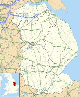
Barton-upon-Humber or Barton is a town and civil parish in the North Lincolnshire, England. The population at the 2011 census was 11,066. It is situated on the south bank of the Humber Estuary at the southern end of the Humber Bridge. It is 46 miles (74 km) east of Leeds, 6 miles (10 km) south-west of Kingston upon Hull and 31 miles (50 km) north north-east of the county town of Lincoln. Other nearby towns include Scunthorpe to the south-west and Grimsby to the south-east.

The Lincolnshire Wolds are a range of low hills in the county of Lincolnshire, England which run roughly parallel with the North Sea coast, from the Humber Estuary in the north-west to the edge of the Lincolnshire Fens in the south-east. They are a designated Area of Outstanding Natural Beauty (AONB), and the highest area of land in eastern England between Yorkshire and Kent.

East Kirkby is a village and civil parish in the East Lindsey district of Lincolnshire, England. It is situated 7 miles (11 km) south-east from Horncastle, and on the A155 road.

Fleet is a village, civil parish and electoral ward in the South Holland district of Lincolnshire, England. It lies on Delph Bank, 3 miles (4.8 km) south-east from Holbeach. The population of the civil parish, including Fleet Hargate, at the 2011 census was 2136.

Hemingby is a dispersed village and civil parish in the East Lindsey district of Lincolnshire, England. It is situated approximately 3 miles (5 km) north from the market town of Horncastle and just west from the junction of the B1225 and A158 roads. It is surrounded by the villages of Baumber, Goulceby and West Ashby. The River Bain and its tributary, the Hemingby Beck, flow through the village.

South Ferriby is a village in North Lincolnshire, England. It is situated on the south bank of the Humber Estuary and 3 miles (5 km) west from the Humber Bridge. North Ferriby is directly opposite on the Estuary’s north bank. Village population was 651 in 2011.

Little Bytham is a village and civil parish in the South Kesteven district of Lincolnshire, England. The population of the civil parish at the 2011 census was 384. It lies on the B1176 road, 4 miles (6 km) south from Corby Glen and 6 miles (10 km) north from Stamford.

Saxby All Saints is a village and civil parish in North Lincolnshire, England. The population of the civil parish at the 2011 census was 385. It is 6 miles (9.7 km) north of Brigg and 4 miles (6.4 km) south-west of Barton upon Humber.

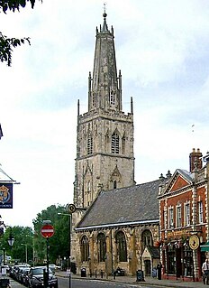
St Nicholas Church is a historic church in Westgate Street in the city of Gloucester, England, under the care of The Churches Conservation Trust. It is recorded in the National Heritage List for England as a designated Grade I listed building. Its truncated spire is a landmark in the city centre.

St Benedict's Church is a redundant Anglican church in the village of Haltham-on-Bain, Lincolnshire, England. It is recorded in the National Heritage List for England as a designated Grade I listed building, and is under the care of the Churches Conservation Trust. It stands between the River Bain and the A153 road connecting Horncastle with Coningsby.

Grainsby is a hamlet and civil parish in the East Lindsey district of Lincolnshire, England. It is situated 5 miles (8 km) south from Grimsby, and just to the west from the A16 road. The nearest village is North Thoresby, 1 mile (1.6 km) to the south-east.

Tumby is a village and township in the East Lindsey district of Lincolnshire, England. It is situated approximately 2 miles (3.2 km) north from Coningsby and 6.5 miles (10.5 km) south from Horncastle, and in the civil parish of Kirkby on Bain.

South Carlton is a village and civil parish in the West Lindsey district of Lincolnshire, England. It is situated on the B1398 road, approximately 2 miles (3 km) north from the city and county town of Lincoln. The population at the 2011 census was 168.

Haltham is a village and civil parish in the East Lindsey district of Lincolnshire, England. The population of the civil parish at the 2011 Census was 122. It is situated 4 miles (6.4 km) south from the town of Horncastle, and on the east bank of the River Bain in the Lincolnshire Wolds, a designated Area of Outstanding Natural Beauty.

Horkstow is a village and civil parish in North Lincolnshire, England, 4 miles (6.4 km) south-west from Barton-upon-Humber, 1 mile (1.6 km) south from South Ferriby and 9 miles (14.5 km) north from Brigg. It lies on the B1204, and 1 mile (1.6 km) east from the navigable River Ancholme. It is one of the five Low Villages - Worlaby, Bonby, Saxby All Saints, Horkstow and South Ferriby - between Brigg and the River Humber, so-called because of their position below the northern edge of the Lincolnshire Wolds. Horkstow was previously part of Glanford administrative district, and before that, the North Lindsey division of Lindsey, Lincolnshire.

Langton by Spilsby, sometimes called Langton by Partney, is a village and civil parish in the East Lindsey district of Lincolnshire, England. It is situated approximately 4 miles (6 km) north from the town of Spilsby, Lincolnshire. The civil parish includes the hamlet of Sutterby. From the 2011 census the population is included in the civil parish of Sausthorpe.

Lutton is a village and civil parish in the South Holland district of Lincolnshire, England. The population of the civil parish at the 2011 census was 1,261. It is situated about 4 miles (6 km) north-east from the town of Holbeach. The village has been known by the alternative name of Sutton St Nicholas. The civil parish comprises the village of Lutton, with Lutton Marsh to the north-east and Lutton Garnsgate to the south-west.

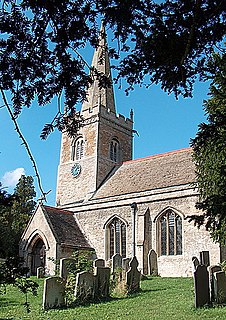
The church of St Medardus and St Gildardus in Little Bytham, Lincolnshire, England, is a Grade I listed building. It is dedicated to two 6th-century French saints, St Medard and St Gildard ; the dedication is unique in the UK. Virtually unknown in Britain, St Medard is still well known in France, with at least 25 towns or villages named after him. Gildard, thought to be his brother, is less well known. The village fête is held annually on or near St Medard's feast day, 8 June.

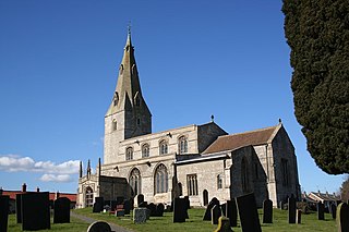
St Peter's Church is a Grade I listed Anglican parish church dedicated to Saint Peter, in Ropsley, Lincolnshire, England. The church is 5 miles (8 km) east from Grantham, and in the South Kesteven Lincolnshire Vales. St Peter's is in the ecclesiastical parish of Ropsley, and is part of the North Beltisloe Group of churches in the Deanery of Beltisloe, and the Diocese of Lincoln.

St John the Evangelist's Church is a Grade I listed Church of England parish church dedicated to John the Evangelist, in Corby Glen, Lincolnshire, England. The church is 9 miles (14 km) south-east of Grantham, and in the South Kesteven Lincolnshire Vales. It is noted in particular for its 14th- and 15th-century medieval wall paintings.


