
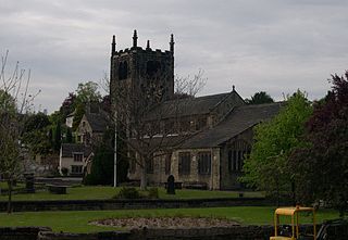
Meanwood is a suburb and former village in north-west Leeds, West Yorkshire, England.

Woodhouse is a largely residential area just north of the city centre of Leeds and close to the University of Leeds. The area considered as Woodhouse is partly in the Little London and Woodhouse ward and partly in the Headingley & Hyde Park ward of City of Leeds metropolitan district.

Linton is a village in the civil parish of Collingham, in the City of Leeds metropolitan borough, in West Yorkshire, England. It is 1.5 miles (2.4 km) south-west of Wetherby Wetherby on the north bank of the River Wharfe, Collingham is on the opposite bank.
Church of All Saints is the Anglican parish church in the town of Bingley, West Yorkshire, England. It is one of two Anglican churches in the town, the other being Holy Trinity. All Saints has existed since Norman times and it is set in the oldest part of the town, near to where the River Aire is crossed by Ireland Bridge.

Quarry Hill is an area of central Leeds, West Yorkshire, England. It is bounded by the Leeds Inner Ring Road in the east and north and the Leeds – York / Hull railway in the south. The area falls within the City and Hunslet ward of Leeds City Council.

Collingham is a village and civil parish 2 miles (3 km) south-west of Wetherby in West Yorkshire, England. It is in the City of Leeds metropolitan borough. The population of the civil parish as of the 2011 census was 2,991.

Tinshill is a district of Leeds, 4 miles (7 km) north of Leeds city centre, West Yorkshire, England. It was the Danes in the 9th century who named the hill "Tyndr's Hyll".

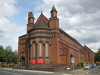
Potternewton also Potter Newton is a suburb and parish between Chapeltown and Chapel Allerton in north-east Leeds, West Yorkshire, England. It is in the Chapel Allerton ward of Leeds City Council.
St Aidan's Church in Harehills, Leeds, West Yorkshire is a Church of England parish church built in 1894. It is a large Victorian basilica-type red-brick building which is Grade II* listed. A church hall is adjacent. The architects were Johnson and Crawford Hick of Newcastle.

This is a list of halls of residence both on and off campus at the University of Leeds in Leeds, England.

Cross Green is a mainly industrial area of Leeds, West Yorkshire, England. It is around 1 mile (1.6 km) on a hill to the south east of Leeds city centre, with the A63 road running through the middle and dividing it into a residential estate with playing fields and housing to the north, and a large industrial estate to the south. The area lies in the LS9 Leeds postcode area between Osmondthorpe, Richmond Hill and Hunslet.

Moor Allerton is an area of Leeds, West Yorkshire, England. The area is situated in North Leeds, near to King Lane and the Leeds Outer Ring Road.

The architecture of Leeds, a city and metropolitan borough in West Yorkshire, England, encompasses a wide range of architectural styles and notable buildings. As with most northern industrial centres, much of Leeds' prominent architecture is of the Victorian era. However, the City of Leeds also contains buildings from as early as the Middle Ages such as Kirkstall Abbey, one of Britain's best preserved ruined Cistercian monasteries, as well as examples of 20th century industrial architecture, particularly in the districts of Hunslet and Holbeck.

Park Square is a Georgian public square in central Leeds, West Yorkshire. The square is grassed over and is a traditional Georgian park. The square is in Leeds' financial quarter and is surrounded by Georgian buildings, which are occupied as offices, many by barristers and solicitors.

St Oswald's Priory was founded by Æthelflæd, daughter of Alfred the Great, and her husband Æthelred, ealdorman of Mercia, in the late 880s or the 890s. It appears to have been an exact copy of the Old Minster, Winchester It is a Grade I listed building.
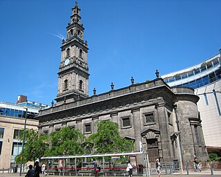
Holy Trinity Church lies on Boar Lane in Leeds, West Yorkshire, England. It is a Grade I listed Church of England parish church in the Parish of Leeds St George in the Diocese of Leeds. It was built in 1722–7, though its steeple dates from 1839. Holy Trinity is in the evangelical church tradition of the Church of England.

Holy Trinity Church is an Anglican parish church in the town of Bingley, West Yorkshire, England notable for its original church being demolished by explosive charge on 7 April 1974.

All Hallows Church in Bardsey, West Yorkshire, England is an active Anglican parish church in the archdeaconry of Leeds and the Diocese of Leeds.

All Saints' Church in Barwick-in-Elmet, West Yorkshire, England is an active Anglican parish church in the archdeaconry of Leeds and the Diocese of Leeds.


