St Paul's College, Walla Walla

Last updated

St Paul’s College
SPCWalla.png
Address
St Paul's College, Walla Walla
3 Klemke Avenue

, ,
2659

Information
Type Independent, coeducational, secondary, day and boarding
MottoNisi Dominus Frustra
Unless the Lord builds the house, its builders labour in vain Ps 127:1
Denomination Lutheran
Established10 February 1948 (1948-02-10)
PrincipalAnita Morton
GradesYears 712
Enrolment290
Colour(s)Blue and gold      
Website www.stpaulscollege.nsw.edu.au

St Paul's College is a coeducational day and boarding school providing secondary schooling in Walla Walla, New South Wales, Australia. It is a member school of Lutheran Education Australia, a network of 85 schools and 42 kindergarten/early childhood centres educating approximately 38,000 students Australia wide, [1] and it forms part of the Riverina group of Lutheran schools together with Lutheran Primary School Wagga Wagga, St Paul's Lutheran Primary School Henty, St John's Primary School Jindera and Victory Lutheran College Wodonga (Victoria).

Contents

St Paul's College provides a Christian education. [2]

Location

Australia New South Wales location map blank.svg
Red pog.svg
Walla Walla
Location of St Paul's College at Walla Walla in New South Wales

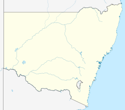
St Paul's is located in a rural setting on the northern outskirts of Walla Walla. Walla Walla is a town of approximately 600 people [3] located 40 kilometres north of the cities of Albury-Wodonga and 100 km south of Wagga Wagga; 540 km south-west of Sydney and 350 km north of Melbourne. [4]

History

When the Lutheran forefathers first settled Walla Walla they established their church and a day school. However, this school was short-lived and it was handed over to the NSW Department of Public Instruction in 1885. [5]

The desire of the local community for Christian secondary education led Pastor JTP Stolz to begin the planning that would lead ultimately to the establishment of St Paul's College. On Tuesday 10 February 1948, 28 foundation students answered the roll called by Werner Hebart, the founding Headmaster. Thirteen of these students were boarders and they resided with local families. [5]

The College moved onto its current premises, from its temporary location in Zion church in 1950.

Milestones in the history of St Paul's include [5] [6]

1948   Founding of St Pauls College
1950   Movement onto the present campus
1955   Enrolments pass 100
1963   Emergence of a heightened focus on Agriculture
1966   Enrolment of the first second generation student
1978   Introduction of the Equine program
1979   Commencement of an extensive building program
1985   Establishment of the Vertical care group structure
2000   Enrolment of the first third generation student
2005   Commencement of a program of refurbishments
2008   60 year anniversary celebrations.

Strategic planning during 2008 set the direction for St Paul's future, in line with the vision of its founders, that St Paul's be a "Christ-centred community valuing people and learning." [7]

Pastoral care [8]

St Paul's has a vertically arranged pastoral care group system consisting of students from Years 7 to 12. This structure, which was introduced in 1985, replaced the typical structure of having a year coordinator assigned to each year group. Each student is assigned to a care group, either within Kavel House or Leidig House and he or she remains in this caregroup for the duration of his or her schooling.

Educational

Some students take the opportunity to specialise in Equine or Agricultural Studies. The majority of the students who do not wish to gain employment in an agricultural field or have an interest in Equine sports can study other subjects. [9]

As part of their learning, students learn about Christianity and other major religious groups.[ citation needed ]

Students’ learning in agriculture is supported by practical activities on the College's farms (totalling 92 ha) that are used for livestock, cropping and pasture production. The White Suffolk stud provides experiences in the production of sheep and wool; the preparation and showing of sheep; and the techniques of modern studwork. The College also runs a small commercial herd of cows, along with steers that are prepared for showing and carcase competitions. Show teams visit local agricultural shows and the Royal shows in Melbourne and Sydney.[ citation needed ]

The focus of the Equine studies programme is on the equestrian industry rather than the racing or breeding industries. The Equine centre includes stables, yards and paddocks, dressage and jumping arenas, a round yard and a cross country training circuit. Boarding students agist their horses at the Equine centre and College horses are available for students who do not have their own horse. Supervised riding takes place after school and boarding students have the opportunity to compete at local shows and gymkhanas.

Boarding

Approximately 30% of the students are boarders. At various times the boarding population has comprised over 80% of the enrolments with up to 160 full and weekly boarding students. [5] Presently, boarding students are drawn from communities within the Greater Hume Shire, the Riverina, North Eastern Victoria and further afield from the cities of Sydney, Canberra and Melbourne. [10]

Weekly boarding students return to their homes on weekends and College operated transport services are provided to and from Wagga Wagga and Wodonga. Full boarding students remain on campus on weekends.

Facilities

New and refurbished facilities include:

Two year round sporting ovals irrigated by reclaimed water from the township of Walla Walla.
Seven synthetic surface tennis courts, which are shared with the local community.
The Equine Centre comprising dressage and jumping arenas, a round yard, stables, tackrooms, paddocks and a cross-country circuit.
The College farms totalling 92 hectares that replicate the agricultural industry in this part of New South Wales.
A Computing and Design Technology Centre equipped with metal and wood-working plant including CNC technology (opened 2005).
Refurbished Science laboratories.
A Chapel and auditorium, which seats 350 people.
Modern computer laboratories with wireless connectivity across the campus.
A modern boarding house for male students (opened 2004).
New toilet block and changing rooms (construction 2008–2009).
Refurbished gymnasium.

See also

Related Research Articles

<span class="mw-page-title-main">Wodonga</span> City in Victoria, Australia

Wodonga is a city on the Victorian side of the border with New South Wales, 300 kilometres (190 mi) north-east of Melbourne, Australia. It is located wholly within the boundaries of the City of Wodonga LGA. Its population is approximately 35,100 and is separated from its twin city in New South Wales, Albury, by the Murray River. Together, the two cities form an urban area with an estimated population of 93,603. There are multiple suburbs of Wodonga including Bandiana, Baranduda, Barnawartha, Bonegilla, Ebden, Huon Creek, Killara, Leneva and Staghorn.

<span class="mw-page-title-main">Wagga Wagga</span> City in New South Wales, Australia

Wagga Wagga is a major regional city in the Riverina region of New South Wales, Australia. Straddling the Murrumbidgee River, with an urban population of more than 56,000 as of June 2018, Wagga Wagga is the state's largest inland city, and is an important agricultural, military, and transport hub of Australia. The ninth largest inland city in Australia, Wagga Wagga is located midway between the two largest cities in Australia—Sydney and Melbourne—and is the major regional centre for the Riverina and South West Slopes regions.

<span class="mw-page-title-main">Charles Sturt University</span> Public university in Australia

Charles Sturt University is an Australian multi-campus public university located in New South Wales, Australian Capital Territory and Victoria. Established in 1989, it was named in honour of Captain Charles Napier Sturt, a British explorer who made expeditions into regional New South Wales and South Australia.

<span class="mw-page-title-main">Riverina</span> Region in New South Wales, Australia

The Riverina is an agricultural region of south-western New South Wales, Australia. The Riverina is distinguished from other Australian regions by the combination of flat plains, warm to hot climate and an ample supply of water for irrigation. This combination has allowed the Riverina to develop into one of the most productive and agriculturally diverse areas of Australia.

<span class="mw-page-title-main">Gerogery</span> Town in New South Wales, Australia

Gerogery is a town established on Wiradjuri land in the Riverina region of the Australian state of New South Wales. The town is in the Greater Hume Shire local government area and on the Main South railway line between Sydney and Melbourne, where it intersects with the Olympic Highway. Gerogery serves a rural farming community. Gerogery has a temperate climate. It lies close to the Great Yambla Range, with its striking Tabletop and Sugar Loaf ridge at the southern end.

<span class="mw-page-title-main">St Francis de Sales Regional College</span> School in Australia

St Francis De Sales Regional College is an independent Roman Catholic co-educational secondary day and boarding school, located in the Riverina town of Leeton, New South Wales, Australia. Founded in 1956 by the Marist Brothers, the College is one of three secondary schools serving Leeton, most enrolments come from Leeton, with students also drawn from around the region as a result of the school's boarding program. These include Griffith, Narrandera, Deniliquin, Coleambally and Hay. The school is situated on Yanco Avenue on the southern approach to Leeton.

<span class="mw-page-title-main">Brocklesby, New South Wales</span> Town in New South Wales, Australia

Brocklesby is a town in the Riverina region of south west New South Wales, Australia. The town is in the Greater Hume Shire Council local government area, 45 kilometres (28 mi) north-west of the regional centre of Albury. In the 2006 census Brocklesby had a population of 238.

<span class="mw-page-title-main">AMV (TV station)</span> Television station in Regional Victoria

AMV is an Australian television station licensed to, and serving the regions surrounding Wagga Wagga and Albury-Wodonga in south western New South Wales and north eastern Victoria. The station was, for many years, merged with RVN-2 as the Riverina and North East Victoria Television Service.

<span class="mw-page-title-main">Culcairn</span> Town in New South Wales, Australia

Culcairn is a town in the south-east Riverina region of New South Wales, Australia. Culcairn is located in the Greater Hume Shire local government area on the Olympic Highway between Albury and Wagga Wagga. The town is 514 kilometres (319 mi) south-west of the state capital, Sydney and at the 2016 census had a population of 1,473.

<span class="mw-page-title-main">Hume Football Netball League</span>

The Hume Australian Football Netball League (HFNL), often shortened to Hume Football League, is an Australian rules football and netball competition containing twelve clubs based in the South West Slopes and southern Riverina regions of New South Wales, Australia. The league features four grades in the Australian rules football competition, with these being First-Grade, Reserve-Grade, Under 17s and Under 14s. In the netball competition, there are six grades, with these being A-Grade, B-Grade, C-Grade, C-Reserve Grade, Intermediates and Juniors.

<span class="mw-page-title-main">Walla Walla, New South Wales</span> Town in New South Wales, Australia

Walla Walla or Wallawalla is a town in the Riverina region of southern New South Wales, Australia and is serviced by the Greater Hume Shire Council. It is about 39 kilometres (24 mi) north of Albury-Wodonga and 130 kilometres (81 mi) south of Wagga Wagga.

<span class="mw-page-title-main">St Peters Lutheran College</span> Private school in Indooroopilly, Queensland, Australia

St Peters Lutheran College (SPLC) is a Lutheran co-educational private school in Queensland, Australia with teaching campuses in Indooroopilly and Springfield, and an outdoor education centre in Crows Nest. The college provides prep to year 12 education, with domestic day schooling at Springfield, with domestic and international day and boarding at the larger Indooroopilly campus. In year 9, students spend five-weeks completing the Ironbark Outdoor Education Program at the outdoor education centre in Crows Nest.

<span class="mw-page-title-main">Boree Creek</span> Town in New South Wales, Australia

Boree Creek is a town in the Riverina district of New South Wales, Australia. The town is located 539 kilometres (335 mi) south west of the state capital, Sydney and 82 kilometres (51 mi) west of the regional centre, Wagga Wagga. Boree Creek is situated in the Federation Council local government area but is closer to the town of Lockhart. At the 2016 census, Boree Creek had a population of 64.

<span class="mw-page-title-main">Jindera</span> Town in New South Wales, Australia

Jindera is a small town in the South West Slopes section of the Riverina region of New South Wales, Australia. The town is situated in the Greater Hume Shire local government area, 15 kilometres (9.3 mi) north of the regional centre of Albury. At the 2016 census, Jindera had a population of 2,222 residents.

<span class="mw-page-title-main">Milbrulong</span> Town in New South Wales, Australia

Milbrulong is a locality in the central east part of the Riverina region of New South Wales, Australia.

<span class="mw-page-title-main">Kooringal High School</span> School in Australia

Kooringal High School is a government-funded co-educational dual modality partially academically selective and comprehensive secondary day school, located in Kooringal, a suburb of Wagga Wagga in the Riverina region of New South Wales, Australia.

Esperance Senior High School is a comprehensive public high day and boarding school, located in Esperance, a regional centre 780 kilometres (485 mi) southeast of Perth, Western Australia.

The Riverina Football Association was an Australian rules football competition formed in 1924 from the following clubs - Balldale, Brocklesby Culcairn, Henty Town, Henty Rovers, Holbrook and Walla Walla.

References

  1. "Lutheran Education Australia". Lutheran Education Australia. Archived from the original on 10 September 2009. Retrieved 10 September 2009.
  2. "St Paul's College – Walla Walla – Christian Education". St Paul's College. Retrieved 28 February 2009.
  3. Australian Bureau of Statistics (25 October 2007). "Walla Walla (L) (Urban Centre/Locality)". 2006 Census QuickStats. Retrieved 31 January 2009.
  4. "St Paul's College - Walla Walla - Our Local Community". St Paul's College. Retrieved 6 February 2009.
  5. 1 2 3 4 Wegener, L. (2002). Never in Vain: A history of St Paul’s College. Walla Walla: St Paul’s College.
  6. "St Paul's College – Walla Walla – Our History". St Paul's College. Retrieved 6 February 2009.
  7. "St Paul's College – Walla Walla – Our Plans for the Future". St Paul's College. Retrieved 6 February 2009.
  8. "St Paul's College - Walla Walla - Student Welfare". St Paul's College. Retrieved 7 February 2009.
  9. "St Paul's College - Walla Walla - Learning". St Paul's College. Retrieved 7 February 2009.
  10. "St Paul's College - Walla Walla - Home". St Paul's College. Retrieved 6 February 2009.

Coordinates: 35°45′18″S146°54′25″E / 35.755°S 146.907°E / -35.755; 146.907