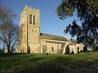
| St Peter & St Paul's Church, Watford | |
|---|---|
 | |
| 52°18′58″N1°06′59″W / 52.3161°N 1.1164°W Coordinates: 52°18′58″N1°06′59″W / 52.3161°N 1.1164°W | |
| Denomination | Church of England |
| Website | http://watfordvillage.weebly.com/the-church-of-stpeter-and-stpaul.html |
| Administration | |
| Deanery | Brixworth |
| Archdeaconry | Northampton |
| Diocese | Diocese of Peterborough |
| Province | Canterbury |
| Clergy | |
| Vicar(s) | Rev Graham Collingridge |
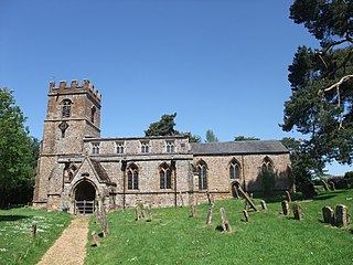
St Peter & St Paul's Church is an Anglican Church and the parish church of Watford, Northamptonshire. It is a Grade I listed building and stands on the west side of the Church Street.

Watford is a village and civil parish in the Daventry district of the county of Northamptonshire in England. At the time of the 2001 census, the parish's population was 224 people, including Murcott and increasing to 320 at the 2011 Census. Watford is home to Watford Gap services Britain's oldest motorway service station opening in 1959. Located directly on the M1 motorway and alongside the West Coast Main Line.

A listed building, or listed structure, is one that has been placed on one of the four statutory lists maintained by Historic England in England, Historic Environment Scotland in Scotland, Cadw in Wales, and the Northern Ireland Environment Agency in Northern Ireland.
There is no reference to a church or priest in the entry for Watford in the Domesday Book. [1]

Domesday Book is a manuscript record of the "Great Survey" of much of England and parts of Wales completed in 1086 by order of King William the Conqueror. The Anglo-Saxon Chronicle states:
Then, at the midwinter [1085], was the king in Gloucester with his council .... After this had the king a large meeting, and very deep consultation with his council, about this land; how it was occupied, and by what sort of men. Then sent he his men over all England into each shire; commissioning them to find out "How many hundreds of hides were in the shire, what land the king himself had, and what stock upon the land; or, what dues he ought to have by the year from the shire."
The main structure of the present building was erected in the 14th and 15th centuries, with further work in the 18th and 19th centuries. The church now consists of a nave, north and south aisles, chancel with north chapel, north and south porches and a west tower. A detailed description appears on the Historic England website. [2]
The parish registers survive from 1565, the historic registers being deposited at Northamptonshire Record Office. [3]
Watford is part of a united Benefice along with Long Buckby, West Haddon and Winwick. Each parish retains its own church building. [4]

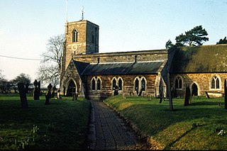
Long Buckby is a populous village and civil parish in the Daventry District of Northamptonshire, England midway between Northampton and Rugby. In the United Kingdom Census 2011, the parish of Long Buckby, which includes the hamlet of Long Buckby Wharf, had a population of 3,913. The west of the parish has the Grand Union Canal, A5 and adjoining M1 motorway all passing through the Watford Gap, with Watford, Northamptonshire being the next village to the north. The centre near a castle has a railway station on the Northampton Loop corollary of the West Coast Main Line.

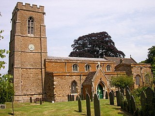
West Haddon is a village in the Daventry district of the county of Northamptonshire, England about 11 miles (18 km) north-west of Northampton and 7 miles (11 km) east of Rugby and just off the A428 road which by-passes the village. The population of civil parish was 1,718 at the 2011 Census. The villages of West Haddon and Crick were by-passed by the A428 main road from Rugby to Northampton when the Daventry International Rail Freight Terminal (DIRFT) was built in 1996 near junction 18 of the M1 Motorway, 3 miles (4.8 km) west of the village.

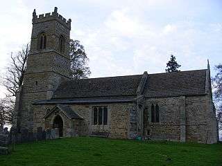
Winwick is a small village, a lost settlement and civil parish in the Daventry district of the county of Northamptonshire in England. The modern settlement is north of West Haddon. A 16th-century brick manor house remains on the site. The population is included in the civil parish of West Haddon.