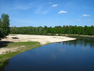
Ilet is a river in Mari El, Russia. Major tributaries are the Ashit, Yushut, Voncha and Petyalka. Minimum mineralization is 1000–1400 mg/l. Tourism and rafting are popular.

Bukowice is a village in the administrative district of Gmina Krośnice, within Milicz County, Lower Silesian Voivodeship, in south-western Poland.

Kazmabudug is a village in the Quba Rayon of Azerbaijan.

Cegłów is a village in the administrative district of Gmina Baranów, within Grodzisk Mazowiecki County, Masovian Voivodeship, in east-central Poland. It lies approximately 10 kilometres (6 mi) north-west of Grodzisk Mazowiecki and 34 km (21 mi) west of Warsaw.
Zawały is a village in the administrative district of Gmina Rzeczniów, within Lipsko County, Masovian Voivodeship, in east-central Poland. It lies approximately 8 kilometres (5 mi) south-west of Rzeczniów, 23 km (14 mi) west of Lipsko, and 129 km (80 mi) south of Warsaw.
Drop is a village in the administrative district of Gmina Dobre, within Mińsk County, Masovian Voivodeship, in east-central Poland.
Grądy Szlacheckie is a village in the administrative district of Gmina Długosiodło, within Wyszków County, Masovian Voivodeship, in east-central Poland.
Piastowo is a village in the administrative district of Gmina Skulsk, within Konin County, Greater Poland Voivodeship, in west-central Poland. It lies approximately 4 kilometres (2 mi) south-east of Skulsk, 28 km (17 mi) north of Konin, and 98 km (61 mi) east of the regional capital Poznań.
Danków is a village in the administrative district of Gmina Strzelce Krajeńskie, within Strzelce-Drezdenko County, Lubusz Voivodeship, in western Poland. It lies approximately 12 kilometres (7 mi) west of Strzelce Krajeńskie and 17 km (11 mi) north-east of Gorzów Wielkopolski.
Bajory Małe is a village in the administrative district of Gmina Srokowo, within Kętrzyn County, Warmian-Masurian Voivodeship, in northern Poland, close to the border with the Kaliningrad Oblast of Russia. It lies approximately 8 kilometres (5 mi) north of Srokowo, 25 km (16 mi) north of Kętrzyn, and 87 km (54 mi) north-east of the regional capital Olsztyn.
Korzec is a settlement in the administrative district of Gmina Barwice, within Szczecinek County, West Pomeranian Voivodeship, in north-western Poland. It lies approximately 2 kilometres (1 mi) south of Barwice, 22 km (14 mi) west of Szczecinek, and 123 km (76 mi) east of the regional capital Szczecin.
Sagok Station is a railway station on the Gyeongbu Line in South Korea.

Duboka is a village in the municipality of Kučevo, Serbia. According to the 2002 census, the village has a population of 1110 people.

Barbarići is a village in the municipality of Bugojno, Bosnia and Herzegovina.
Prohići is a village in the municipality of Srebrenica, Bosnia and Herzegovina.
Karakışla is a village in the District of Sultandağı, Afyonkarahisar Province, Turkey.

The Alfréd Hajós National Swimming Stadium is an aquatics complex located on Margaret Island in Budapest, Hungary. It was planned by and since 1975 bears the name of Alfréd Hajós, a renowned Hungarian swimmer and architect. The facility has four floors and eight pools, including training pools, a diving pool and competitive swimming pools both for short course and long course.
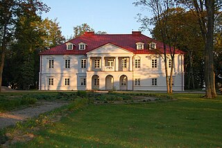
Bistrampolis Manor is a former residential manor in Kučiai, Panevėžys district. Currently it is used as a hotel and coffee-restaurant. The manor stables are used as a concert hall, where various festivals takes place. The chapel is used as a museum of Lithuanian book smugglers. Bistrampolis Manor is also famous for its park.
Skuodas Manor is a former residential manor in Skuodas, Lithuania.
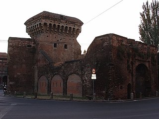
Porta San Donato, also known as Porta Zamboni, was a gate or portal of the former outer medieval walls of the city of Bologna, Italy. It was a gate into the University area of the City.


