
Southern Norway is the geographical region (landsdel) along the Skagerrak coast of southern Norway. The region is an informal description since it does not have any governmental function. It roughly corresponds to the old petty kingdom of Agder as well as the two present-day counties of Vest-Agder and Aust-Agder. The total combined area of Vest-Agder and Aust-Agder counties is 16,493 square kilometres (6,368 sq mi). The name is relatively new, having first been used in Norway around 1900.

Kilsund is a village in Arendal municipality in Aust-Agder county, Norway. The village is located on the island of Tverrdalsøya, although the village has grown over the bridge onto the nearby island of Flostaøya a short distance to the south. The village lies about 6.5 kilometres (4.0 mi) northeast of the village of Strengereid, about 10 kilometres (6.2 mi) northeast of the village of Eydehavn, about 16 kilometres (9.9 mi) northeast of the town of Arendal, and about 8 kilometres (5.0 mi) south of the town of Tvedestrand. Kilsund has two small villages located just to the north and east: Staubø and Holmsund.

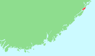
Flosta is a former municipality in Aust-Agder county, Norway. The 22.8-square-kilometre (8.8 sq mi) municipality existed from 1902 until its dissolution in 1962. It is currently part of the municipality of Arendal in the Sørlandet region of NOrway. The administrative center of Flosta was at Staubø in the village of Kilsund. The municipality primarily encompassed the two islands of Flostaøya and Tverrdalsøya and about 9 square kilometres (3.5 sq mi) on the mainland just north of the islands including the villages of Eikeland, Borås, and Vatnebu.

Strengereid is a village in the municipality of Arendal in Aust-Agder county, Norway. It is located along the Norwegian County Road 410, about 3 kilometres (1.9 mi) northeast of the village of Eydehavn and just west of the island of Flostaøya. The village of Sagene lies about 2 kilometres (1.2 mi) to the northwest.

Eydehavn or Eydehamn is a village in the municipality of Arendal in Aust-Agder county, Norway. The village is located about 10 kilometres (6.2 mi) northeast of the centre of the town of Arendal, about 2 kilometres (1.2 mi) northeast of the village of Saltrød, about 2 kilometres (1.2 mi) south of the village of Strengereid, and just across the Tromøysundet strait from Kongshamn on the island of Tromøy. The village is named after Sam Eyde, the Norwegian engineer and industrialist. The local sports team is called IL Sørfjell. Eydehavn has about 1,100 residents as of 2015.
Borås is a village in Arendal municipality in Aust-Agder county, Norway. The village is located along the Norwegian County Road 410 on the east side of the Eikelandsfjorden. The large village of Kilsund lies about 3 kilometres (1.9 mi) to the southeast on the nearby island of Tverrdalsøya and the village of Vatnebu lies about 2 kilometres (1.2 mi) to the south on the mainland.
Holmesund or Holmsund is a village in Arendal municipality in Aust-Agder county, Norway. The village is located on the eastern shore of the island of Tverrdalsøya, about 1 kilometre (0.62 mi) east of the large village of Kilsund and about the same distance southeast of the village of Staubø. Holmsund is considered by Statistics Norway to be part of the Kilsund urban area.

Kalvøysund is a village in Arendal municipality in Aust-Agder county, Norway. The village is located on the eastern shore of the island of Flostaøya, about 2 kilometres (1.2 mi) south of the village of Kilsund and about 3 kilometres (1.9 mi) northeast of the village of Narestø. Kalvøysund was the site of an old German fortress to defend the coastline during the German occupation of Norway.

Kolbjørnsvik is a village in Arendal municipality in Aust-Agder county, Norway. The village is located on the northern part of the island of Hisøya, across the harbour from the town of Arendal. The village of His and the Hisøy Church lie about 2 kilometres (1.2 mi) south of Kolbjørnsvik. The former municipality of Hisøy had its municipal government located in this village. Today, the village is considered to be part of the town of Arendal, so separate population statistics are not kept.
Nedenes is a village in Arendal municipality in Aust-Agder county, Norway. The village is located in the southern part of Arendal, just north of the municipal border with Grimstad. The Norwegian County Road 420 runs through the village heading north to the village of Rød and onwards to the island of Hisøya to the north. Engene Church is located in Nedenes.

Pusnes is a village in Arendal municipality in Aust-Agder county, Norway. The village is located on the southwestern edge of the island of Tromøy, just across the strait from the town of Arendal. There is a ferry that regularly crosses the strait from Pusnes to Arendal. Pusnes is primarily an industrial area.
Vatnebu is a village in Arendal municipality in Aust-Agder county, Norway. The village is located on the mainland near the Skaggerak coast, about 2 kilometres (1.2 mi) southwest of the village of Kilsund on the nearby island of Tverrdalsøya and about 8 kilometres (5.0 mi) northeast of the village of Eydehavn.

Aust-Agder District Court is a court of first instance under Agder Court of Appeal in Norway. The former district courts of Holt, Nedenes and Sand was incorporated in Aust-Agder District Court from September 2004.

Østre Agder is a district or region in Aust-Agder county in southern Norway. The district covers the eastern, coastal areas of the county including the eight municipalities of Arendal, Tvedestrand, Risør, Grimstad, Gjerstad, Vegårshei, Åmli, and Froland. The city of Arendal is the largest city in the region. Other cities in the district include Tvedestrand, Grimstad, and Risør. This region is bounded by Telemark county to the north, by the Setesdal region to the northwest, and by the Kristiansand Region to the southwest.

Barbu Church is a parish church in Arendal municipality in Aust-Agder county, Norway. It is located in the Barbu area of the town of Arendal. It is the church for the Barbu parish which is part of the Arendal prosti (deanery) in the Diocese of Agder og Telemark. The brown, brick/stone church was built in 1880 using plans by the architect Jacob Wilhelm Nordan. The church seats about 500 people. It was consecrated on 17 September 1880 by the Bishop Jørgen Engebretsen Moe.
Flostaøya is an island in Arendal municipality in Aust-Agder county, Norway. The 7.9-square-kilometre (3.1 sq mi) island lies along the Skaggerak coast between the islands of Tromøy to the southwest and Tverrdalsøya to the northeast. The island lies about 11 kilometres (6.8 mi) northeast of the town of Arendal. Some of the larger villages on the island include Arnevik, Narestø, and Kalvøysund. The island has a bridge connection to the mainland at the southwest corner of the island and there is a bridge connection to Kilsund on the neighboring island of Tverrdalsøya at the north end.

Tverrdalsøya is an island in Arendal municipality in Aust-Agder county, Norway. The 3.4-square-kilometre (1.3 sq mi) island lies between the Oksefjorden, Eikelandsfjorden, and Kilsundet straits just off the mainland coast at the entrance to the Tvedestrandsfjorden which leads north to the town of Tvedestrand. The island of Flostaøya lies immediately to the south and the island of Borøy lies immediately to the east. The main population centre on the island is the village of Kilsund at the southern end of the island.


