
The Oak Ridges Moraine is an ecologically important geological landform in the Mixedwood Plains of south-central Ontario, Canada. The moraine covers a geographic area of 1,900 square kilometres (730 sq mi) between Caledon and Rice Lake, near Peterborough. One of the most significant landforms in southern Ontario, the moraine gets its name from the rolling hills and river valleys extending 160 km (99 mi) east from the Niagara Escarpment to Rice Lake, formed 12,000 years ago by advancing and retreating glaciers during the last glaciation period. Below the approximately 200 metre thick glacial derived sediments of the moraine lies thick bedrock successions of Precambrian rocks and up to 200 metres of Ordovician aged rock, capped by a regional unconformity of erosion and non-deposition to the Quaternary period. Rivers and lakes scatter the landscape and are important for creating habitat for the rich diversity of species of animals, trees and shrubbery. These are also the supply of fresh water to aquifers in the moraine through complex subterranean connections. Construction development nearby, and with expansion of communities around the moraine in need of potable water, it is a contested site in Ontario, since it stands in the path of major urban development. Conservation of the moraine is thus an important step for keeping aquifers in a safe drinkable condition while also protecting the natural ecosystems surrounding and within the moraine. This region has been subject to multiple decades of scientific research to study the origins of formation, and how early communities used the land. A larger focus currently is how to source potable water without removing the aquifer entirely.

The Rouge River is a river in Markham, Pickering, Richmond Hill and Toronto in the Greater Toronto Area of Ontario, Canada. The river flows from the Oak Ridges Moraine to Lake Ontario at the eastern border of Toronto, and is the location of Rouge Park, the only national park in Canada within a municipality. At its southern end, the Rouge River is the boundary between Toronto and southwestern Pickering in the Regional Municipality of Durham.

The Nottawasaga River is a river in Simcoe County and Dufferin County in Central Ontario, Canada. It is part of the Great Lakes Basin, and is a tributary of Lake Huron. The river flows from the Orangeville Reservoir in the town of Orangeville, Dufferin County, through the Niagara Escarpment and the Minesing Wetlands, the latter a wetland of international significance, and empties into Nottawasaga Bay, an inlet of Georgian Bay on Lake Huron, at the town of Wasaga Beach, Simcoe County.

The Southern Laurentian Channel is an ancient underground river in southern Ontario, Canada. The river predates the recent ice ages. The river valley was filled with glacial debris. Water still flows down this old valley—underground. The source of the aquifer is the Georgian Bay, approximately 200 kilometres (120 mi) away.
The Toronto and Region Conservation Authority (TRCA) is a conservation authority in southern Ontario, Canada. It owns about 16,000 hectares of land in the Toronto region, and it employs more than 400 full-time employees and coordinates more than 3,000 volunteers each year. TRCA's area of jurisdiction is watershed-based and includes 3,467 square kilometres (1,339 sq mi) – 2,506 on land and 961 water-based in Lake Ontario. This area comprises nine watersheds from west to east – Etobicoke Creek, Mimico Creek, Humber River, Don River, Highland Creek, Petticoat Creek, Rouge River, Duffins Creek and Carruthers Creek.

The Musi River is a river in Southern Sumatra, Indonesia. It flows from south-west to north-east, from the Barisan Mountains range that form the backbone of Sumatra, in Kepahiang Regency, Bengkulu Province, to the Bangka Strait that forms an extension of the South China Sea. It is about 750 kilometers long, and drains most of South Sumatra province. After flowing through Palembang, the provincial capital, it joins with several other rivers, including the Banyuasin River, to form a delta near the town of Sungsang. The river, dredged to a depth of about 6.5 meters, is navigable by large ships as far as Palembang, which is the site of major port facilities used primarily for the export of petroleum, rubber and palm oil.
The Uxbridge Forest Kames is a 644-hectare (1,591-acre) provincially significant Earth Science Area of Natural and Scientific Interest in Ontario, Canada. The land is owned and managed by the Toronto and Region Conservation Authority.

Opak River is a river in central south area of Java island, Indonesia.
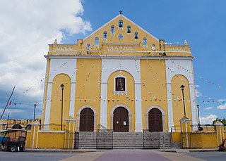
Hunucmá is a town and the municipal seat of the Hunucmá Municipality, Yucatán in Mexico. As of 2020, the town has a population of 28,412.In that town it's very popular for the food called "sopes" from a poupular snack bar called "the maya"
Pemali River is a river in northern Central Java, Indonesia, about 250 km east of the capital Jakarta.
The Baliung River is a river flowing in southern Java, within the Banten province, Indonesia. The upstream starts in the southern mountains of Java; it flows southward into the Indian Ocean, about 130 kilometres (81 mi) southwest of Jakarta.
The Wapoga River is a river in northern New Guinea, Indonesia. It is a tributary of the Warenai River. The Wapoga River basin and surrounding mountains were surveyed by a team of scientists organized by Conservation International in 1998. The rainbowfish Glossolepis leggetti and Melanotaenia rubripinnis are only known from this river system.

Walanae River is a river in South Sulawesi on the island of Sulawesi, Indonesia, about 1500 km northeast of the capital Jakarta.
Petticoat Creek is a stream in the cities of Pickering, Toronto and Markham in the Greater Toronto Area of Ontario, Canada. The creek is in the Great Lakes Basin, is a tributary of Lake Ontario, and falls under the auspices of the Toronto and Region Conservation Authority. Its watershed covers 26.77 square kilometres (10.34 sq mi), and the cumulative length of all its branches is 49 kilometres (30 mi). Land use in the watershed consists of 52% agricultural, 27% protected greenspace and 21% urban.
The Tuntang is a major river of northern Central Java, Indonesia, about 400 km east of the capital Jakarta. It connects Lake Rawa Pening to the Java Sea, east of Semarang. There is a hydroelectric powerstation on the river near the lake.
The Eti River is a river of Seram Island, Maluku province, Indonesia, about 2400 km northeast of the capital Jakarta. It flows into the sea on the southwest side of the island, a few kilometres south of the town of Piru, West Seram Regency.
Darlington Creek is a stream in the municipality of Clarington, Regional Municipality of Durham in Ontario, Canada. It is a tributary of Lake Ontario and is located in geographic Darlington Township, after which it is named.
Bowmanville Creek is a stream in the municipality of Clarington, Regional Municipality of Durham in south-central Ontario, Canada. It flows from the Oak Ridges Moraine to Lake Ontario at Bowmanville. The creek is under the auspices of the Central Lake Ontario Conservation Authority.

The Toronto waterway system comprises a series of natural and man-made watercourses in the Canadian city of Toronto. The city is dominated by a large river system spanning most of the city including the Don River, Etobicoke Creek, Highland Creek, Humber River, Mimico Creek and Rouge River.
McArthur Lake is a lake in Ontario, Canada to the south of the city of Timmins. The lake has a rocky shoreline and 13 islands. It is used for recreation in the summer, but freezes in the winter. Due to the harsh climate most of the trees around the lake are conifers. The rocks around the lake have potential for nickel extraction.
