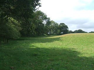
Cadbury Castle is an Iron Age Hillfort close to Bickleigh, Devon, England. It was later encamped by the Parliamentarian forces during the English Civil War under Thomas Fairfax when he laid siege to Bickleigh Castle.

Woodbury Castle is an Iron Age hillfort near the village of Woodbury in the English county of Devon, some eight miles southeast of the city of Exeter.

Cotley Castle is a large Iron Age Hill fort near Dunchideock in Devon and close to Exeter in England. It occupies a significant hilltop at 220 metres (720 ft) above sea level, just to the north of Great Haldon, part of the same ridge of the Haldon Hills.

Prestonbury Castle is an Iron Age Hill fort on the north east edge of Dartmoor in Devon, England. Situated on a massive hilltop some 240 metres above sea level overlooking the Teign Valley, it is located near two other hill forts both of which lie about 2 km (1 mi) away.

Denbury Hill is the name of an Iron Age hill fort near the village of Denbury in Devon, England.

Stockland Castle is the name given to two Iron Age hill forts on Stockland Hill close to Stockland in Devon, England. Stockland Great Castle occupies a position on the eastern slope of the hill at 190–210 metres (620–690 ft) above sea level. Stockland Little Castle, located about 1 kilometre (0.6 mi) northeast of its larger neighbour, occupies a small promontory on the eastern slope of the hill at approximately 175 metres (574 ft) above sea level.
Beacon Castle is an Iron Age hill fort close to Parracombe in Devon, England. It is situated on a hilltop some 290 metres (950 ft) above sea level, overlooking the Heddon Valley.

Castle Dyke is an Iron Age hill fort situated between Chudleigh and Dawlish in Devon, England. The fort is situated on a hilltop at approximately 140 metres above sea level.

Brent Hill is the site of an Iron Age hill fort situated close to South Brent in Devon, England. The fort occupies the top of Brent Hill at approx 311 Metres above Sea Level.
Yellowberries Copse is an Iron Age enclosure, or possibly hill fort situated South of South Brent in Devon, England. The fort is situated on the North West slope of Cutwell Hill at approx 155 Metres above Sea Level.

The Blackdown Rings are the earthworks of an Iron Age hill fort near the hamlet of Hazelwood in Devon, England. The fort is situated on a hilltop approximately 185 metres (607 ft) above sea level, in a commanding position above the River Avon.
Stanborough is the site of an Iron Age hill fort near the village of Halwell, south of Totnes, Devon, England. The fort is situated on a promontory on the western edge of a hill at about 200 metres (660 ft) above sea level. The site was first listed as a historical heritage in 1923.

Slapton Castle is an Iron Age hill fort situated close to Slapton in Devon, England. The fort is on a promontory on the eastern side of a hilltop at approximately 65 metres (213 ft) above sea level, overlooking Slapton Ley.
Woodbury is an Iron Age hillfort situated in the parish of Stoke Fleming, close to Dartmouth in Devon, England. The fort is situated on a promontory on the southern side of Norton Down at approximately 145 metres (476 ft) above sea level.
Greenway Camp is an Iron Age hill fort in the parish of Kingswear close to Dartmouth in Devon, England. The fort is situated on the south western slope of a promontory on the eastern side of a hill west of the village of Hillhead some 65-80 metres above sea level overlooking Noss Point in the Dart Estuary.
Wasteberry Camp is an Iron Age hill fort situated close to the hamlet of Blackpool, southeast of Plympton, Devon, England. The fort is situated on a hilltop in Warren Wood at approximately 90 metres (300 ft) above sea level, overlooking Silverbridge Lake.
Holbury is an Iron Age hill fort situated close to Holbeton in Devon, England. The fort is situated on a hilltop east of the Village approximately 95 metres above sea level overlooking the Erme Estuary.
Yarrowbury is an Iron Age hill fort situated close to Bigbury in Devon, England. The fort is situated on Hilltop to the north east of the village at approximately 80 metres above sea level, overlooking the Avon Estuary.
Smythapark is the site of an Iron Age hill fort, situated close to the village of Bratton Fleming in Devon, England. The site is on a hillside forming a promontory above a tributary of the River Yeo to the west of the village, at approximately 200 metres (660 ft) above sea level. The surrounding area is rich in small enclosures.
Cunnilear Camp is an Iron Age hill fort close to the village of Loxhore in Devon, England. It is on a hillside forming a promontory above the River Yeo to the south of the village, at approximately 110 metres (360 ft) above sea level.


