
Wayne County is a county located in the U.S. state of North Carolina. As of the 2020 census, the population was 117,333. Its county seat is Goldsboro, and it is home to Seymour Johnson Air Force Base.
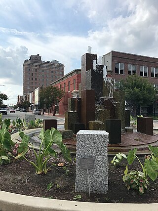
Goldsboro, originally Goldsborough, is a city in and the county seat of Wayne County, North Carolina, United States. The population was 33,657 at the 2020 census. It is the principal city of and is included in the Goldsboro, North Carolina Metropolitan Statistical Area. The nearby town of Waynesboro was founded in 1787, and Goldsboro was incorporated in 1847. It is the county seat of Wayne County.
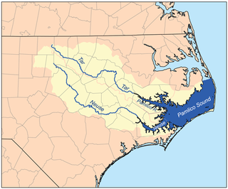
The Neuse River is a river rising in the Piedmont of North Carolina and emptying into Pamlico Sound below New Bern. Its total length is approximately 275 miles (443 km), making it the longest river entirely contained in North Carolina. The Trent River joins the Neuse at New Bern. Its drainage basin, measuring 5,630 square miles (14,600 km2) in area, also lies entirely inside North Carolina. It is formed by the confluence of the Flat and Eno rivers prior to entering the Falls Lake reservoir in northern Wake County. Its fall line shoals, known as the Falls of the Neuse, lie submerged under the waters of Falls Lake. This River also creates the beauty of the Neuse River Trail, a 34.5 miles (55.5 km) long greenway that stretches from Falls Lake Dam, Raleigh, North Carolina to Legend Park, Clayton, North Carolina.

The Kobuk River, also known by the names Kooak, Kowak, Kubuk, Kuvuk, and Putnam, is a river located in the Arctic region of northwestern Alaska in the United States. It is approximately 280 miles (451 km) long. Draining a basin with an area of 12,300 square miles (32,000 km2), the Kobuk River is among the largest rivers in northwest Alaska, with widths of up to 1,500 feet and flows reaching speeds of 3–5 miles per hour in its lower and middle reaches. The average elevation for the Kobuk River Basin is 1,300 feet (400 m) above sea level, ranging from sea level at its mouth on the Bering Sea to 11,400 feet near its headwaters in the Brooks Range.
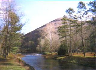
Kettle Creek is a tributary of the West Branch Susquehanna River running through Tioga, Potter, and Clinton counties, in Pennsylvania. It is slightly less than 43 miles (69 km) long. Although many streams in the Kettle Creek watershed are considered "Class A Wild Trout streams" by the Pennsylvania Fish and Boat Commission, the lower reaches of the stream experience acid mine drainage. The upper reaches of the creek are considered to be very high-quality.
Sonoma Creek is a 33.4-mile-long (53.8 km) stream in northern California. It is one of two principal drainages of southern Sonoma County, California, with headwaters rising in the rugged hills of Sugarloaf Ridge State Park and discharging to San Pablo Bay, the northern arm of San Francisco Bay. The watershed drained by Sonoma Creek is roughly equivalent to the wine region of Sonoma Valley, an area of about 170 square miles (440 km2). The State of California has designated the Sonoma Creek watershed as a “Critical Coastal Water Resource”. To the east of this generally rectangular watershed is the Napa River watershed, and to the west are the Petaluma River and Tolay Creek watersheds.
Huntington Creek is a tributary of Fishing Creek in Luzerne and Columbia counties, Pennsylvania, in the United States. It is approximately 29.5 miles (47.5 km) long.

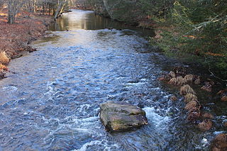
Mehoopany Creek is a tributary of the Susquehanna River in Sullivan and Wyoming counties, Pennsylvania, in the United States. It is approximately 26.8 miles (43.1 km) long. In Sullivan County the creek flows through Colley Township and in Wyoming County it flows through Forkston Township and Mehoopany Township. The stream's watershed has an area of 123 square miles (320 km2). Its major tributaries include Stony Brook and North Fork Mehoopany Creek.
Stony Brook is a tributary of Mehoopany Creek in Wyoming County, Pennsylvania, in the United States. It is approximately 4.3 miles (6.9 km) long and flows through North Branch township and Forkston Township. The brook has a tributary known as Red Brook. Logging was done in the upper reaches of the watershed of Stony Brook in the early 1900s.

San Juan Creek, also called the San Juan River, is a 29-mile (47 km) long stream in Orange and Riverside Counties, draining a watershed of 133.9 square miles (347 km2). Its mainstem begins in the southern Santa Ana Mountains in the Cleveland National Forest. It winds west and south through San Juan Canyon, and is joined by Arroyo Trabuco as it passes through San Juan Capistrano. It flows into the Pacific Ocean at Doheny State Beach. State Route 74, the Ortega Highway, crosses the Santa Ana Mountains via San Juan Canyon.

Stony Creek is a 73.5-mile (118.3 km)-long tributary of the Sacramento River in Northern California. It drains a watershed of more than 700 square miles (1,800 km2) on the west side of the Sacramento Valley in Glenn, Colusa, Lake and Tehama Counties.
Tangascootack Creek is a tributary of the West Branch Susquehanna River in Clinton County, Pennsylvania in the United States. Tangascootack Creek stretches for 11.4 miles (18.3 km) through Bald Eagle, Beech Creek and Colebrook Townships. Its watershed covers 36.5 square miles. Among its tributaries are North Fork Tangascootack Creek and Muddy Run, and there is also a swamp called Bear Swamp near the headwaters. Coal mining, including strip mining, was common in the watershed throughout the 1800s and 1900s. The creek experiences acid mine drainage, much of which comes from Muddy Run.
Drury Run is a tributary of the West Branch Susquehanna River in Clinton County, Pennsylvania, in the United States. It is 7.71 miles (12.41 km) long and its watershed is 11.5 square miles in area, most of which is forest. The stream's tributaries are affected by acid mine drainage, as are the lower reaches of the stream itself. It begins in Tamarack Swamp and flows through Leidy Township, Noyes Township, and Renovo. Brook trout, brown trout, creek chub, and eastern blacknose dace all inhabit the stream.
Twomile Run is a tributary of Kettle Creek in Clinton County, Pennsylvania, in the United States. It is 4.5 miles (7.2 km) long. Tributaries of the stream include Huling Branch and Middle Branch Twomile Run. The stream flows through Leidy Township and Noyes Township. The stream's watershed has an area of approximately 9 square miles. Coal is mined in the watershed. Most of the acid mine drainage in Kettle Creek comes from Twomile Run.

Green Creek is a tributary of Fishing Creek in Columbia County, Pennsylvania, in the United States. It is approximately 12.7 miles (20.4 km) long and flows through Jackson Township, Greenwood Township, and Orange Township. The watershed of the creek has an area of 36.8 square miles (95 km2). Green Creek has three named tributaries: Little Green Creek, Rickard Hollow, and Mud Run. The creek is not designated as an impaired waterbody and is a relatively large stream, contributing a significant amount of water to Fishing Creek. A valley known as the Greenwood Valley is located in the vicinity of Green Creek. The creek's own valley was likely affected by glaciation during the Ice Age.

Spring Brook is a tributary of the Lackawanna River in Lackawanna County and Luzerne County, in Pennsylvania, in the United States. It is approximately 17 miles (27 km) long and flows through Covington Township, Spring Brook Township, and Moosic in Lackawanna County and Pittston Township in Luzerne County. The watershed of the stream has an area of 57.2 square miles (148 km2). It is designated as a High-Quality Coldwater Fishery and a Migratory Fishery above Interstate 476 and as a Coldwater Fishery and a Migratory Fishery below it. A section is also designated as Class A Wild Trout Waters. The stream's tributaries include Panther Creek, Plank Bridge Creek, Rattlesnake Creek, Green Run, Monument Creek, and Covey Swamp Creek. It has a relatively high level of water quality and is very slightly acidic, with a pH of 6.4 to 6.9.
The Little River is a tributary of the Neuse River, which originates in Moore's Pond, south of Youngsville in Franklin County. The river crosses through Wake, Johnston, and Wayne counties, joining the Neuse at Waynesborough State Park and Busco Beach just east of Goldsboro. Wake County and the City of Raleigh have been purchasing land in the watershed in order to create a reservoir in northeast Wake County.

Batavia Kill is a 21-mile-long (34 km) tributary of Schoharie Creek, that flows across the towns of Windham, Ashland and Prattsville in the U.S. state of New York. Its waters reach the Hudson River via Schoharie Creek and the Mohawk River. Since it drains into the Schoharie upstream of Schoharie Reservoir, it is part of the New York City water supply system. From the source to Maplecrest, Batavia Kill drains the northern slopes of the Blackhead Mountains, which include Thomas Cole Mountain, Black Dome, and Blackhead Mountain, the fourth-, third-, and fifth-highest peaks in the Catskills, respectively.
Bear Creek is a tributary of the Neuse River in North Carolina, USA. It drains an area of intensive agriculture, and is heavily polluted with nitrates.
The H.F. Lee Energy Complex, formerly the Goldsboro Plant, is an electrical power generating complex operated by Duke Energy. The power complex was originally owned by the Carolina Power & Light Company, which inaugurated a coal-fired power plant in 1951. Two more coal plants were added in 1952 and 1962, and then oil-fueled turbines were added in 1967–71. In 2012 these units were shut down and replaced by four gas-fired units. The Quaker Neck Lake was built as a cooling pond for the coal-fired power stations, and is still used to supply cooling water. It was originally impounded by a low dam on the Neuse River, but in 1998 the dam was removed, while the lake remained contained in an earthen wall. This change allowed fish to migrate further upstream for spawning. Ash ponds near the lake hold toxic coal ash. There are plans to remove and recycle or bury the ash.
