Related Research Articles

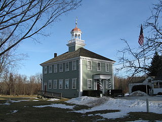
Littleton is a town in Middlesex County, Massachusetts, United States. The population was 8,924 at the 2010 census.
Westford is a town in Middlesex County, Massachusetts, United States. The population was 24,310 at the 2017 census.
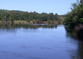
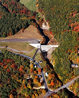
The Nashua River, 37.5 miles (60.4 km) long, is a tributary of the Merrimack River in Massachusetts and New Hampshire in the United States. It is formed in eastern Worcester County, Massachusetts, by junction of its north and south branches near Lancaster, and flows generally north-northeast past Groton to join the Merrimack at Nashua, New Hampshire. The Nashua River Watershed occupies a major portion of north-central Massachusetts and a much smaller portion of southern New Hampshire.
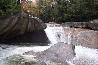
The Pemigewasset River, known locally as "The Pemi", is a river in the state of New Hampshire, the United States. It is 65.0 miles (104.6 km) in length and drains approximately 1,021 square miles (2,644 km2). The name "Pemigewasset" comes from the Abenaki word bemijijoasek [bəmidzidzoasək], meaning "where side (entering) current is".
North Chelmsford is an unincorporated village in the town of Chelmsford, Massachusetts, United States. Although North Chelmsford has its own zip code (01863), library, post office, fire station, water district, and local calling area, it is run by the same local town government and shares a school district with Chelmsford.

The Baker River, or Asquamchumauke, is a 36.4-mile-long (58.6 km) river in the White Mountains region of New Hampshire in the United States. It rises on the south side of Mount Moosilauke and runs south and east to empty into the Pemigewasset River in Plymouth. The river traverses the towns of Warren, Wentworth, and Rumney. It is part of the Merrimack River watershed.

The Nissitissit River is a 10.5-mile-long (16.9 km) river located in southern New Hampshire and northern Massachusetts in the United States. It is a tributary of the Nashua River, itself a tributary of the Merrimack River, which flows to the Gulf of Maine. This river is part of the Nashua River Watershed.

The Piscataquog River is a 34.7-mile-long (55.8 km) river located in southern New Hampshire in the United States. It is a tributary of the Merrimack River, which flows to the Gulf of Maine.

Nubanusit Brook is a 14.3-mile-long (23.0 km) stream located in southern New Hampshire in the United States. It is a tributary of the Contoocook River, part of the Merrimack River watershed.
Beards Brook or Beard Brook is a 12.5-mile-long (20.1 km) stream located in southern New Hampshire in the United States. It is a tributary of the North Branch of the Contoocook River, part of the Merrimack River watershed.
The Blackwater River is a 37.5-mile-long (60.4 km) river located in central New Hampshire in the United States. It is a tributary of the Contoocook River, part of the Merrimack River watershed.
Little Massabesic Brook and Sucker Brook form a 1.9-mile-long (3.1 km) stream located in southern New Hampshire in the United States. They are tributaries of Massabesic Lake, part of the Merrimack River and Gulf of Maine watersheds. Despite the streams' short length, they are subject to the New Hampshire Comprehensive Shoreland Protection Act, because of their fourth order stream status.
Beaver Brook is a 30.7-mile-long (49.4 km) river located in New Hampshire and Massachusetts in the United States. It is a tributary of the Merrimack River, part of the Gulf of Maine watershed.
The Spicket River is a 17.7-mile-long (28.5 km) river located in New Hampshire and Massachusetts in the United States. It is a left tributary of the Merrimack River, part of the Gulf of Maine watershed. It is sometimes spelled "Spickett".

The Five Mile River is a 10.1-mile-long (16.3 km) river in central Massachusetts, part of the Chicopee River watershed. It rises north of Dean Pond in the Town of Oakham within Rutland State Forest and flows south through Dean Pond to Brooks Pond, 2.5 miles (4.0 km) northeast of North Brookfield, then continues south to its mouth at the north end of Lake Lashaway, also in North Brookfield.

Salmon Brook is one of the 6 major tributaries of the Merrimack River in northeastern Massachusetts in the United States. Its watershed is 31 square miles (80 km2) and is one of the 14 subwatersheds of the Merrimack River. It passes through Groton, Dunstable, and Tyngsborough, Massachusetts, and then through Nashua, New Hampshire.

Stony Brook is a major watercourse, now almost entirely covered, in the city of Boston, USA. It runs through a culvert for 7.5 miles, along almost its entire length; despite being underground, it is the largest tributary stream of the lower Charles River. It originates at Turtle Pond in the Stony Brook Reservation; it flows through Hyde Park, Roslindale, Jamaica Plain, and Roxbury. It empties into the Charles River Basin just upstream of the Massachusetts Avenue bridge; it formerly emptied into the Back Bay when that was a tidal estuary of the Charles River.

Stony Brook is a stream largely running through Weston, Massachusetts, then forming the Weston/Waltham boundary, and emptying into the Charles River across from the Waltham/Newton boundary. It has two tributaries, Cherry Brook and Hobbs Brook, and its watershed includes about half of Lincoln and Weston as well as parts of Lexington and Waltham. Since 1887, it has been the water supply for Cambridge.

Pennichuck Brook is one of the tributaries of the Merrimack River in New Hampshire in the United States. Its watershed is 31 square miles (80 km2) and is one of the 14 subwatersheds of the Merrimack River. It passes through Nashua and Merrimack, New Hampshire and serves as the public water supply for greater Nashua.
References
- ↑ "Year 3 Assessment Report for the Merrimack River Watershed" (PDF). Massachusetts Executive Office of Environmental Affairs. Retrieved 28 July 2017.
- ↑ "North Chelmsford, MA". ACME mapper. Retrieved December 20, 2019.
Coordinates: 42°38′18″N71°22′29″W / 42.63833°N 71.37472°W
| This Massachusetts state location article is a stub. You can help Wikipedia by expanding it. |