
Au Train Township is a civil township of Alger County in the U.S. state of Michigan. As of the 2020 census, its population was 1,019.
Chassell Township is a civil township of Houghton County in the U.S. state of Michigan. The population was 1,822 at the 2000 census.

Clay Township is a civil township of St. Clair County in the U.S. state of Michigan. The population was 8,446 at the 2020 census.

Belleville is a city in Wayne County in the U.S. state Michigan. The population was 3,991 at the 2010 census.

The St. Joseph River is an 86.1-mile-long (138.6 km) tributary of the Maumee River in northwestern Ohio and northeastern Indiana in the United States, with headwater tributaries rising in southern Michigan. It drains a primarily rural farming region in the watershed of Lake Erie.

The Fawn River is a 55.4-mile-long (89.2 km) river in southwest Michigan and northeast Indiana in the United States. It flows into the St. Joseph River in the city of Constantine, Michigan. The headwaters rise in a series of lakes and marshes in northern Steuben County, Indiana near Pokagon State Park, where it is known as "Crooked Creek" and "Little Fawn River". It flows west-northwest across the northeast corner of LaGrange County, Indiana and then over the state line across the southeast corner of Branch County, Michigan before entering St. Joseph County, Michigan. Passing to the south of Sturgis, Michigan, the river meanders across the state line a few more times before flowing north into Constantine. Except for Constantine, the river does not flow through any large communities, although it passes near Fremont, Indiana, Orland, Indiana, Sturgis, Howe, Indiana, and White Pigeon, Michigan.

The San Jacinto River is a 42-mile-long (68 km) river in Riverside County, California. The river's headwaters are in Santa Rosa and San Jacinto Mountains National Monument. The lower portion of the 765-square-mile (1,980 km2) watershed is urban and agricultural land. As a partially endorheic watershed that is contiguous with other Great Basin watersheds, the western side of the San Jacinto Basin is a portion of the Great Basin Divide.
Mud Lake is the current or former name of over 300 lakes within the U.S. state of Michigan.

The Ontonagon River is a river flowing into Lake Superior at the village of Ontonagon, on the western Upper Peninsula of Michigan in the United States. The main stem of the river is 25 miles (40 km) long and is formed by a confluence of several longer branches, portions of which have been collectively designated as a National Wild and Scenic River. Several waterfalls occur on the river including Agate Falls and Bond Falls.

The Strawberry Range, also known as the Strawberry Mountains, is a mountain range in the U.S. state of Oregon. It is east of John Day, within Malheur National Forest. The highest peak is Strawberry Mountain.
The Whitefish River is an 11.9-mile-long (19.2 km) river on the Upper Peninsula of the U.S. state of Michigan. The mouth of the river is in Delta County at 45°54′34″N86°58′01″W on the Little Bay De Noc of Lake Michigan. The main branch of the river is formed by the confluence of the east and west branches at 46°03′25″N86°52′17″W.

Gravel Lake is a 296-acre (1.20 km2) freshwater lake in the southeast corner of Porter Township near the southern boundary of Van Buren County in the U.S. state of Michigan. The lake is located between Lawton and Marcellus. The lake is controlled and managed by a homeowners association, the Gravel Lake Association.
Long Lake is the name of several lakes in the U.S. state of Michigan:

Lake Hudson State Recreation Area is a public recreation area located within southwestern Lenawee County in the U.S. state of Michigan. With its main entrance located along M-156, it is mostly located within Hudson Township and a very small portion extending south into neighboring Medina Township.
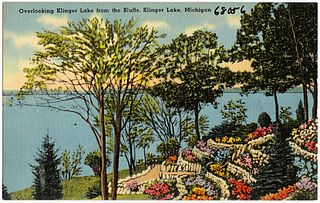
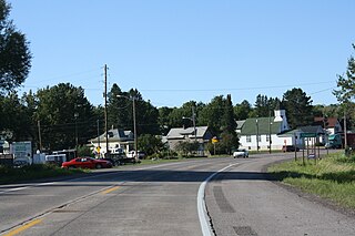
Klingers is an unincorporated community based around the nearby Klinger Lake located inside St. Joseph County in the southwest region of the U.S. state of Michigan.
Sturgeon River is a 63.6-mile-long (102.4 km) river in the U.S. state of Michigan, flowing mostly southward through Alger County and Delta County counties on the Upper Peninsula.

The Strawberry Islands are a small chain of four islands located on the Wisconsin side of Green Bay between Chambers Island and Peninsula State Park. The islands are part of the Town of Gibraltar, Wisconsin.
Lake George is a lake in Chippewa County, Michigan, United States, and Algoma District, Northwestern Ontario, Canada, that lies between Sugar Island in Michigan on the west and the Ontario mainland on the east.


