
The Tower of London, officially His Majesty's Royal Palace and Fortress of the Tower of London, is a historic castle on the north bank of the River Thames in central London, England. It lies within the London Borough of Tower Hamlets, which is separated from the eastern edge of the square mile of the City of London by the open space known as Tower Hill. It was founded toward the end of 1066 as part of the Norman Conquest. The White Tower, which gives the entire castle its name, was built by William the Conqueror in 1078 and was initially a resented symbol of oppression, inflicted upon London by the new Norman ruling class. The castle was also used as a prison from 1100 until 1952, although that was not its primary purpose. A grand palace early in its history, it served as a royal residence. As a whole, the Tower is a complex of several buildings set within two concentric rings of defensive walls and a moat. There were several phases of expansion, mainly under kings Richard I, Henry III, and Edward I in the 12th and 13th centuries. The general layout established by the late 13th century remains despite later activity on the site.
Drury Lane is a street on the eastern boundary of the Covent Garden area of London, running between Aldwych and High Holborn. The northern part is in the borough of Camden and the southern part in the City of Westminster. Drury Lane is part of London's West End Theatreland.
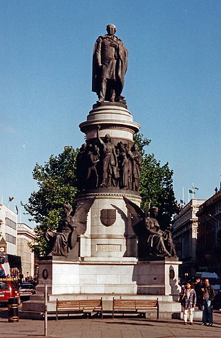
O'Connell Street is a street in the centre of Dublin, Ireland, running north from the River Liffey. It connects the O'Connell Bridge to the south with Parnell Street to the north and is roughly split into two sections bisected by Henry Street. The Luas tram system runs along the street.

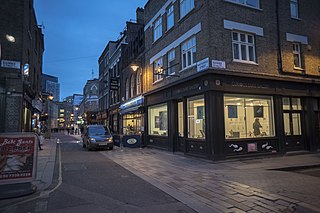
Commercial Street is an arterial road in the boroughs of Tower Hamlets and Hackney that runs north to south from Shoreditch High Street to Whitechapel High Street through Spitalfields. The road is a section of the A1202 London Inner Ring Road and as such forms part of the boundary of the London congestion charge zone.

Urban renewal is a program of land redevelopment often used to address urban decay in cities. Urban renewal involves the clearing out of blighted areas in inner cities in favour of new housing, businesses, and other developments.

The Worshipful Company of Armourers and Brasiers is one of the livery companies of the City of London. The Armourers' Guild was established in 1322; it received a royal charter in 1453. Other companies, including the Armour Repairers, merged with the Armourers. In 1708, brass workers joined the company, which was renamed as the Armourers' and Brasiers' Company. The company does support the metallurgy industry, but does not retain a close association with its original trade, as is the case with a majority of livery companies. It exists primarily as a charitable establishment.

Farringdon Road is a road in Clerkenwell, London.

Brixton Hill is the name given to a two-thirds of a mile (1 km) section of road between Brixton and Streatham Hill in south London, England.

A tenement is a type of building shared by multiple dwellings, typically with flats or apartments on each floor and with shared entrance stairway access. They are common on the British Isles, particularly in Scotland. In the medieval Old Town, in Edinburgh, tenements were developed with each apartment treated as a separate house, built on top of each other. Over hundreds of years, custom grew to become law concerning maintenance and repairs, as first formally discussed in Stair's 1681 writings on Scots property law. In Scotland, these are now governed by the Tenements Act, which replaced the old Law of the Tenement and created a new system of common ownership and procedures concerning repairs and maintenance of tenements. Tenements with one- or two-room flats provided popular rented accommodation for workers, but in some inner-city areas, overcrowding and maintenance problems led to shanty towns, which have been cleared and redeveloped. In more affluent areas, tenement flats form spacious privately owned houses, some with up to six bedrooms, which continue to be desirable properties.

Montagu House was a late 17th-century mansion in Great Russell Street in the Bloomsbury district of London, which became the first home of the British Museum. The first house on the site was destroyed by fire in 1686. The rebuilt house was sold to the British Museum in 1759, and demolished in the 1840s to make way for the present larger building.

Vine Street is a street in Westminster, London, running from Swallow Street, parallel to Regent Street and Piccadilly. It is now a dead end that was shortened from a longer road in the early 18th century owing to the building of Regent Street.
Sunshine Way is the name of a crescent-shaped street in Mitcham, England, built in 1936 for families from overcrowded areas of inner London, and including specially-designed houses to suit the needs of tuberculosis (TB) patients.

Jacob's Island was a notorious slum in Bermondsey, London, in the 19th century. It was located on the south bank of the River Thames, approximately delineated by the modern streets of Mill Street, Bermondsey Wall West, George Row and Wolseley Street. Jacob's Island developed a reputation as one of the worst slums in London, and was popularised by the Charles Dickens novel Oliver Twist, published shortly before the area was cleared in the 1860s.

Flower and Dean Street was a road at the heart of the Spitalfields rookery in the East End of London. It was one of the most notorious slums of the Victorian era, being described in 1883 as "perhaps the foulest and most dangerous street in the whole metropolis", and was closely associated with the victims of Jack the Ripper.

Dorset Street, originally known as Datchet Street, was a street in Spitalfields, East London, once situated at the heart of the area's rookery. By repute it was "the worst street in London", and it was the scene of the brutal murder of Mary Jane Kelly by Jack the Ripper on 9 November 1888. The murder was committed at Kelly's lodgings which were situated at No. 13, Miller's Court, entered from a passageway between 26 and 27, Dorset Street.

Pottery Lane is a street in Notting Hill, west London. Today it forms part of one of London's most fashionable and expensive neighbourhoods, but in the mid-19th century it lay at the heart of a wretched and notorious slum known as the "Potteries and the Piggeries". The slum came to the attention of Londoners with the building of the Hippodrome in 1837 by entrepreneur John Whyte. Unfortunately for Whyte a public right of way existed over his land and "dirty and dissolute vagabonds" from the nearby slum invaded his racecourse, adding to his financial difficulties and, in part, leading to the closure of his venture in 1842. Pottery Lane gradually improved in the late 20th century along with the rest of the Notting Hill area, and today the houses there fetch multi-million pound prices. Just one of the original brick kilns still survives; it is located in Walmer Road, just north of Pottery Lane, and bears a commemorative plaque placed there by the Royal Borough of Kensington and Chelsea.

The Ossulston Estate is a multi-storey council estate built by the London County Council on Chalton Street in Somers Town between 1927 and 1931. It was unusual at the time both in its inner-city location and in its modernist design, and all the original parts of the estate are now Grade II listed buildings.
Whitecross Street is a short street in Islington, in Inner London. It features an eponymous street market and a large housing estate.
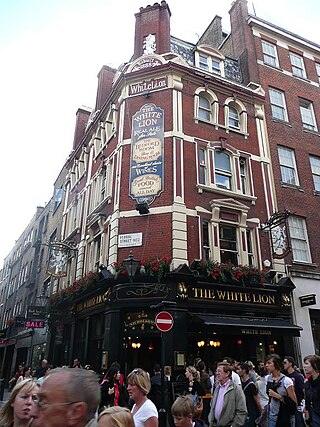
The White Lion is a pub in Covent Garden, London, on the corner of James Street and Floral Street.
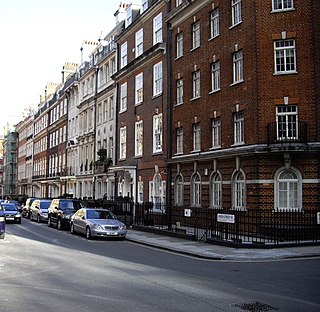
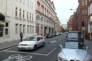
Green Street is a street in Mayfair, London. It has been built up since the mid-18th century, but most of the current properties date from the late 19th and early 20th century. It has had a number of significant residents, including various members of the British aristocracy, the James Bond author Ian Fleming, and the Beatles.
