
Greater Manchester is a metropolitan county and combined authority area in North West England, with a population of 2.8 million; comprising ten metropolitan boroughs: Bolton, Bury, Oldham, Rochdale, Stockport, Tameside, Trafford, Wigan, and the cities of Manchester and Salford. Greater Manchester was created on 1 April 1974, as a result of the Local Government Act 1972, and designated a functional city region on 1 April 2011.

The River Douglas, also known as the River Asland or Astland, flows through parts of Lancashire and Greater Manchester in North West England. It is a tributary of the River Ribble and has several tributaries, the major ones being the River Tawd and the River Yarrow.
The term Lees can refer to:
Albert Bridge may refer to:

Strinesdale is a reservoir situated on the A62 between Oldham and Delph in Greater Manchester, England. The town of Rochdale is to the north and the town of Oldham to the south. It is fed by the River Medlock.

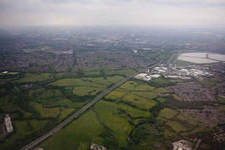
Strines is a village in Greater Manchester, in the valley of the River Goyt midway between Marple and New Mills and about six miles southeast of Stockport. The village falls within Marple parish and the Stockport metropolitan borough. Immediately surrounding Strines are the villages of Woodend, Hague Bar and Brookbottom, where there is a Conservation area. Close by are the towns of Marple and New Mills and the villages of Mellor and Rowarth. Nearby is the hamlet of Turf Lea.

Marple Bridge is a village in the Metropolitan Borough of Stockport, Greater Manchester, England, on the River Goyt, which runs through the centre of the village, close to Marple.

Strines railway station serves the village of Strines, in the Metropolitan Borough of Stockport, on the outskirts of Greater Manchester, England. Until boundary changes in 1994, the station itself lay over the border in Derbyshire.
Reddish Vale is in the Tame Valley close to Reddish, Greater Manchester, England. The centre of the vale is around the bottom of Reddish Vale Road. Reddish Vale Country Park is a country park managed by Stockport Metropolitan Borough Council. It covers 161 hectares in all and comprises some of the traditional Reddish Vale area, Reddish Vale Farm and the grazing land and Woodhall Fields, about half a mile to the south. Part of it is a designated local nature reserve.

A large number of canals were built in Cheshire, England, during the early phases of the Industrial Revolution to transport goods and raw materials. This resulted in a significant canal network which is now enjoyed by holiday-makers, anglers, walkers, and others.
Blackfriars, derived from Black Friars, a common name for the Dominican Order of friars, may refer to:

There are 48 Grade I listed buildings in Greater Manchester, England. In the United Kingdom, the term listed building refers to a building or other structure officially designated as being of special architectural, historical or cultural significance; Grade I structures are those considered to be "buildings of exceptional interest". In England, the authority for listing under the Planning Act 1990 rests with Historic England, a non-departmental public body sponsored by the Department for Culture, Media and Sport.

The River Strine is a 3.4-mile-long (5.4 km) tributary of the River Tern flowing through the Telford and Wrekin district of Shropshire in England. The river drains the Weald Moors a fenland area north of Telford, and also takes runoff from Newport and Lilleshall. Tributaries of the Strine include the Pipe Strine, Red Strine, and Wall Brook.

The Goyt Way is a 10-mile (16 km) walking route from Etherow Country Park, Greater Manchester, to Whaley Bridge, Derbyshire, following the valley of the River Goyt. It is part of the longer Midshires Way, which in turn is part of the E2 European long-distance path. The path is waymarked, and intersects with the Cheshire Ring Canal Walk and the Peak District Boundary Walk. It passes through the following settlements: Compstall, Marple, Strines, Brookbottom, Hague Bar, New Mills and Furness Vale. In its latter stages, it follows the towpath of the Peak Forest Canal to its terminus at Whaley Bridge.
This page is based on this
Wikipedia article Text is available under the
CC BY-SA 4.0 license; additional terms may apply.
Images, videos and audio are available under their respective licenses.