
Opole Voivodeship, or Opole Province, is the smallest and least populated voivodeship (province) of Poland. The province's name derives from that of the region's capital and largest city, Opole. It is part of Upper Silesia. A relatively large German minority, with representatives in the Sejm, lives in the voivodeship, and the German language is co-official in 28 communes.

Złocieniec is a town in northwestern Poland. Located in West Pomeranian Voivodeship's Drawsko County since 1999, it was previously a part of Koszalin Voivodeship (1950–1998). The population of Złocieniec is around 12,000 - it is therefore the biggest town in the county (powiat).
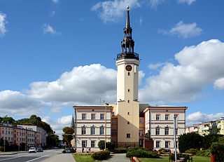
Strzelce Opolskie(listen) is a town in southern Poland with 17,900 inhabitants (2019), situated in the Opole Voivodeship. It is the capital of Strzelce County.

Holice is a town in Pardubice District in the Pardubice Region of the Czech Republic. It has about 6,500 inhabitants.
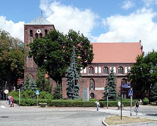
Strzelce Krajeńskie is a town in western Poland, in the Lubusz Voivodeship. It is the capital of the Strzelce-Drezdenko County. The town's population is 9,950 (2019).

Strzelce County is a unit of territorial administration and local government (powiat) in Opole Voivodeship, south-western Poland. It came into being on January 1, 1999, as a result of the Polish local government reforms passed in 1998. Its administrative seat and largest town is Strzelce Opolskie, which lies 31 kilometres (19 mi) south-east of the regional capital Opole. The county contains four other towns: Zawadzkie, 19 km (12 mi) north-east of Strzelce Opolskie, Kolonowskie, 19 km (12 mi) north-east of Strzelce Opolskie, Leśnica, 11 km (7 mi) south-west of Strzelce Opolskie, and Ujazd, 14 km (9 mi) south-east of Strzelce Opolskie.
Polish Military Organization of the Upper Silesia was a secret military organization formed in February 1919 in Upper Silesia. It was involved in the three Silesian Uprisings, although officially it was disbanded after the Second Uprising. It had over 20,000 members, including Alfons Zgrzebniok, Jan Wyglenda, Stanisław Krzyżowski, Walenty Fojkis, Karol Grzesik, Rudolf Kornke, Wolfgang Kornke, Maksymilian Iksal.

Gmina Strzelce Opolskie is an urban-rural gmina in Strzelce County, Opole Voivodeship, in south-western Poland. Its seat is the town of Strzelce Opolskie, which lies approximately 31 kilometres (19 mi) south-east of the regional capital Opole.
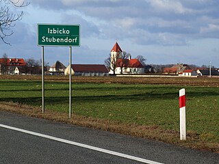
Gmina Izbicko, German Gemeinde Stubendorf, is a rural gmina in Strzelce County, Opole Voivodeship, in south-western Poland. Its seat is the village of Izbicko, which lies approximately 14 kilometres (9 mi) north-west of Strzelce Opolskie and 18 km (11 mi) south-east of the regional capital Opole.

Gmina Kolonowskie, German Gemeinde Colonnowska is an urban-rural gmina (municipality) in Strzelce County, Opole Voivodeship, in Upper Silesia in Poland. Its seat is the town of Kolonowskie (Colonnowska), which lies approximately 19 kilometres (12 mi) north-east of Strzelce Opolskie and 33 km (21 mi) east of the regional capital Opole.

Gmina Leśnica, German Gemeinde Leschnitz is an urban-rural gmina in Strzelce County, Opole Voivodeship, in Upper Silesia in Poland. Its seat is the town of Leśnica (Leschnitz), which lies approximately 11 kilometres (7 mi) south-west of Strzelce Opolskie and 32 km (20 mi) south-east of the regional capital Opole.

Gmina Ujazd, German Gemeinde Ujest is an urban-rural gmina in Strzelce County, Opole Voivodeship, in south-western Poland. Its seat is the town of Ujazd (Ujest), which lies approximately 14 kilometres (9 mi) south-east of Strzelce Opolskie and 43 km (27 mi) south-east of the regional capital Opole.
Góra Świętej Anny Landscape Park is a protected area in south-western Poland, established in 1988, covering an area of 50.50 square kilometres (19.50 sq mi).
Grodzisko is a village in the administrative district of Gmina Strzelce Opolskie, within Strzelce County, Opole Voivodeship, in south-western Poland. It lies approximately 10 kilometres (6 mi) north of Strzelce Opolskie and 24 km (15 mi) south-east of the regional capital Opole.
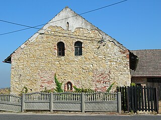
Ligota Górna is a village in the administrative district of Gmina Strzelce Opolskie, within Strzelce County, Opole Voivodeship, in south-western Poland. It lies approximately 10 kilometres (6 mi) west of Strzelce Opolskie and 26 km (16 mi) south-east of the regional capital Opole.
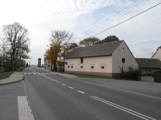
Niwki is a village in the administrative district of Gmina Strzelce Opolskie, within Strzelce County, Opole Voivodeship, in south-western Poland. It lies approximately 9 kilometres (6 mi) west of Strzelce Opolskie and 25 km (16 mi) south-east of the regional capital Opole.
Osiek is a village in the administrative district of Gmina Strzelce Opolskie, within Strzelce County, Opole Voivodeship, in south-western Poland. It lies approximately 10 kilometres (6 mi) north of Strzelce Opolskie and 28 km (17 mi) east of the regional capital Opole.

Szymiszów is a village in the administrative district of Gmina Strzelce Opolskie, within Strzelce County, Opole Voivodeship, in south-western Poland. It lies approximately 4 kilometres (2 mi) north-west of Strzelce Opolskie and 28 km (17 mi) south-east of the regional capital Opole.

Byczyna Town Hall is a town hall built in the Baroque and Classical architectural style in Byczyna, Poland. In later years the building was modernised, during World War II the building was destroyed and subsequently rebuilt. The current tenants of the building are the Byczyna City Council, pharmacy, and a café.

Paczków Town Hall - a building built in the Renaissance architectural style and later reconstructed into Neoclassicism, is located in the centre of the Market Square (Rynek) in Paczków, Poland. Currently, the town hall is the seat for the Paczków authorities.


