Related Research Articles

In geomorphology and geology, a peneplain is a low-relief plain formed by protracted erosion. This is the definition in the broadest of terms, albeit with frequency the usage of peneplain is meant to imply the representation of a near-final stage of fluvial erosion during times of extended tectonic stability. Peneplains are sometimes associated with the cycle of erosion theory of William Morris Davis, but Davis and other workers have also used the term in a purely descriptive manner without any theory or particular genesis attached.

The Baltic Shield is a segment of the Earth's crust belonging to the East European Craton, representing a large part of Fennoscandia, northwestern Russia and the northern Baltic Sea. It is composed mostly of Archean and Proterozoic gneisses and greenstone which have undergone numerous deformations through tectonic activity. It contains the oldest rocks of the European continent with a thickness of 250–300 km.

In geology and geomorphology a base level is the lower limit for an erosion process. The modern term was introduced by John Wesley Powell in 1875. The term was subsequently appropriated by William Morris Davis who used it in his cycle of erosion theory. The "ultimate base level" is the plane that results from projection of the sea level under landmasses. It is to this base level that topography tends to approach due to erosion, eventually forming a peneplain close to the end of a cycle of erosion.

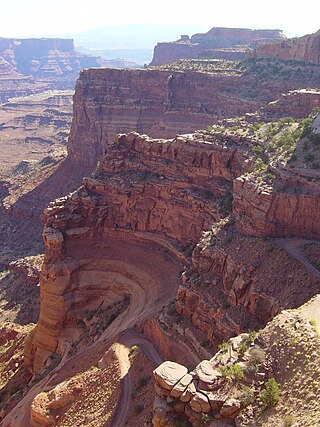
The exposed geology of the Canyonlands area is complex and diverse; 12 formations are exposed in Canyonlands National Park that range in age from Pennsylvanian to Cretaceous. The oldest and perhaps most interesting was created from evaporites deposited from evaporating seawater. Various fossil-rich limestones, sandstones, and shales were deposited by advancing and retreating warm shallow seas through much of the remaining Paleozoic.
Sequence stratigraphy is a branch of geology, specifically a branch of stratigraphy, that attempts to discern and understand historic geology through time by subdividing and linking sedimentary deposits into unconformity bounded units on a variety of scales. The essence of the method is mapping of strata based on identification of surfaces which are assumed to represent time lines, thereby placing stratigraphy in chronostratigraphic framework allowing understanding of the evolution of the earth's surface in a particular region through time. Sequence stratigraphy is a useful alternative to a purely lithostratigraphic approach, which emphasizes solely based on the compositional similarity of the lithology of rock units rather than time significance. Unconformities are particularly important in understanding geologic history because they represent erosional surfaces where there is a clear gap in the record. Conversely within a sequence the geologic record should be relatively continuous and complete record that is genetically related.

A marine transgression is a geologic event during which sea level rises relative to the land and the shoreline moves toward higher ground, which results in flooding. Transgressions can be caused by the land sinking or by the ocean basins filling with water or decreasing in capacity. Transgressions and regressions may be caused by tectonic events such as orogenies, severe climate change such as ice ages or isostatic adjustments following removal of ice or sediment load.
The geology of the Netherlands describes the geological sequence of the Netherlands. Large parts of the Netherlands today are below sea level and have in the past been covered by the sea or flooded at regular intervals. The modern Netherlands formed as a result of the interplay of the four main rivers and the influence of the North Sea and glaciers during ice-ages. The Netherlands is mostly composed of deltaic, coastal and eolian derived sediments during the Pleistocene glacial and interglacial periods.

The Dallas–Fort Worth Metroplex sits above Cretaceous-age strata ranging from ≈145-66 Ma. These Cretaceous-aged sediments lie above the eroded Ouachita Mountains and the Fort Worth Basin, which was formed by the Ouachita Orogeny. Going from west to east in the DFW Metroplex and down towards the Gulf of Mexico, the strata get progressively younger. The Cretaceous sediments dip very gently to the east.

The geology of England is mainly sedimentary. The youngest rocks are in the south east around London, progressing in age in a north westerly direction. The Tees–Exe line marks the division between younger, softer and low-lying rocks in the south east and the generally older and harder rocks of the north and west which give rise to higher relief in those regions. The geology of England is recognisable in the landscape of its counties, the building materials of its towns and its regional extractive industries.
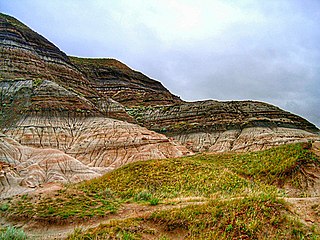
The Frenchman Formation is stratigraphic unit of Late Cretaceous age in the Western Canada Sedimentary Basin. It is present in southern Saskatchewan and the Cypress Hills of southeastern Alberta. The formation was defined by G.M. Furnival in 1942 from observations of outcrops along the Frenchman River, between Ravenscrag and Highway 37. It contains the youngest of dinosaur genera, much like the Hell Creek Formation in the United States.

The Cretaceous–Paleogene (K–Pg) boundary, formerly known as the Cretaceous–Tertiary (K–T) boundary, is a geological signature, usually a thin band of rock containing much more iridium than other bands. The K–Pg boundary marks the end of the Cretaceous Period, the last period of the Mesozoic Era, and marks the beginning of the Paleogene Period, the first period of the Cenozoic Era. Its age is usually estimated at around 66 million years, with radiometric dating yielding a more precise age of 66.043 ± 0.011 Ma.
The Aquitaine Basin is the second largest Mesozoic and Cenozoic sedimentary basin in France after the Paris Basin, occupying a large part of the country's southwestern quadrant. Its surface area covers 66,000 km2 onshore. It formed on Variscan basement which was peneplained during the Permian and then started subsiding in the early Triassic. The basement is covered in the Parentis Basin and in the Subpyrenean Basin—both sub-basins of the main Aquitaine Basin—by 11,000 m of sediment.
The climate across the Cretaceous–Paleogene boundary is very important to geologic time as it marks a catastrophic global extinction event. Numerous theories have been proposed as to why this extinction event happened including an asteroid known as the Chicxulub asteroid, volcanism, or sea level changes. While the mass extinction is well documented, there is much debate about the immediate and long-term climatic and environmental changes caused by the event. The terrestrial climates at this time are poorly known, which limits the understanding of environmentally driven changes in biodiversity that occurred before the Chicxulub crater impact. Oxygen isotopes across the K–T boundary suggest that oceanic temperatures fluctuated in the Late Cretaceous and through the boundary itself. Carbon isotope measurements of benthic foraminifera at the K–T boundary suggest rapid, repeated fluctuations in oceanic productivity in the 3 million years before the final extinction, and that productivity and ocean circulation ended abruptly for at least tens of thousands of years just after the boundary, indicating devastation of terrestrial and marine ecosystems. Some researchers suggest that climate change is the main connection between the impact and the extinction. The impact perturbed the climate system with long-term effects that were much worse than the immediate, direct consequences of the impact.

The North Sea is part of the Atlantic Ocean in northern Europe. It is located between Norway and Denmark in the east, Scotland and England in the west, Germany, the Netherlands, Belgium and France in the south.

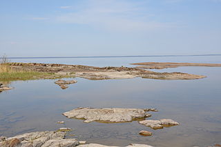
The sub-Cambrian peneplain is an ancient, extremely flat, erosion surface (peneplain) that has been exhumed and exposed by erosion from under Cambrian strata over large swathes of Fennoscandia. Eastward, where this peneplain dips below Cambrian and other Lower Paleozoic cover rocks. The exposed parts of this peneplain are extraordinarily flat with relief of less than 20 m. The overlying cover rocks demonstrate that the peneplain was flooded by shallow seas during the Early Paleozoic. Being the oldest identifiable peneplain in its area the Sub-Cambrian peneplain qualifies as a primary peneplain.

The Arauco Basin is a sediment-filled depression –a sedimentary basin– in south-central Chile. In the context of plate tectonics it is classified as a forearc basin. The basin has an approximate area of 8,000 square kilometres (3,100 sq mi) and at its deeper parts the surface of its sedimentary fill reaches 200 metres (660 ft) below sea-level. The basin is interpreted as being part of an uplifted part of the continental shelf. To the west it bounds an active accretionary prism that lies next to the Chile trench and to the east it bounds metamorphic basement representing a fossil Paleozoic accretionary complex that has been intruded by the Coastal Batholith of central Chile.

The Sub-Mesozoic hilly peneplains or Sub-Mesozoic hilly relief is a landscape in Scandinavia made up of undulating hills and joint valleys and occasional kaolinized bedrock in valley bottoms. The landscape formed in the Mesozoic Era and was eventually drowned by the sea during the Campanian transgression and covered by a thick cover of Cretaceous sedimentary rocks. Later erosion of the cover rocks partly re-exposed this landscape. During the Quaternary epoch the re-exposed Mesozoic hilly relief escaped major glacier erosion being only surficially scoured in parts.

The geology of Ethiopia includes rocks of the Neoproterozoic East African Orogeny, Jurassic marine sediments and Quaternary rift-related volcanism. Events that greatly shaped Ethiopian geology is the assembly and break-up of Gondwana and the present-day rifting of Africa.
The geology of Nigeria formed beginning in the Archean and Proterozoic eons of the Precambrian. The country forms the Nigerian Province and more than half of its surface is igneous and metamorphic crystalline basement rock from the Precambrian. Between 2.9 billion and 500 million years ago, Nigeria was affected by three major orogeny mountain-building events and related igneous intrusions. Following the Pan-African orogeny, in the Cambrian at the time that multi-cellular life proliferated, Nigeria began to experience regional sedimentation and witnessed new igneous intrusions. By the Cretaceous period of the late Mesozoic, massive sedimentation was underway in different basins, due to a large marine transgression. By the Eocene, in the Cenozoic, the region returned to terrestrial conditions.
The geology of Denmark includes 12 kilometers of unmetamorphosed sediments lying atop the Precambrian Fennoscandian Shield, the Norwegian-Scottish Caledonides and buried North German-Polish Caledonides. The stable Fennoscandian Shield formed from 1.45 billion years ago to 850 million years ago in the Proterozoic. The Fennoscandian Border Zone is a large fault, bounding the deep basement rock of the Danish Basin—a trough between the Border Zone and the Ringkobing-Fyn High. The Sorgenfrei-Tornquist Zone is a fault-bounded area displaying Cretaceous-Cenozoic inversion.
References
- 1 2 3 Huggett, Richard John (2011) [2002]. "Landscape evolution: Long term geomorphology". Fundamentals of Geomorphology (3rd ed.). Routledge. pp. 442–446. ISBN 978-0-203-86008-3.
- 1 2 Gale, Andrew S.; Lovell, Bryan (2018). "Proceedings of the Geologists' Association". The Cretaceous–Paleogene Unconformity in England: Uplift and Erosion Related to the Iceland Mantle Plume. 129 (3): 421–435. doi:10.1016/j.pgeola.2017.04.002. S2CID 133817989.